
Forecast for the Logan Area Mountains

Issued by Toby Weed on
Friday morning, April 5, 2024
Friday morning, April 5, 2024
Overnight temperatures stayed well above freezing at all stations again, but cooling and continuing strong winds should keep a lid on wet avalanche activity. The danger is MODERATE, with natural and human-triggered wet avalanches and cornice falls possible. Rain on the already-saturated snow could elevate the danger of wet avalanches on steep low—and mid-elevation slopes. Also, areas with heightened conditions exist in drifted upper-elevation terrain where people might trigger hard wind slab avalanches.
Evaluate snow and terrain carefully.
Evaluate snow and terrain carefully.

Low
Moderate
Considerable
High
Extreme
Learn how to read the forecast here
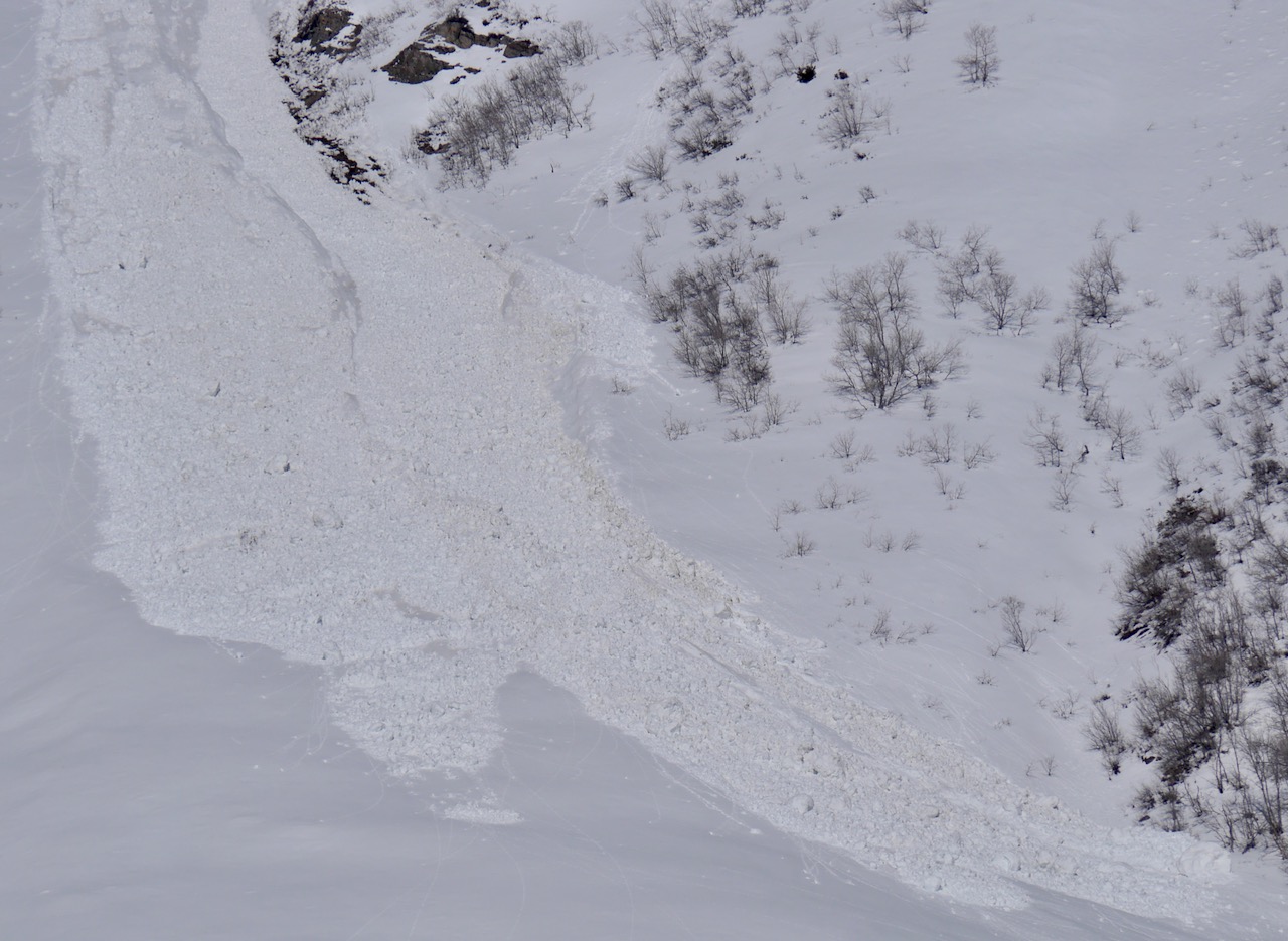
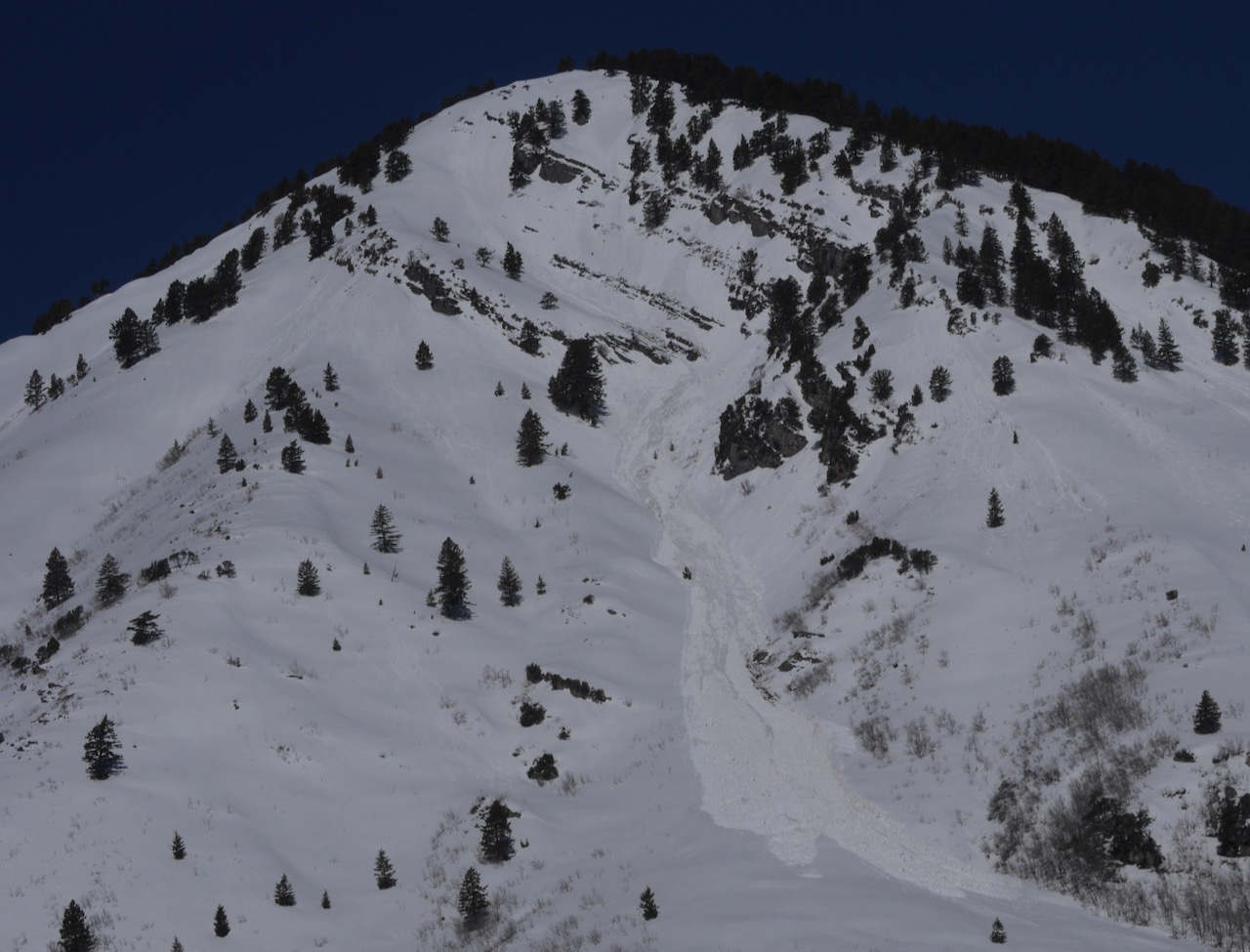 A good-sized natural wet avalanche that ran on Tuesday off Mitton Peak in the Wellsville Range is visible from Hwy 89/91.

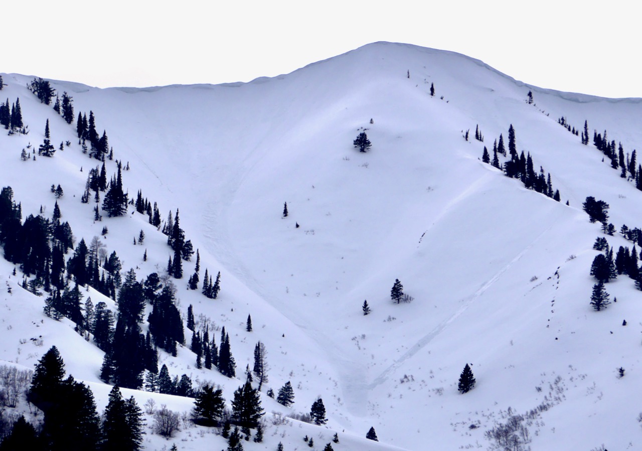 Yesterday afternoon, I looked at the east side of the Wellsville Range and observed several wet avalanches that weren't there on Wednesday. Most of these were under large cornices. This is looking up Hell Canyon above Mendon.


