Forecast for the Logan Area Mountains

Issued by Toby Weed on
Wednesday morning, April 3, 2024
Wednesday morning, April 3, 2024
Sunny skies and warm temperatures today will elevate the potential for (slow-moving) wet avalanches at all elevations. The danger could rise to CONSIDERABLE on sunny slopes steeper than 30°, with natural wet avalanches becoming likely and large cornice falls possible off the high ridges. People could trigger large, dangerous wet avalanches, especially in steep rocky terrain.
- Evaluate snow and terrain carefully and make conservative decisions.
- Avoid being on or under slopes with melt-softened saturated snow, and stay out from under large overhanging cornices that may fail in the heat of the day.

Low
Moderate
Considerable
High
Extreme
Learn how to read the forecast here


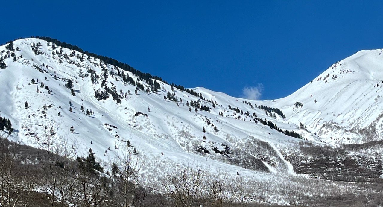 From the Highway on Tuesday, we could see large piles of fresh wet avalanche debris below Mitton Peak
 Small wet slab avalanches and extensive cracking were apparent on the banks of the Logan River on Monday. These red flags indicate the potential for wet avalanche activity on steep lower-elevation slopes.


