Forecast for the Logan Area Mountains

Issued by Toby Weed on
Sunday morning, April 2, 2023
Sunday morning, April 2, 2023
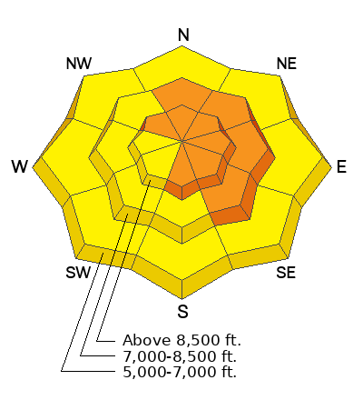
There is CONSIDERABLE danger on drifted backcountry slopes steeper than 30°, especially in mid and upper elevation easterly facing terrain. Large natural cornice falls are possible, and these or people are likely to trigger 2 to 3' thick and 100-200' wide slab avalanches of wind drifted snow. Heightened conditions exist and avalanches of storm snow are possible in all other terrain, and on low elevation slopes there is potential for natural wet avalanches entraining big piles of heavy saturated new snow.
Dangerous avalanche conditions dictate careful snow and terrain evaluation as well as cautious decision making. Continue to avoid frequently running avalanche paths and avalanche runouts.
Low
Moderate
Considerable
High
Extreme
Learn how to read the forecast here
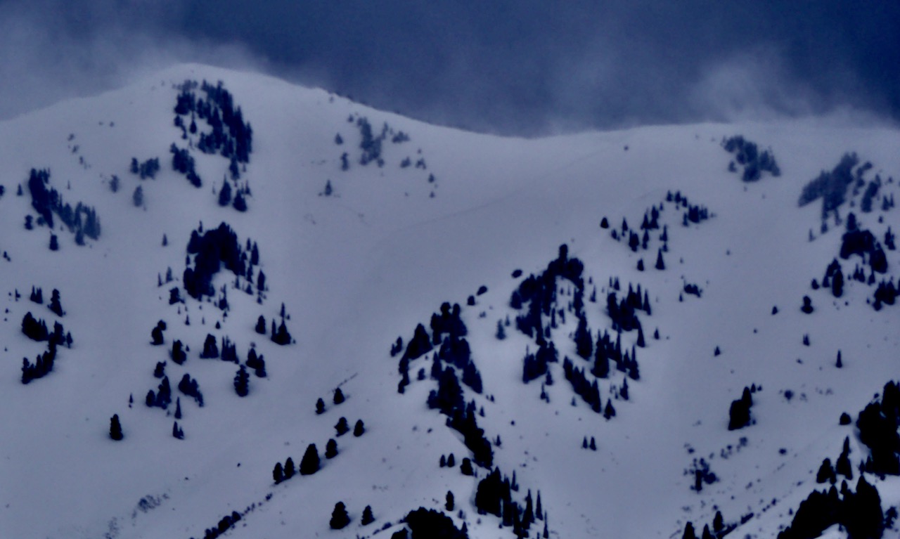 You can barely make out a broad crown from a natural avalanche of wind drifted snow in the upper reaches of Shumway Canyon in the Wellsville Mountain Wilderness.

 Obvious drifting going on Saturday, plumes of snow blowing off the Wellsville Range and on up into the atmosphere.


