Check out our Holiday Auction

Forecast for the Logan Area Mountains

Toby Weed
Issued by Toby Weed on
Friday morning, April 16, 2021
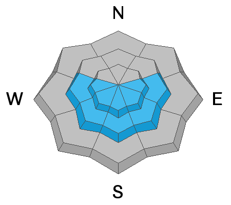
Heightened avalanche conditions and MODERATE danger exist on mid and upper elevation slopes in the backcountry. People could trigger 1 to 2-foot-deep soft slab avalanches of wind drifted snow on steep upper elevation slopes. Also, natural and human triggered wet loose avalanches, entraining deep piles of moist new snow, are possible due to seasonal warmth and may become likely later today in steep sunny terrain.
EVALUATE SNOW AND TERRAIN CAREFULLY
Low
Moderate
Considerable
High
Extreme
Learn how to read the forecast here
Special Announcements
Thank you to everyone who helped make our Spring Campaign a huge success. We are grateful for your donations and what they will allow us to accomplish next season. We look forward to continuing to serve you with our forecasting, education, and awareness programs in new and exciting ways.
Weather and Snow
It's snowing this morning in the Bear River Range, and it is 21°F at the 8400' Tony Grove Snotel. A foot of snow accumulated on Wednesday night and a couple more inches fell last night, with 4" in the last 24 hours, and there is 53"of total snow at the station. Easterly winds are blowing around 20 mph with gusts around 30 mph at the CSI Logan Peak weather station, and it's a chilly 14°F at 9700'.

A quick return to winter for a few days in the mountains - fresh snow and cold temperatures should make for decent riding conditions. Snow showers are possible in the mountains today, but it will be partly sunny, with high temperatures at 9000' around 32°F and 10 to 15 mph east winds. The sun will be out in full force over the weekend with daytime high temperatures in the mid thirties tomorrow and in the mid forties on Sunday.

All signs point towards springtime in Cache Valley, but it's still winter in the Bear River Range with over 16" of new snow since Tuesday night....
Recent Avalanches
No new avalanches were reported or observed in the Logan Zone in the last week.
There were a few avalanches or wind drifted new snow Wednesday and yesterday in the Salt Lake and Ogden Area mountains.
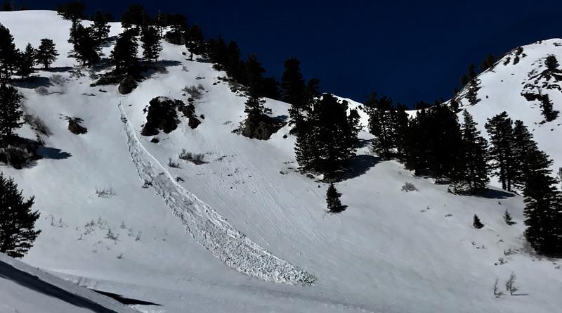
This soft slab avalanche of wind drifted fresh snow was intentionally triggered in Big Cottonwood Canyon in the Wasatch Range in the backcountry above Salt Lake City yesterday, 4-15-2021.
Ad
Avalanche Problem #1
Wind Drifted Snow
Type
Location
Likelihood
Size
Description
Although the new snow is stabilizing, it is still possible for people to trigger a soft slab avalanche of wind drifted fresh snow in steep terrain.
  • Avoid drifts on the lee side of major ridges and in and around terrain features like sub ridges, gullies, and cliff bands.
  • Find a smaller test slope before hitting the bigger slopes, and consider choosing slopes that are free of trees, rocks, cliffs, or other terrain traps to minimize consequences.
Avalanche Problem #2
Wet Snow
Type
Location
Likelihood
Size
Description
Wet loose avalanches or sluffs entraining this week's new snow are possible today in steep terrain due to seasonal warmth. If the sun pops out later today, the fresh snow will almost instantly become moist and natural wet loose avalanches will become likely. Wet loose avalanches are generally manageable, but can certainly be a problem because of terrain traps or if people find themselves below an avalanche. Some wet loose avalanches this weekend could entrain large piles of cement-like debris containing all the recent snow, especially on long steep slopes.
Additional Information
General Spring Travel Advise:
As daytime temperatures rise, softening the snow, the danger of wet avalanches will increase, so its a good idea to get in the habit of an early start and to plan on heading down before things get too sloppy.
-Watch for trees or other terrain traps below you if you venture onto steep slopes.
-Roller balls, pin-wheels, and natural wet avalanche activity are red flags indicating potential for people to trigger wet avalanches.
-If you start sinking deeply into wet snow, or if the snow you are traveling on becomes unsupportable due to the heat, it's time to leave.
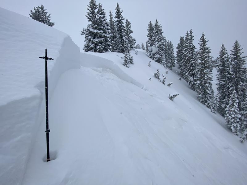
Fresh snow blankets upper elevation terrain in the Bear River Range, 4-15-2021...
General Announcements
EMAIL ADVISORY. If you would like to get the daily advisory by email you subscribe HERE.
Remember your information can save lives. If you see anything we should know about, please help us out by submitting snow and avalanche observations....HERE. You can also call us at 801-524-5304, email by clicking HERE, or include #utavy in your Instagram, or @UAClogan on Twitter.
We will update this forecast by around 7:30 tomorrow morning.
This forecast is from the USDA Forest Service, which is solely responsible for its content. The forecast describes general avalanche conditions and local variations always occur.