We'd like to thank our incredible community for your support of the 2022 Spring Campaign. We raised $75,000 in two weeks to help grow our avalanche forecasting program. Thank You!
Temperatures dropped well below freezing last night at all elevations. I'm reading 27°F at the airport in Logan and 18°F at 9700' near the summit of Logan Peak. The welcome cold temperatures put a hold on the meltdown and formed a pretty solid and thick melt-freeze crust on top of the saturated snow. In this refrozen state, wet snow is stable and avalanches are generally unlikely. With clear skies today, high angled sun and seasonal daytime warmth will probably soften up the saturated surface snow a bit, and if you start sinking into wet snow, it's time to reevaluate your route.
The 8400' Tony Grove Snotel reports 22°F
this morning, and a couple inches of snow containing around 0.6" SWE. There is 58 inches of total snow at the site, containing 73% of normal SWE for the date. Northwest winds are blowing around 15 mph at the 9700' CSI Logan Peak weather station, where overnight temperatures dropped below freezing for the third night in a row, and it's 18°F.
- Expect sunny skies today, with high temperatures at 8500' around 38°F and 10 to 15 mph west winds.
- It will be partly cloudy tonight with low temperatures around 23°F and 10 to 13 mph winds blowing from the southwest.
- Tomorrow will be partly sunny, with high temperatures pushing 46°F. It will be rather breezy, with west-southwest winds blowing 15 to 25 mph with gusts around 35 mph.
- It should be sunny on Sunday, with high temperatures around 45°F and 15 mph north winds.
- Unsettled weather is expected for the early part of next week, with snow showers, clouds, and cool mountain temperatures.
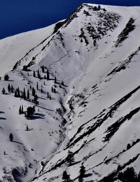
Conditions are quite a bit different this weekend than last, with much colder temperatures and much more stable snow in the backcountry. Last weekend's exceptionally warm weather caused a fairly widespread natural wet avalanche cycle in the Logan Zone, with large wet slab and wet loose avalanches observed, especially widespread in the Wellsville Range.
A large natural wet slab avalanche from last Saturday (3-26-22), likely triggered by a wet loose avalanche overrunning the slope, in Bird Canyon off Mendon Peak in the Wellsville Mountain Wilderness.
Check out all the recent backcountry observations and many recent avalanche reports from across Utah
HERE.


