Check out our Holiday Auction

Forecast for the Logan Area Mountains

Toby Weed
Issued by Toby Weed on
Saturday morning, March 27, 2021
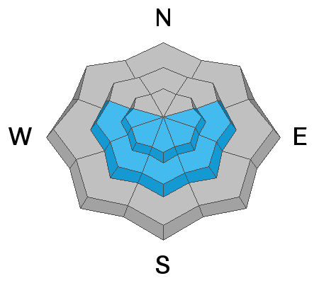
There is LOW avalanche danger in the backcountry this morning, and people will again find excellent shallow powder riding conditions in north facing terrain. There are exceptions, and small human triggered avalanches of wind drifted snow or cornice falls remain possible on some very steep upper elevation slopes. Solar heating today will cause heightened wet avalanche conditions and MODERATE danger in sunny terrain. Loose wet avalanches entraining moist surface snow could rapidly become an issue as high angled sun warms up the fresh powder from the last couple days.

EVALUATE SNOW AND TERRAIN CAREFULLY
Low
Moderate
Considerable
High
Extreme
Learn how to read the forecast here
Special Announcements
Spring Awareness Campaign - Help us save lives through avalanche forecasts and education. Consider making a donation to show your support. HERE
Weather and Snow
It's 23°F this morning at the 8400' Tony Grove Snotel, and there is 69 inches of total snow. It's 16°F and northwest winds are blowing around 23 mph at the 9700' CSI Logan Peak weather station. People will find very nice shallow powder riding conditions in the backcountry again today, especially in shady or north facing terrain. The high angled spring sun will be out later today and it will heat up the snow, make it sticky and moist, and cause an elevated danger of loose wet avalanches that could entrain large piles of debris on sustained pitches.
We expect mostly sunny skies today, with high temperatures at 9000' around 33°F and moderate winds from the northwest. Looks like fair weather and even warmer daytime temperatures tomorrow. We should see much cooler and windy weather on Monday, with snow showers and a chance of a couple inches of snow.
Recent Avalanches
One party reported intentionally triggering four soft slabs, 1 to 1.5' deep and 30 to 40 feet wide in extreme north facing terrain at upper elevations in the Central Bear River Range yesterday, 3-26-2021.
A party reported triggering multiple long running sluffs of moist storm snow in Wood Camp on Tuesday 3-23-2021.

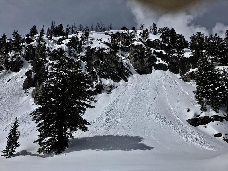
When the sun popped out for a while on Wednesday morning, numerous predictable natural loose wet avalanches or sluffs of moist storm snow occurred on sunny slopes.
Natural sluffs were fairly widespread on sunny slopes near Tony Grove Lake on Wednesday.
Ad
Avalanche Problem #1
Wind Drifted Snow
Type
Location
Likelihood
Size
Description
Avalanche problems are limited to newer snow and are found only in the very upper layers of the snowpack. Even so, it is wise to continue to use safe backcountry travel protocols and check be sure everyone in your party is transmitting and has a good probe and shovel. Go one person at a time and watch each other.
  1. Avalanches of recently drifted new snow up to about a foot-and-a-half deep are possible for people to trigger in very steep upper elevation terrain. Watch for stiffer, recently drifted snow in and around terrain features like cliff bands, gullies, and sub-ridges
  2. Large, overhanging ridge-top cornices have grown in recent days, and people might be fooled into getting too close to the edge. Warm temperatures this weekend could cause some of these to sag or even calve off. Cornice falls could cause avalanches on steep slopes below.
Avalanche Problem #2
Wet Snow
Type
Location
Likelihood
Size
Description
Natural sluffs or loose wet avalanches entraining up to about a foot moist fresh snow are quite possible in steep terrain today as the sun warms up the fresh powder. These are quite predictable and generally manageable, but you really have to pay attention to the terrain you are in. Snow falling off rock bands or trees onto steep slopes or people venturing into steep terrain are the most likely triggers of loose wet avalanches today. Obviously, people want to avoid being hit by these avalanches from above, so be sure there are no other people above or below you and avoid being under steep slopes with potential for natural avalanches.
  • Watch out for trees, gullies, and other terrain traps below you if you venture into steep terrain... Even a small avalanche in the wrong place can hurt or kill you.
Additional Information
General Spring Travel Advise:
As daytime temperatures rise, softening the snow, the danger of wet avalanches will increase, so its a good idea to get in the habit of an early start and to plan on heading down before things get too sloppy.
-Watch for trees or other terrain traps below you if you venture onto steep slopes.
-If you start sinking deeply into wet snow, or if the snow you are traveling on becomes unsupportable due to the heat, it's time to leave.
Do you have the essential avalanche rescue gear (transceiver, probe, and shovel) and do you know how to use them? Watch this video to see how the three pieces of equipment work together. HERE

Please keep practicing with the Beacon Training Park at the Franklin Basin Trailhead. Test yourself and your riding partners. It is free, fun, and easy to use.
General Announcements
Preston rider Allen Foss was killed in an avalanche on February 20 near Sherman Peak. Please consider supporting the Foss family during this difficult time. HERE
Visit this website with information about Responsible Winter Recreation by the Utah Office of Outdoor Recreation.
EMAIL ADVISORY. If you would like to get the daily advisory by email you subscribe HERE.
Remember your information can save lives. If you see anything we should know about, please help us out by submitting snow and avalanche observations....HERE. You can also call us at 801-524-5304, email by clicking HERE, or include #utavy in your Instagram, or @UAClogan on Twitter.
We will update this forecast by around 7:30 tomorrow morning.
This forecast is from the USDA Forest Service, which is solely responsible for its content. The forecast describes general avalanche conditions and local variations always occur.