Check out our Holiday Auction

Forecast for the Logan Area Mountains

Toby Weed
Issued by Toby Weed on
Tuesday morning, March 23, 2021
Heightened avalanche conditions exist on upper and mid elevation slopes, and there is MODERATE danger in the backcountry today. People will find excellent shallow powder riding conditions, but you could trigger shallow soft slab avalanches of drifted new snow or loose dry avalanches in steep terrain. If the sun peeks out for even a little while, loose wet avalanches entraining moist new snow may become likely.
EVALUATE SNOW AND TERRAIN CAREFULLY
Low
Moderate
Considerable
High
Extreme
Learn how to read the forecast here
Special Announcements
Spring Awareness Campaign - Help us save lives through avalanche forecasts and education. Consider making a donation to show your support. HERE
Weather and Snow
It's 20°F this morning at the 8400' Tony Grove Snotel, and there is 72 inches of total snow with 78% of normal SWE. About 3" of new snow fell overnight, and 7" in the last 24 hours with 0.6" SWE. It's 14°F and northwest winds are blowing around 15 mph at the 9700' CSI Logan Peak weather station. People will find very nice shallow powder riding conditions in the backcountry, especially where the underlying refrozen snow is smooth.
We expect mostly cloudy skies again today, with snow showers likely this afternoon and not much accumulation. High temperatures at 9000' will be around 26°F, and 10 to 20 mph north winds will create wind chill values as low as -3°F. The sun will be out tomorrow and upper elevation temperatures will approach 30°F. Unsettled conditions will continue through the work week.
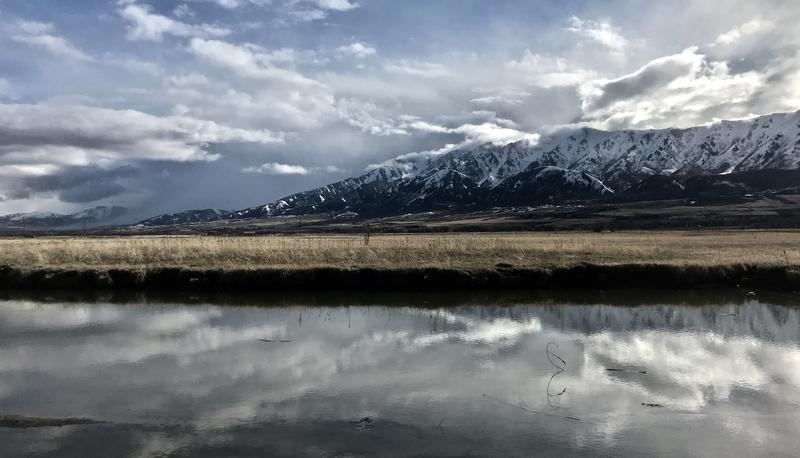
The Wellsville Range viewed from the Little Bear River on 3-21-2021.
Recent Avalanches
One party reports triggering fast moving loose avalanches or sluffs on steep upper elevation slopes in the Central Bear River Range over the weekend. Some wet avalanches occurred with last week's heat, but no other avalanches were reported in the Logan Zone recently.
Ad
Avalanche Problem #1
New Snow
Type
Location
Likelihood
Size
Description
Avalanche problems are limited to newer snow and are found only in the very upper part of the snowpack. Loose avalanches or sluffs and shallow soft slab avalanches of drifted storm snow are possible for people to trigger in steep upper and mid elevation terrain. Soft slab avalanches of wind-drifted fresh snow up to about a foot deep are most likely on upper elevation slopes facing the eastern side of the compass, but possible on any steep slope with recent deposits of drifted snow.
  • Continue to use safe backcountry travel protocols. Go one person at a time and watch each other.
Avalanche Problem #2
Wet Snow
Type
Location
Likelihood
Size
Description
Loose wet avalanches entraining moistened fresh snow will become likely in steep terrain if the high angle sun peaks out of the clouds, even for a short period.
  • Watch out for trees, gullies, and other terrain traps below you if you venture into steep terrain... Even a small avalanche in the wrong place can hurt or kill you.
Additional Information
As daytime temperatures rise, softening the snow, the danger of wet avalanches will increase, so its a good idea to get in the habit of an early start and to plan on heading down before things get too sloppy.
-Watch for trees or other terrain traps below you if you venture onto steep slopes.
-If you start sinking deeply into wet snow, or if the snow you are traveling on becomes unsupportable due to the heat, it's time to leave.
Do you have the essential avalanche rescue gear (transceiver, probe, and shovel) and do you know how to use them? Watch this video to see how the three pieces of equipment work together. HERE

Please keep practicing with the Beacon Training Park at the Franklin Basin Trailhead. Test yourself and your riding partners. It is free, fun, and easy to use.
General Announcements
Preston rider Allen Foss was killed in an avalanche on February 20 near Sherman Peak. Please consider supporting the Foss family during this difficult time. HERE
Visit this website with information about Responsible Winter Recreation by the Utah Office of Outdoor Recreation.
EMAIL ADVISORY. If you would like to get the daily advisory by email you subscribe HERE.
Remember your information can save lives. If you see anything we should know about, please help us out by submitting snow and avalanche observations....HERE. You can also call us at 801-524-5304, email by clicking HERE, or include #utavy in your Instagram, or @UAClogan on Twitter.
We will update this forecast by around 7:30 tomorrow morning.
This forecast is from the USDA Forest Service, which is solely responsible for its content. The forecast describes general avalanche conditions and local variations always occur.