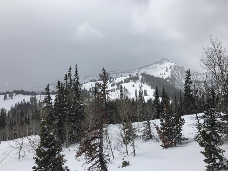
It's 25°F at the 8400' Tony Grove Snotel. About 3 inches of new snow fell in the last 24 hours at the site, and there is 89 inches of total snow, containing 109% of normal Snow Water Equivalent. It's 20°F at the 9700' CSI Logan Peak weather station, and southwest winds are currently blowing about 17 mph.
People could trigger wet avalanches in steep terrain during the heat of the day today. Lower elevation snow is melting fast and the saturated snow in some areas is too soft. Shallow natural and triggered wet avalanches consisting of fresh snow are likely today in upper and mid elevation sunny terrain, but they should stay pretty small. Although they might be hard to trigger, wet avalanches on northerly facing slopes on lower elevation slopes could gouge all the snow out to the ground, and involve deep piles of heavy wet snow.
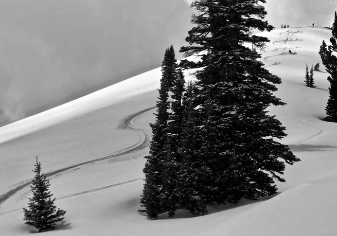
We found nice spring powder on northerly facing slopes yesterday afternoon.
The National Weather Service has issued a
Winter Storm Watch for our area from tomorrow afternoon through Thursday evening. A storm system will spread moisture across southern, central and eastern Utah today. A colder and stronger system will impact mainly northern Utah late Tuesday into Wednesday, then the remainder of the state Thursday into Friday.
Snow showers are possible this afternoon and so is some thunder, but it will be partly sunny today, with 8500' high temperatures close 40°F and 8 to 16 mph south-southwest wind. Snow showers are likely tonight, with 1 to 3 inches possible. Low temperatures are expected to be around 21°F and west-southwest winds will blow around 17 mph. Snow and thunder showers are likely tomorrow, with 3 to 5 inches of snow possible. High temperatures will be near 36°F and west-southwest winds will blow 13 to 16 mph.
Clouds and a cool breeze kept a few inches of new snow at upper elevations nice and dry yesterday.
Yesterday, we noticed a sizable natural cornice fall avalanche off the south ridge of Mt. Magog on an east facing slope at around 9400' and some long running natural loose wet avalanches in Logan Dry Canyon, (SW @ 8000')
Observers report triggering small slabs of wind drifted snow as well as loose avalanches of dry and moist surface snow at upper elevations this weekend.
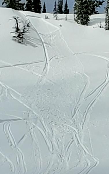
This 1' x 20' rider triggered soft slab avalanche occurred Friday, 3-20-2020.
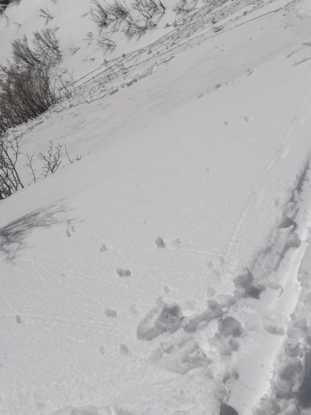
A skier intentionally triggered a loose wet avalanche in the Wellsville Mountain Wilderness Saturday, 3-21-2020.