
Forecast for the Logan Area Mountains

Issued by Toby Weed on
Monday morning, March 20, 2023
Monday morning, March 20, 2023
Periods of heavy snow and drifting from southwest winds will elevate backcountry avalanche conditions today. The danger is MODERATE at all elevations, people could trigger soft slab or loose avalanches of storm snow on upper and mid elevation slopes, and wet avalanches are possible lower down where rain is falling on the snow.
Expect rising danger today in upper elevation terrain, and CONSIDERABLE danger is likely develop this evening and tonight as accumulations of storm snow become significant, and long running natural avalanches become possible.
Expect rising danger today in upper elevation terrain, and CONSIDERABLE danger is likely develop this evening and tonight as accumulations of storm snow become significant, and long running natural avalanches become possible.
Plan for rising avalanche danger, make conservative decisions, and evaluate snow and terrain carefully.

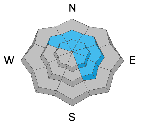
Low
Moderate
Considerable
High
Extreme
Learn how to read the forecast here

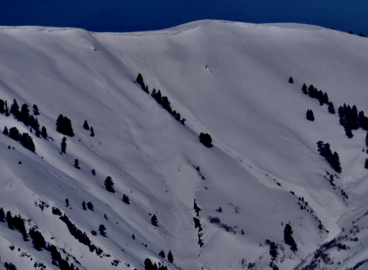
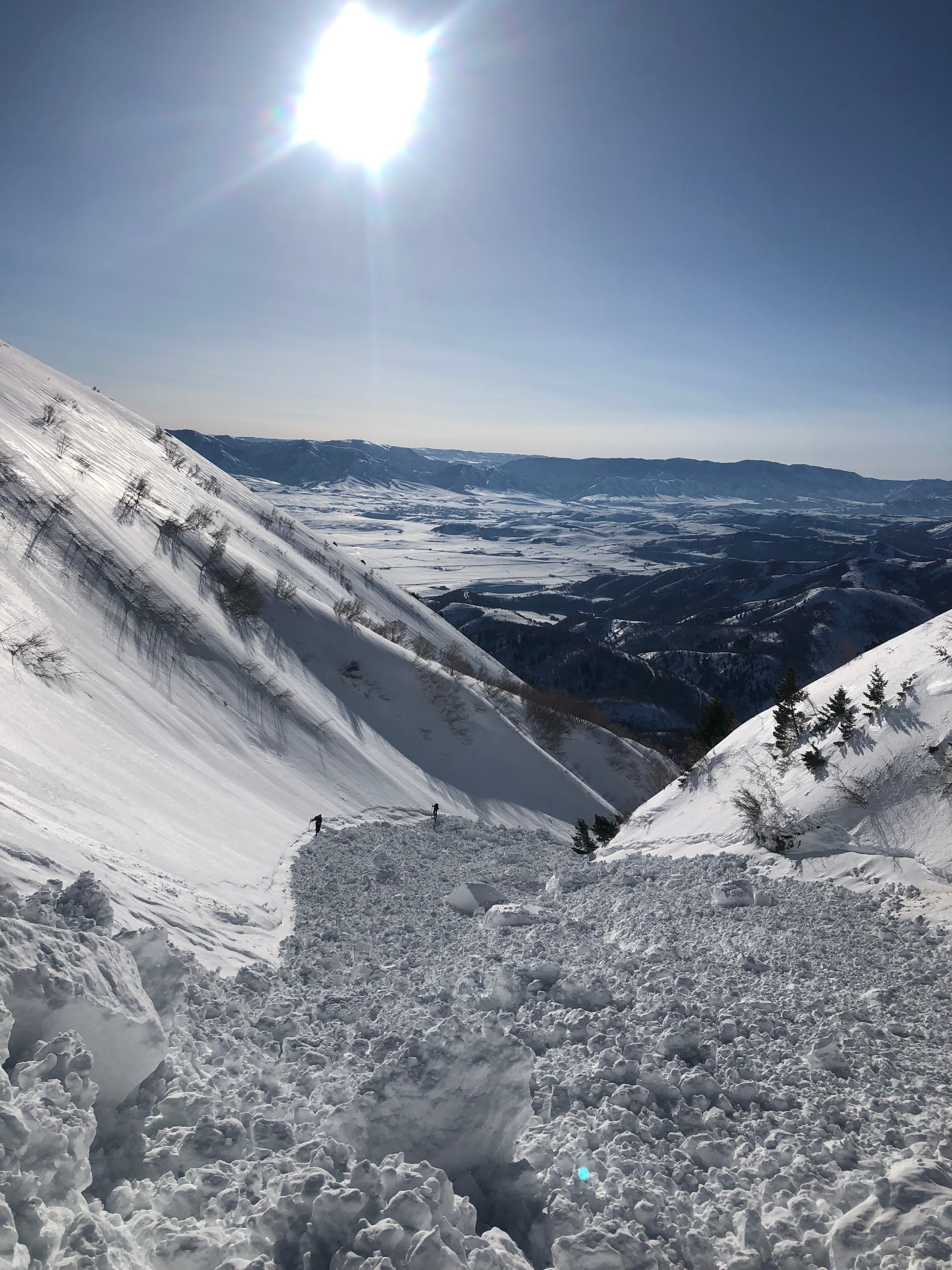 There are very large cornices in the Logan Zone this spring, and this is a good reason to stay well away from and out from under them for a while. Cornices can fail way back from the edge, on seemingly flat ridgelines, and they can trick and roll even the most experienced people. Natural cornice falls like this one are most likely during storms with significant ongoing drifting or when warm temps and spring sun cause rapid warming, but they can occur at anytime.....


