It's 12°F at the 8400' Tony Grove Snotel, and there is an inch or two of graupel with 0.2" of Snow Water Equivalent in the last 24 hours. The station recorded almost 5"of SWE with the windy and warm late week storm. There is now 88 inches of total snow, containing 137% of normal SWE. The winds veered from the northeast overnight, and are currently blowing around 15 mph at the CSI Logan Peak weather station, and it's 8°F at 9700'.
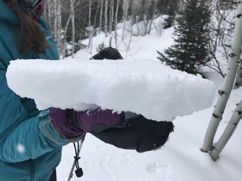
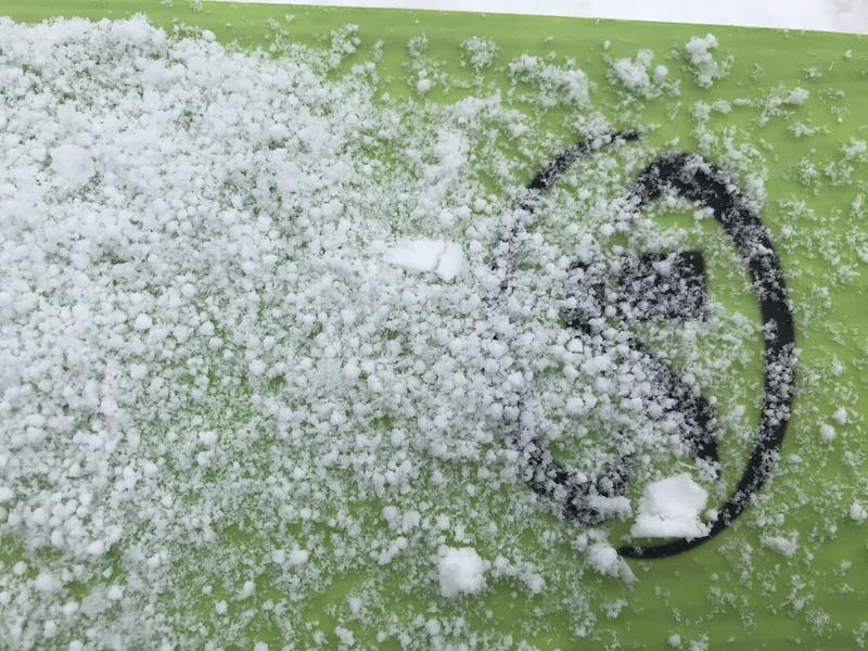
Accumulations of very heavy snow, rain at lower elevations, and sustained strong westerly winds created heightened avalanche conditions in the backcountry this weekend. Much cooler temperatures last night have set up the mushy and wet snow at lower elevations, and the snow is now harder and much more stable. A thick rain-crust, translucent and brittle in places, exists in many areas even at high elevations. It is capping a soft and moist layer of graupel and heavily rimed snow. A fast moving squall dropped another inch or two of graupel in the Central Bear River Range yesterday.
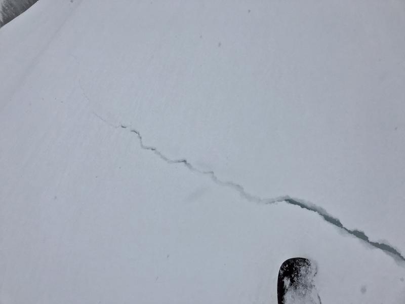
A thick and supportable rain-crust caps Thursday's moist layer of fresh graupel and rimed snow.
Graupel fell during yesterday's squall
There's a chance of snow showers this morning, then expect partly sunny conditions, with high temperatures at 8500' around 21°F, and 13 to 15 mph east winds. Tonight will be mostly clear, with low temperatures around 5°F, 9 to 14 mph northeast winds, and wind chill values as low as -12°F. Snow showers are possible tomorrow afternoon. It'll be mostly cloudy, with a high temperature near 20°F, 20 to 25 mph north winds, and wind chill values as low as -11°F.
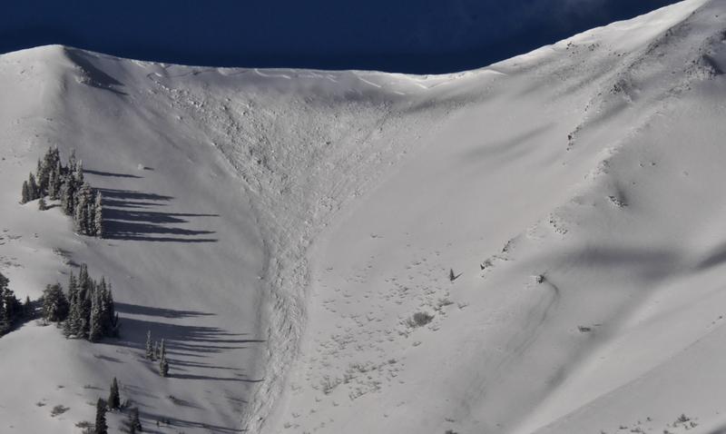
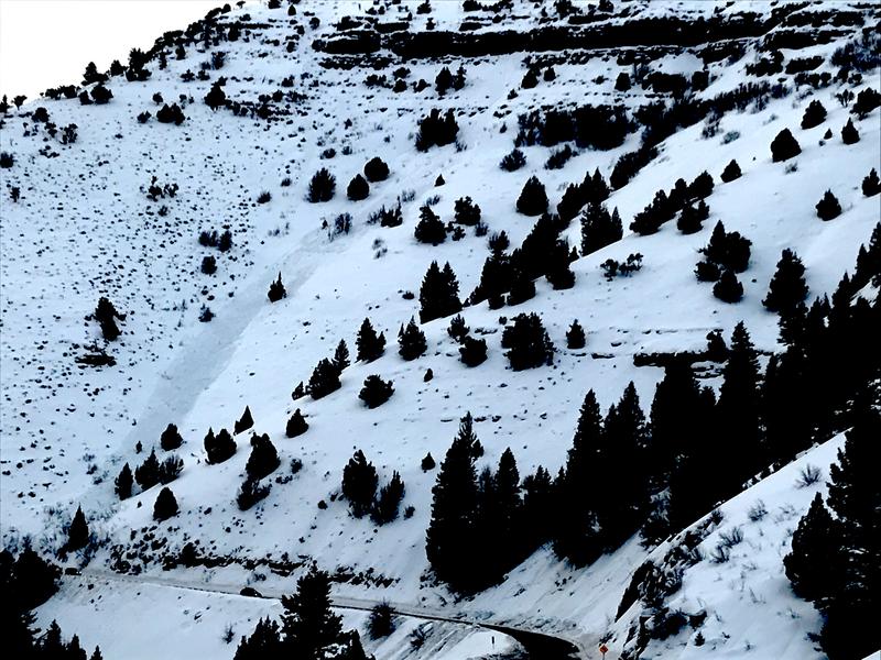
Clearing yesterday morning allowed us to get views of fairly widespread natural avalanche activity in the Wellsville Mountain Wilderness, including this nice fresh avalanche of wind drifted snow in Old Logway Canyon. The avalanche appears to be two to three feet deep and 300' to 400' wide, running well over 2000 vrt', but stopping just short of the flats on Maple Bench.
Natural wet avalanches hit highway 89 in the Dugway Area of Logan Canyon and forced it's closure around 3:00 Friday afternoon. The highway was closed for a couple hours so crews could clear the debris.
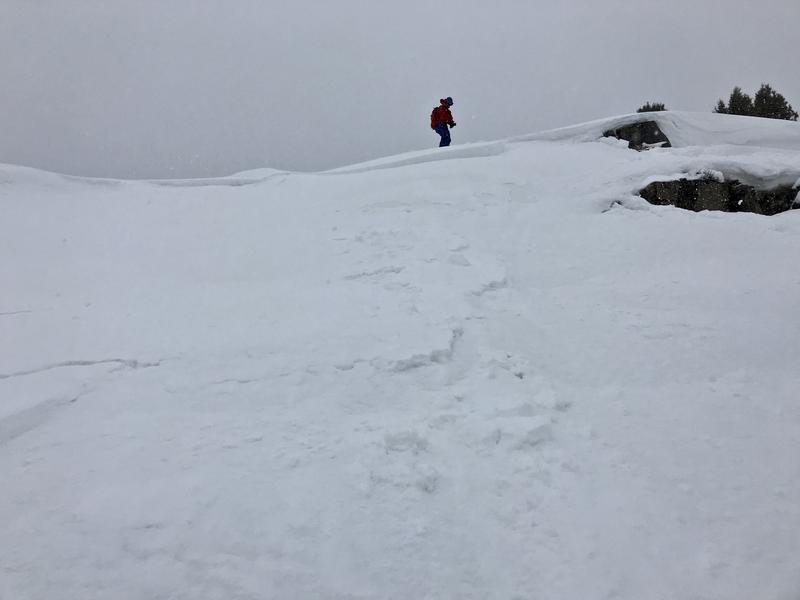
We easily and intentionally triggered a good sized avalanche Thursday in Hatties Bowl above Rick Springs in Logan Canyon. The 1' deep and 100' wide avalanche cracked released after we dropped a very small chunk of cornice on it.