Check out our Holiday Auction

Forecast for the Logan Area Mountains

Toby Weed
Issued by Toby Weed on
Friday morning, February 26, 2021
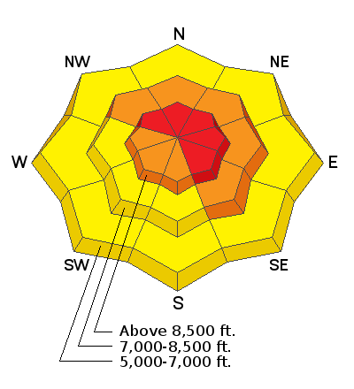
Conditions in the backcountry are dangerous, and there is CONSIDERABLE danger on steep upper and mid elevation elevation slopes. Heavy snowfall and drifting from strong westerly winds will cause the danger to rise today, especially in the northern part of the zone. HIGH danger may develop on drifted upper elevation slopes. Natural avalanches are possible and people would likely trigger large avalanches failing 3 to 4 feet deep on a widespread buried persistent weak layer if they venture into steep terrain. Large and dangerous avalanches might be triggered remotely, from a distance, or below.
  • Expect unstable snow conditions, even if obvious signs of instability are absent.
  • Choose safe routes in low angled terrain well out from under and not connected to drifted slopes steeper than about 30 degrees.
  • You can find safer conditions in sheltered terrain, at lower elevations, and on gentle lower angled slopes.
Low
Moderate
Considerable
High
Extreme
Learn how to read the forecast here
Special Announcements
We are very sad to report that on 2-20-2021, a 48-year-old Preston man was killed in an avalanche on the east side of Sherman Peak west of Georgetown Idaho. Our preliminary accident report is HERE.
Weather and Snow
Looks like about 5 inches of new snow overnight, with 0.3" SWE in the last 24 hours at the 8400' Tony Grove Snotel. It's 14°F, and there is 75 inches of total snow and 81% of normal SWE. Winds from the west are blowing 25 to 30 mph at the CSI Logan Peak weather station. There has been a good deal of drifting at upper elevations from mostly west winds in the past several days.
The National Weather Service has continued a Winter Storm Warning through tomorrow morning for the northern Bear River Range. A Winter Weather Advisory remains in affect through tomorrow for the rest of the mountains in the Logan Zone. We're expecting heavy snowfall today, with 6 to 10 inches likely to accumulate on upper elevation slopes. Temperatures at 8500' will top out at around 18°F, and 25 to 30 mph west-southwest winds blowing along the ridges will create wind chill values as low as -11°F. Snow will continue and be heavy at times tonight, with continuing west winds and a possibility of some thunder-snow. Expect increasing avalanche danger, with snow and blowing snow in the mountains today and night, and we're on track for a foot to a foot-and-a-half of accumulation on upper elevation slopes by Saturday morning.
Recent Avalanches
On Saturday 2-20-2021 a party of riders remotely triggered a very large avalanche near Gibson Lakes in Franklin Basin, a few miles north of the Idaho state line. The large group of riders were down in the flats, and well out from under any steep terrain when they heard a very loud "sonic boom" audible collapse, and the whole hill came down... clouds obscured the crown, but the debris field was quite broad.
A significant natural cycle occurred across the Logan Zone early last week, with many huge avalanches observed. Very large natural avalanches failing on a buried sugary persistent weak layer and running well out into lower elevation runout zones were widespread and occurred on slopes facing every direction.
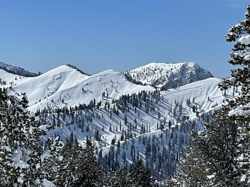
Large natural avalanches were widespread across the Logan Zone early last week. Here's a picture from yesterday of the Seven Sisters in the Mount Naomi Wilderness. (Jensen)
Ad
Avalanche Problem #1
Persistent Weak Layer
Type
Location
Likelihood
Size
Description
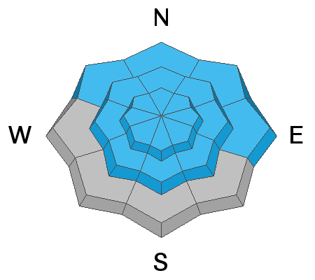
Most natural avalanches in the Logan Zone occur during windy winter storms. Heavy snowfall and westerly winds today will add weight and overload slopes with poor snow structure that are currently near the tipping point. Buried persistent weak layers consisting of sugary faceted snow are widespread across the Logan Zone, and the threat of large and deadly avalanches failing on weak snow near the ground remains quite real.
  • Avalanches failing on a buried persistent weak layer might be triggered remotely, from a distance, or worse from below!
  • Cracking and collapsing of the snow are a red flag, indicating unstable snow conditions.
Avalanche Problem #2
Wind Drifted Snow
Type
Location
Likelihood
Size
Description
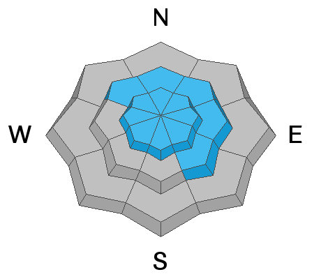
Avalanches of wind drifted snow are possible where fresh drifts build today or formed recently, especially on slopes with buried persistent weak layers.
  • Wind slabs are often rounded and chalky looking, and they can sound and feel hollow and drum-like when you walk on them.
  • Watch for and avoid stiffer drifted snow near ridge tops and in and around terrain features like gullies, scoops, cliff bands, and sub ridges.
  • Stay well back from cornice edges as they can break much further back than you expect and avalanches are likely on slopes below.
Additional Information
Do you have the essential avalanche rescue gear (transceiver, probe, and shovel) and do you know how to use them? Watch this video to see how the three pieces of equipment work together. HERE
Please keep practicing with the Beacon Training Park at the Franklin Basin Trailhead. Test yourself and your riding partners. It is free, fun, and easy to use.
General Announcements
Visit this website with information about Responsible Winter Recreation by the Utah Office of Outdoor Recreation.
EMAIL ADVISORY. If you would like to get the daily advisory by email you subscribe HERE.
Remember your information can save lives. If you see anything we should know about, please help us out by submitting snow and avalanche observations....HERE. You can also call us at 801-524-5304, email by clicking HERE, or include #utavy in your tweet or Instagram.
I will update this forecast by around 7:30 tomorrow morning.
This forecast is from the USDA Forest Service, which is solely responsible for its content. The forecast describes general avalanche conditions and local variations always occur.