Forecast for the Logan Area Mountains

Issued by Toby Weed on
Monday morning, February 14, 2022
Monday morning, February 14, 2022
Today, the avalanche danger is LOW in the backcountry. Avalanches are unlikely, and the snow is stable on most slopes with few exceptions.
Finally, a change in the weather and there is a little new snow in the forecast for tomorrow! Although stable, the existing snow is very weak in many areas, and the new snow will cap and preserve widespread layers of loose and sugary faceted snow at all elevations.
Use normal caution. Watch for and avoid (1) stiff wind drifted snow on steep upper elevation slopes, (2) loose recrystallized snow sluffing on very steep sustained slopes, and (3) saturated, sun-softened snow on steep slopes in the midday heat.
Use normal caution. Watch for and avoid (1) stiff wind drifted snow on steep upper elevation slopes, (2) loose recrystallized snow sluffing on very steep sustained slopes, and (3) saturated, sun-softened snow on steep slopes in the midday heat.

Low
Moderate
Considerable
High
Extreme
Learn how to read the forecast here
 Special Announcements
-
The Utah Avalanche Center will be holding a BC 101 class in Logan on Feb 24-25. This class is great for those new to the backcountry or wanting to refresh their skills. Click here for details and registration.
- Thanks to the generous support of our local resorts and Ski Utah, discount lift tickets are now available. Support the UAC while you ski at the resorts this season. Tickets are available HERE.
 Weather and Snow
The snow is generally stable across the Logan Zone, and it's been over a month since we've seen any significant avalanche activity. As you'd expect after a month of dry weather conditions, variable snow surface conditions are found in most places, ranging from soft and shallow recrystallized "powder", to smooth springlike "corn snow" in sunny terrain, to thin, breakable, and bulletproof crusts. The 8400' Tony Grove Snotel reports 31°F, and there is 64 inches of total snow containing an even 100% of normal SWE for the date. Winds out of the southwest are blowing around 25 mph this morning at the 9700' CSI Logan Peak weather station.
- It will be mostly sunny in the mountains again today, but cloud cover and winds will be increasing ahead of a pair of storm systems that should bring a little snow to the mountains in the Logan Zone tomorrow. Expect a high temperature at 8500' around 41°F and breezy conditions, with increasing 25 to 30 mph west-southwest winds.
- Tonight, temperatures will drop to around 24°F around 2200 hrs, but then increase to around 36°F for the rest of the night. South winds will blow 20 to 30 mph, and snow is likely to start falling in the early morning hours, with up to an inch of accumulation possible by tomorrow morning.
- Snow is likely tomorrow, with 2 to 4 inches of accumulation possible, high temperatures around 34°F, and 10 to 15 mph northwest winds.
- A little more snow accumulation is possible on Wednesday, with gradual clearing and warming as we head into the weekend.

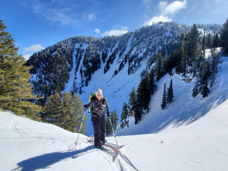
You can find nice smooth, shallow, recrystallized surface snow or "loud powder" in sheltered areas, springlike "corn snow" in sunny terrain, and a wide variety of wind-jack, sun and rain crusts, and thick and thin layers of sugary faceted snow elsewhere. (Amy Flygare topping out on the Mill Hollow/Logan Dry Ridge with Logan Peak in the Background, 2-11-2022)
 Recent Avalanches
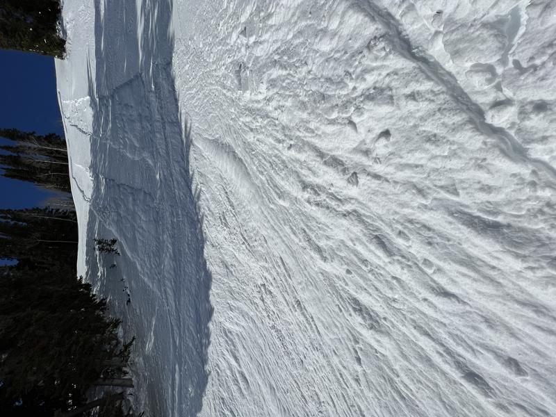
Friday in steep terrain in the Bear River Range a party of riders triggered a few loose avalanches or sluffs involving 10" to 12" of very loose sugary faceted surface snow. These were manageable but indicate potential for larger avalanches if we do ever get some significant snow accumulations.
Saturday in the Wasatch Range, two different parties reported a person being caught in loose dry avalanches or sluffs. Both occurred on steep north facing slopes.

On a sustained slope, this kind of avalanche could be a problem if you get swept into trees or other terrain traps below like gullies or benches...
Avalanche Problem #1
Normal Caution
Type
Location

Likelihood
Size
Description
Remember, LOW avalanche danger doesn't mean NO avalanche danger.
- Although unlikely, people might trigger shallow hard slab avalanches of drifted snow on steep slopes in wind exposed upper elevation terrain. Some hard wind slabs formed last week on weak faceted surface snow, which may now be a buried persistent weak layer. Watch for and avoid stiffer drifted snow at upper elevations on the lee side of major ridges and in and around terrain features like sub-ridges, gullies, and cliff bands.
- Loose avalanches (or sluffs) of recrystallized or faceted surface snow are possible on some very steep and sustained slopes. These are generally manageable unless you are caught and pulled into terrain traps like trees, gullies, or benches.
- Mountain high temperatures will be several degrees warmer today than they were yesterday. Although the snow has been refreezing well at night, warmer mountain temperatures mean small loose wet avalanches may become possible in sheltered sunny terrain in the heat of the day, especially in steep terrain with shallow snow cover and around heat-trapping rocks or cliff bands. Roller balls, pinwheels, and loose sluffs indicate potential for wet avalanche activity. If you start sinking into saturated snow, it's time to move into the shade or leave.
Additional Information
- Now is a great time to practice your avalanche rescue skills. Thanks to the generous support of Northstar, the Franklin Basin Beacon Training Park is up and running. The park is located directly west of the parking lot and is open for anyone to use. All you need is your beacon and probe. Please do not dig up the transmitters.
- Always follow safe backcountry travel protocols. Go one person at a time in avalanche terrain, while the rest of your party watches from a safe area. (practice anytime while traveling on or under backcountry slopes steeper than 30°)
- Check your avalanche rescue equipment, change your batteries, and practice often with your backcountry partners.
Check slope angles, and to avoid avalanche terrain stay off of and out from under slopes steeper than 30° and adjacent slopes. Video Here
General Announcements
Special thank you to Polaris and Northstar...Video Here
Who's up for some free avalanche training? Get a refresher, become better prepared for an upcoming avalanche class, or just boost your skills. Go to https://learn.kbyg.org/ and scroll down to Step 2 for a series of interactive online avalanche courses produced by the UAC.
- Check out all the upcoming education classes and clinics HERE.
- Please submit your observations from the backcountry HERE.
This information does not apply to developed ski areas or highways where avalanche control is normally done. This forecast is from the U.S.D.A. Forest Service, which is solely responsible for its content. This forecast describes general avalanche conditions and local variations always occur.


