Join us at our 2nd Annual Blizzard Ball

Forecast for the Logan Area Mountains

Toby Weed
Issued by Toby Weed on
Thursday morning, February 11, 2021
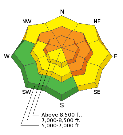
Drifting from strong and persistent west winds created dangerous avalanche conditions and CONSIDERABLE danger in the backcountry. People could trigger dangerous avalanches on steep drifted slopes at all elevations, but more dangerous conditions exist on drifted upper and mid elevation slopes facing northwest through southeast.
A powerful winter storm with heavy snowfall and significant drifting will cause increasing avalanche danger tonight, and we expect very dangerous avalanche conditions in the backcountry tomorrow, lasting through the long weekend. Plan on avoiding travel in backcountry avalanche terrain.
  • Evaluate snow and terrain carefully. Make conservative decisions.
  • Continue to stay off and out from under drifted slopes steeper than about 30 degrees.
Low
Moderate
Considerable
High
Extreme
Learn how to read the forecast here
Avalanche Watch
  • WATCH IS FOR HIGH AVALANCHE DANGER IN THE BACKCOUNTRY BEGINNING FRIDAY MORNING AND LASTING THROUGH THE WEEKEND
  • FOR ALL THE MOUNTAINS OF NORTHERN UTAH INCLUDING THE WASATCH RANGE...BEAR RIVER RANGE...UINTA MOUNTAINS... AND MANTI SKYLINE
  • THE AVALANCHE DANGER FOR THE WARNING AREA WILL RISE TO HIGH BY FRIDAY, AND VERY DANGEROUS AVALANCHE CONDITIONS ARE LIKELY TO CONTINUE THROUGH THE WEEKEND.
  • HEAVY SNOW AND DRIFTING WILL OVERLOAD BURIED PERSISTENT WEAK LAYERS AND CREATE WIDESPREAD AREAS OF UNSTABLE SNOW.
  • BOTH HUMAN TRIGGERED AND NATURAL AVALANCHES WILL BECOME LIKELY. STAY OFF OF AND OUT FROM UNDER SLOPES STEEPER THAN 30 DEGREES.
Special Announcements
We are very sad to report that four skiers were killed in an avalanche in the backcountry in Mill Creek Canyon above Salt Lake City on Saturday. Preliminary Accident Report
The UAC in Logan is offering a Youth BC 101 avalanche class for youth aged 16-20 on Feb 21. For more info and to register, click HERE
Weather and Snow
*DANGEROUS BACKCOUNTRY AVALANCHE CONDITIONS EXIST*
Light snow is falling in the Bear River Range this morning. It's 26°F and there is 53 inches of total snow at the 8400' Tony Grove Snotel, with 72% of normal SWE. West winds are blowing around 25 mph at the 9700' CSI Logan Peak weather station again this morning, and there really isn't much transportable snow left for the wind to drift at upper elevations after several days of very windy conditions. Strong westerly winds over the weekend drifted tremendous quantities of the fresh snow into lee slope avalanche starting zones and cross-loaded drifts in exposed terrain lower down. With widespread layers of preexisting very weak snow, the recent significant increase in load on the fragile snowpack has created dangerous avalanche conditions on drifted slopes in the backcountry.

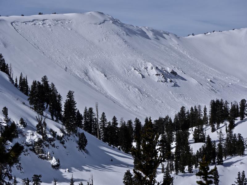
We went up to Cornice Ridge on 2-8-2021 to check out a large natural hard slab avalanche that occurred overnight Saturday night or early Saturday morning. Wind drifted snow overloaded weak sugary or faceted snow near the ground and tipped the scales before any people could even get out on or under the slope.

It's snowing lightly this morning and more snow is expected today in the mountains, with 2 to 4 inches of accumulation possible. High temperatures at 8500' will be around 26°F, with continuing 20 mph+ west winds. The National Weather Service has issued a Winter Storm Warning for the Logan Zone, for tonight through tomorrow night, and it looks like a foot to a foot-and-a-half of new snow could accumulate on upper elevation slopes. Westerly winds will continue to be pretty strong, and significant drifting is a sure bet.
A dangerous avalanche situation is likely to develop for the long weekend, with a high avalanche danger in the backcountry and lots of nice powder to lure people into steep avalanche terrain.
A snowpit test on a drifted mid elevation slope on the eastern slope of the Bear River Range showed unstable snow conditions on 2-10-2021. The extended column test was done near a recent remotely triggered avalanche of wind drifted snow at 7600' on an east-northeast facing slope.
Recent Avalanches
Monday (2-8-2021), a rider triggered a 4' deep hard slab avalanche within sight of Hwy 89 and the Bear Lake Overlook. The avalanche did not run very far and did not catch anyone, but illustrates the existing CONSIDERABLE avalanche danger that can be found even in unexpected or unusual places.
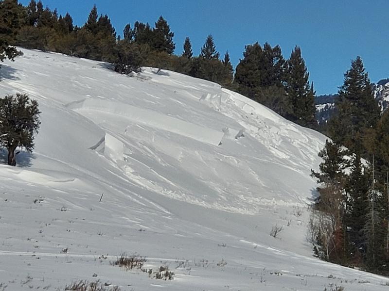
Saturday, backcountry skiers remote triggered a 2' deep and 200' wide avalanche on a fairly low angled slope on the shoulder of Swan Peak (or Bridger Peak) above Bear Lake.
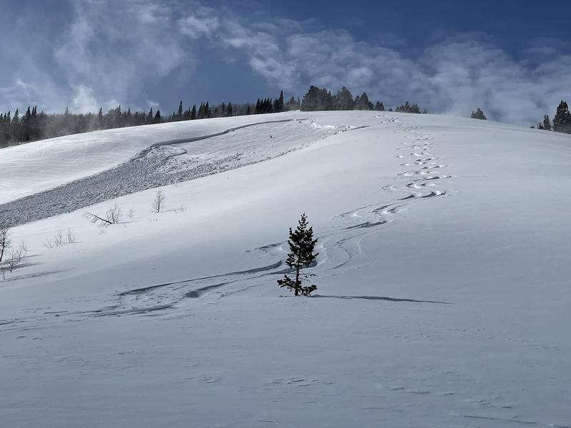
With a bit of clearing, large natural avalanches, likely from during the height of Friday's storm, were observed on Chicken Hill in Bunch Grass, the east face of Wilderness Peak in the Gibson Lakes Area in Franklin Basin, a few miles north of the Idaho State Line, in Steep Hollow, just south of Doubletop Mountain or "Gunsight", off the south ridge of Mt. Magog, and near Mt. Elmer in the Mt. Naomi Wilderness.
A fresher, very large natural avalanche, perhaps from Saturday night or early Sunday morning, was observed Sunday (2-7-2021) on Cornice Ridge.
A huge fresh natural avalanche was observed Sunday (2-7-2021) on Cornice Ridge.
Ad
Avalanche Problem #1
Persistent Weak Layer
Type
Location
Likelihood
Size
Description
Heavy snowfall and strong winds added weight to slopes that were already near the tipping point. Buried persistent weak layers consisting of sugary faceted snow are widespread across the Logan Zone, and the threat of large and deadly avalanches failing on weak snow near the ground is quite real. Avalanches are likely where a slab of more cohesive wind drifted snow has formed on top of the weak snow.
  • Avalanches failing on a buried persistent weak layer might be triggered remotely, from a distance, or worse from below!
  • Cracking and collapsing of the snow are a red flag, indicating unstable snow conditions.

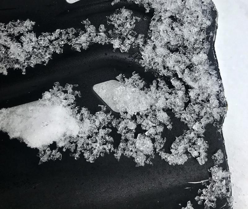
These large faceted snow grains make up a nasty buried persistent weak layer that is widespread in the Logan Zone. It exists on slopes at all elevations across the zone. (Beaver Mt. Backside, 2-7-2021)
Avalanche Problem #2
Wind Drifted Snow
Type
Location
Likelihood
Size
Description
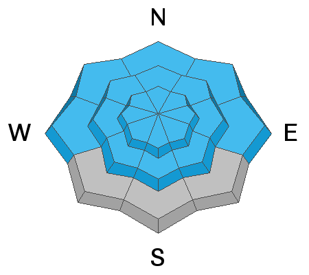
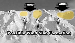
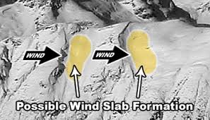
Westerly winds over the weekend drifted fresh snow into lee slope avalanche starting zones, and built drifts and wind slabs on steep slopes at upper and mid elevations. Human triggered avalanches of wind drifted snow are likely, especially where drifts have built on top of a buried persistent weak layer.
  • Wind slabs are often rounded and chalky looking, and they can sound and feel hollow and drum-like when you walk on them.
  • Watch for and avoid stiffer drifted snow near ridge tops and in and around terrain features like gullies, scoops, cliff bands, and sub ridges.
  • Cornices are starting to grow with the recent strong winds. Stay well back from the edge as they can break much further back than you expect.
Additional Information
Do you have the essential avalanche rescue gear (transceiver, probe, and shovel) and do you know how to use them? Watch this video to see how the three pieces of equipment work together. HERE
Please keep practicing with the Beacon Training Park at the Franklin Basin Trailhead. Test yourself and your riding partners. It is free, fun, and easy to use.
General Announcements
Thanks to the generous support of our local resorts, Ski Utah, and Backcountry, discount lift tickets are now available. Support the UAC while you ski at the resorts this season. Tickets are available here.
Visit this website with information about Responsible Winter Recreation by the Utah Office of Outdoor Recreation.
EMAIL ADVISORY. If you would like to get the daily advisory by email you subscribe HERE.
Remember your information can save lives. If you see anything we should know about, please help us out by submitting snow and avalanche observations....HERE. You can also call us at 801-524-5304, email by clicking HERE, or include #utavy in your tweet or Instagram.
I will update this forecast by around 7:30 tomorrow morning.
This forecast is from the USDA Forest Service, which is solely responsible for its content. The forecast describes general avalanche conditions and local variations always occur.