It's 23°F at the 8400' Tony Grove Snotel this morning, and there is 7 inches of heavy new snow, containing .9" SWE from the last 24 hours. I'm reading 34 inches of total snow containing 101% of normal for the date. It's 17°F at the 9700' CSI Logan Peak weather station, and northwest winds are diminishing a bit and are blowing about 15 mph, after sustaining average wind speeds in the 20s overnight. Sustained west and northwest wind yesterday and overnight caused an increase in danger of avalanches involving wind drifted snow. Areas with dangerous avalanche conditions exist on upper elevation slopes facing east, northeast, north, and northwest, where people could trigger large and scary avalanches failing on a buried persistent weak layer near the ground.
Expect snow showers to taper out this morning, and it'll be mostly sunny today. 8500' high temperatures will drop to around 16°F by evening, and 9 to 13 mph northwest winds will blow along the ridges. It'll be mostly cloudy in the mountains tonight, with low temperatures around 13°F, but rising during the night to around 21°F. Calm winds will become 5 to 8 mph from the west after midnight. It'll be partly cloudy tomorrow, with high temperatures around 22°F, and 5 to 7 mph southwest winds. The next round of winter weather is expected around Thursday, with growing potential for a decent storm for the weekend.
Two riders were caught and carried, and one of them was partially buried in an avalanche just north of the Idaho State Line on Saturday afternoon. Here's the
report.
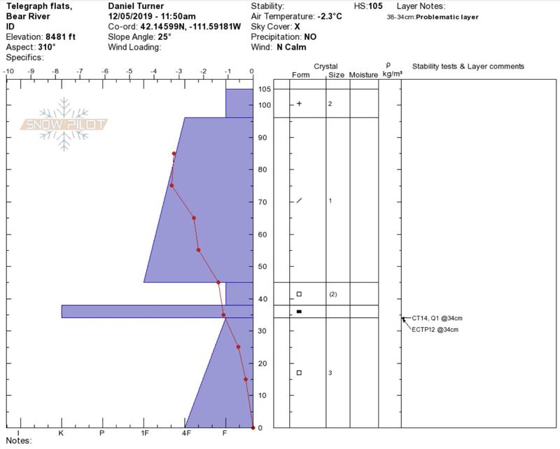
Tuesday, a solo skier unintentionally triggered a good sized avalanche failing on the sugary persistent weak layer near the ground in the west half of Miller Bowl south of Tony Grove Lake. The avalanche on a north facing slope at around 8700' was around 2' deep and at least 150' wide. report is
HERE