There's an inch of new snow and it's 28°F at the 8400' Tony Grove Snotel this morning. I'm reading 30 inches of total snow containing 7" SWE, which is 99% of normal for the date. It's 22°F at the 9700' CSI Logan Peak weather station, and south-southwest winds are blowing about 20 mph. Heightened avalanche conditions persist on upper elevation slopes facing northeast, north, and northwest, and dangerous human triggered avalanches remain possible.
Today will be partly sunny, with 8500' high temperatures around 31°F and 10 mph southwest winds. It'll be cloudy in the mountains tonight, with temperatures around 25°F. I expect we'll see increasing danger of avalanches involving wind drifted snow this weekend, and tonight, 10-15 mph south-southwest winds will increase to 18-23 mph during the night. It will be partly cloudy tomorrow, with snow showers in the afternoon. Expect high temperatures around 28°F, and it will be breezy, with 25 mph southwest wind. A progressive but weakening storm will bring several inches of snow to the Logan Zone Saturday night and Sunday.
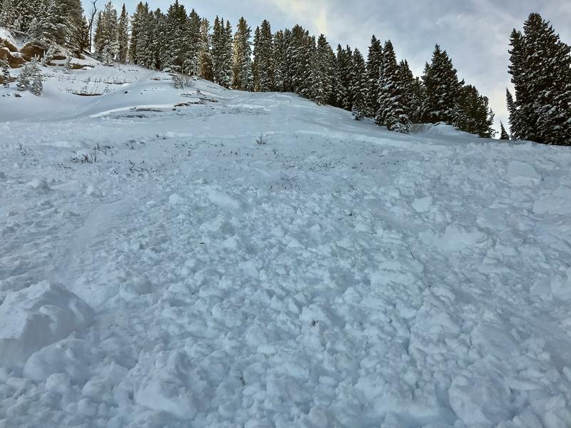
Tuesday, a solo skier unintentionally triggered a good sized avalanche failing on the sugary persistent weak layer near the ground in the west half of Miller Bowl south of Tony Grove Lake. The avalanche on a north facing slope at around 8700' was around 2' deep and at least 150' wide.
A natural avalanche involving wind drifted snow was spotted by observers Sunday (12-1-19) on the west side of Logan Peak in upper Logan Dry Canyon. The fresh avalanche was about 1 foot deep and 300 feet wide..