Join us at our 2nd Annual Blizzard Ball

Forecast for the Logan Area Mountains

Toby Weed
Issued by Toby Weed on
Saturday morning, December 17, 2022
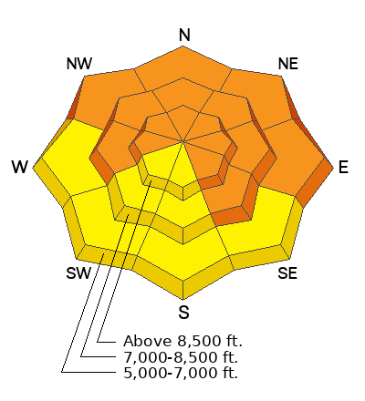
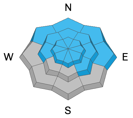
CONSIDERABLE: Areas with dangerous avalanche conditions exist on steep slopes in the backcountry at all elevations. This week's new snow and extensive drifting created thick slabs and overloaded slopes with poor snow structure. Even though the weather and snow will be nice, people are likely to trigger slab avalanches 1 to 4 feet deep failing on a widespread buried persistent weak layer. Dangerous avalanches could be triggered remotely, from a distance, or below!
Conditions are less dangerous on southerly facing slopes and in sheltered low and mid elevation terrain, but dangerous avalanches remain possible on all backcountry slopes steeper than 30°. ***We've found areas with great powder riding this week in safe lower angled terrain.

Careful snowpack evaluation, cautious route-finding, and conservative decision making are essential for backcountry travel.
Low
Moderate
Considerable
High
Extreme
Learn how to read the forecast here
Special Avalanche Bulletin
DANGEROUS AND UNUSUAL AVALANCHE CONDITIONS WILL LAST THROUGH THIS WEEKEND. HEAVY SNOWFALL AND DRIFTING THIS PAST WEEK OVERLOADED SLOPES WITH POOR SNOW STRUCTURE AND CREATED DANGEROUS AVALANCHE CONDITIONS AT ALL ELEVATIONS. PEOPLE ARE LIKELY TO TRIGGER LARGE AND DANGEROUS AVALANCHES.
  • DON'T BE LURED BY SUNNY SKIES AND FRESH POWDER INTO THINKING AVALANCHE CONDITIONS ARE SAFE WHEN THEY ARE NOT.
  • AVALANCHES CAN OCCUR IN LOW-ELEVATION FOOTHILLS, NOT FAR FROM PARKING AREAS AND TRAILHEADS.
Special Announcements
We have discounted Beaver Mountain tickets for sale. HERE.. Huge thanks to Beaver Mountain for supporting the work we do.
Weather and Snow
Very light powder stacked up this week and the snow is so nice that it's easy to forget that conditions are dangerous on many slopes steeper than 30°. Earlier in the week, heavy snow and drifting overloaded many slopes plagued by buried weak layers and poor snow structure. Most recent backcountry observations included reports of audible collapsing or "whumpfs" and some included cracking in drifted terrain. These red flags indicate unstable snow and real potential for dangerous slab avalanches failing on a buried persistent weak layer.
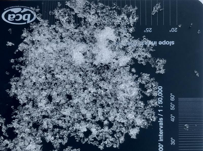
A nasty persistent weak layer of loose sugary faceted snow is widespread across the zone.

Looks like about 3 inches of new snow at the 8400' in the Central Bear River Range in the past 24 hours, with three to four feet of total snow on the ground across the zone. Winds blowing from the west were blowing 30 to 40 mph last night at the 9700' CSI Logan Peak weather station. I'm reading 5° F at 8500' this morning.
Expect this morning's clouds to gradually clear off, and we'll see mostly sunny but rather cold weather in the mountains this weekend. Today's 8500' high temperatures will be around 15° F, and 11 to 16 mph west winds will create wind chill values as low as -11° F.
Tomorrow is expected to be mostly sunny but cold in the mountains, with high temperatures around 18° F, 15 mph winds from the west-southwest, and wind chill values as low as -8. Snowy conditions will return next week, with heavier snowfall and decent accumulations likely Tuesday night through Wednesday.
Recent Avalanches
I could see lots of small and a few large natural avalanches on Friday in the Wellsville Range through some brief breaks in the clouds. I also couldn't see many slopes very well at all, so I likely missed seeing a lot of recent activity.
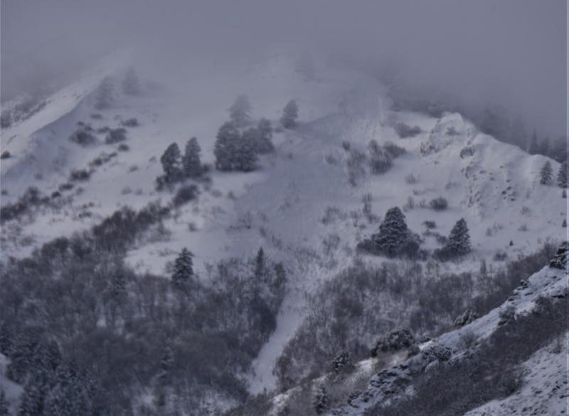
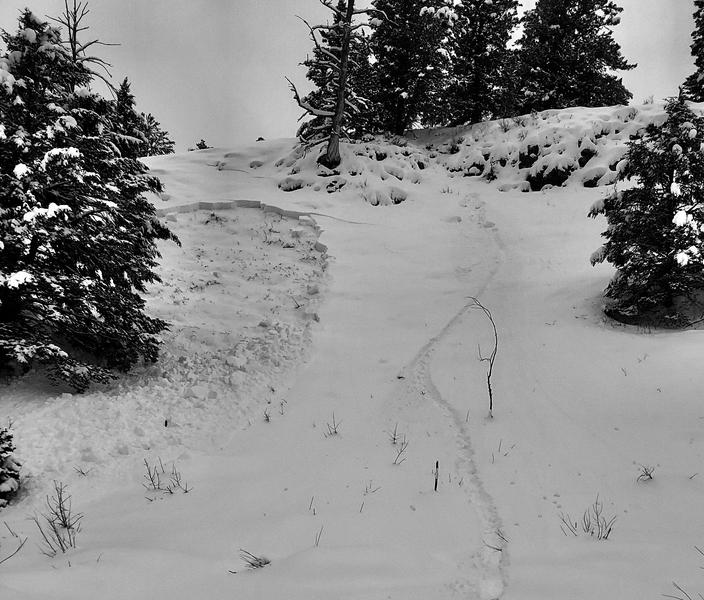
I could see this deep crown at around 7400' on the north side of Mitton Peak in Rattlesnake Canyon, (likely stepped deeper when a smaller avalanche overran the slope).
This natural slab avalanche on an east facing slope in Shumway Canyon (in the Wellsville Mountain Wilderness) started at around 7400' in elevation and ran around 1250 vrt'. It occurred earlier this week on Monday or Tuesday.

On Tuesday a rider remotely triggered a slab avalanche failing on a sugary persistent weak layer near the ground in the Beaver Mountain backcountry.
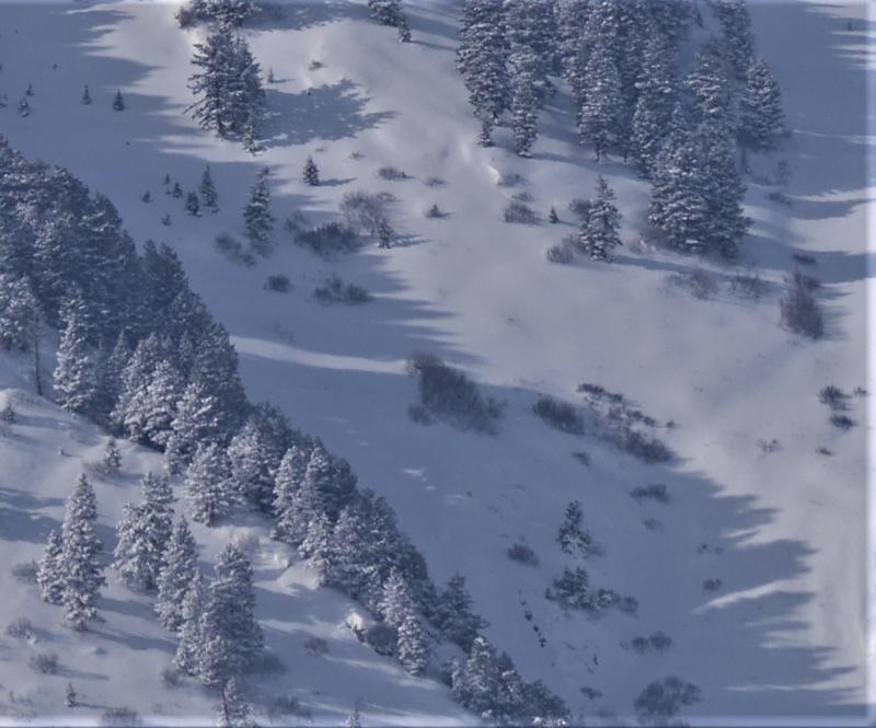
Tracks show where a solo rider landed a jump and triggered this sizable slab avalanche that failed on a sugary persistent weak layer near the ground. ( visible from Hwy 89, 7000', east facing)

Wednesday, a solo skier was caught, carried, and partially buried in Neff's Canyon in the Salt Lake foothills. The skier sustained serious injuries in the 2' deep and ~200' wide avalanche that occurred at around 7200' in elevation on a northwest facing slope. (details and preliminary report HERE
A skier was seriously injured in an avalanche in Little Cottonwood Canyon in the Central Wasatch Range on Tuesday. Our preliminary report is HERE
***See our updated list of observed avalanches from across Utah HERE
Ad
Avalanche Problem #1
Persistent Weak Layer
Type
Location
Likelihood
Size
Description
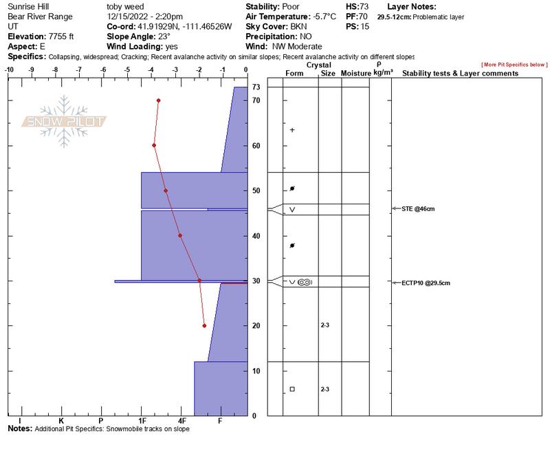
We've found buried layers of sugary snow at all elevations and on slopes facing every direction. In many areas the basal layers of the snowpack are becoming loose and sugary. It's getting pretty easy to get the sled stuck if you sink and spin your track into the bottomless sugary snow. On Thursday, I triggered 3 large whumpfs on Sunrise Hill above Bear Lake Overlook on an east facing slope between 7600 and 7800'. After one collapse, a test pit near trigger point showed a fairly easily initiated propagating failure.
  • Red Flags indicating a persistent weak layer instability will include audible collapses or whumpfs and shooting cracks, but sometimes no red flags are apparent, and you have to dig down into the snow to find the sugary weak layer.
  • Slab avalanches failing on a buried persistent weak layer could be remotely triggered from a distance, and hopefully not from below.
Avalanche Problem #2
Wind Drifted Snow
Type
Location
Likelihood
Size
Description
30 to 40 mph winds from the west were cranking along the ridges last night, and they continued to drift the light powder into avalanche starting zones at upper elevations. Sustained strong south winds last weekend picked up vast quantities of last week's nice light powder and drifted it into downwind deposition areas and avalanche starting zones. The drifting overloaded slopes with buried persistent weak layers, build stiffer slabs, and created dangerous avalanche conditions.
  • Westerly winds yesterday and overnight formed fresh drifts, but many of last weekend's older hard drifts are now hidden by this week's nice light powder.
  • Slabs of drifted snow formed and are still building on the lee side of major ridges, under cornices, and in and around terrain features like sub-ridges, saddles, cliff bands, and gully walls.
  • This weekend we plan to continue to stay off of and out from under all recently and previously drifted slopes in the backcountry steeper than about 30°.
Additional Information
Take the all-new online avalanche courses the UAC built for Know Before You Go or take other online courses listed on the KBYG website (Develop skills -> Online Learning).
Remember, when you leave the ski area boundary, Beaver Mt or Cherry Peak, you are entering the backcountry, and you could trigger dangerous avalanches....

Get your avalanche rescue gear ready for winter.
  • Put fresh batteries in your transceiver and update the firmware.
  • Inspect your shovel and probe.
  • Get your airbag backpack ready by possibly doing a test deployment and update the firmware if it is an electric version.
  • Practice Companion Rescue with your backcountry partners.
General Announcements
Please submit your observations from the backcountry HERE.
For a list of avalanche classes from the Utah Avalanche Center go HERE
For information on where you can ride your sled or snowbike, check out this map of the winter travel plan for the Tony Grove and Franklin Basin Areas HERE.
This forecast is from the U.S.D.A. Forest Service, which is solely responsible for its content. This forecast describes general avalanche conditions and local variations always occur.