Join us at our 2nd Annual Blizzard Ball

Forecast for the Logan Area Mountains

Toby Weed
Issued by Toby Weed on
Tuesday morning, December 13, 2022
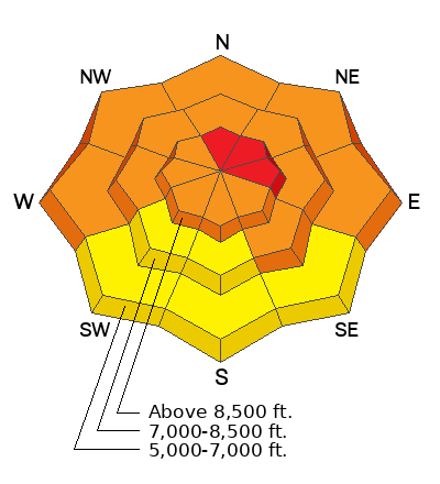
Dangerous avalanche conditions exist in the backcountry at all elevations. Heavy new snow and extensive drifting overloaded slopes with poor snow structure. The danger may be HIGH in some drifted upper elevation terrain, and avalanches are also likely at low elevations. People are likely to trigger dangerous avalanches failing on a widespread buried persistent weak layer. Natural avalanches are possible and some could be large, long running, and destructive. Dangerous avalanches could be triggered remotely, from a distance, or below! Conditions are less dangerous on southerly facing slopes at low and mid elevations.

Careful snowpack evaluation, cautious route-finding, and conservative decision making are essential for backcountry travel today. Stay off and out from under drifted slopes steeper than 30°.
Low
Moderate
Considerable
High
Extreme
Learn how to read the forecast here
Special Announcements
We have discounted Beaver Mountain tickets for sale. HERE..... Huge thanks to Beaver Mountian for supporting the work we do.
Weather and Snow
Heavy snow and drifting overloaded many slopes plagued by buried weak layers and poor snow structure. All backcountry observations from the weekend included reports of audible collapsing or "whumpfs" and some cracking. These red flags indicate unstable snow and real potential for dangerous slab avalanches failing on a buried persistent weak layer. I found very poor snow structure on many slopes and sugary buried persistent weak layers at all elevations in the backcountry around Beaver Sunday..

The National Weather Service has continued a Winter Storm Warning for the Logan Zone through 5:00 pm. A significant winter storm will continue to impact the area as it moves east. Expect unsettled cold and cloudy weather to continue through the work week, with some periods with snow but no significant accumulations expected.
Looks like about 13 inches of new snow at the 8400' TGLU1 Snotel in the Central Bear River Range so far from the storm, with around four feet of total snow on the ground. More snow fell on the western slopes of the Bear River Range and in the southern part of the zone, with maybe 14 inches of fresh snow visible on the Cherry Peak webcam and a couple feet of new snow reported up at Powder Mountain. Temperatures at 8500' are around 16° F this morning but will drop into the lower teens this afternoon.
Recent Avalanches
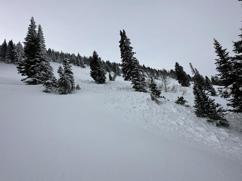
Saturday a skier unintentionally triggered an avalanche in Providence Canyon on a north facing slope at 8700'. It failed as a soft slab on a PWL of facets 2.5' deep and 100' wide, running around 500 vrt'.

***See our updated list of observed avalanches from across Utah HERE
Ad
Avalanche Problem #1
Persistent Weak Layer
Type
Location
Likelihood
Size
Description
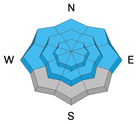
We've found buried layers of sugary snow at all elevations and on slopes facing every direction. In many areas the basal layers of the snowpack are becoming loose and sugary. It's getting pretty easy to get the sled stuck if you sink and spin your track into the bottomless sugary snow. In many areas at all elevations I found droppy conditions, sinking into weak sugary snow even with wide skis on, and I could easily plunge my ski pole to the ground in most places.
  • Red Flags indicating a persistent weak layer instability will include audible collapses or whumpfs and shooting cracks. Sometimes no red flags are apparent and you have to dig down into the snow to find the sugary weak layer.
  • Slab avalanches failing on a buried persistent weak layer could be remotely triggered from a distance, hopefully not from below.
Avalanche Problem #2
Wind Drifted Snow
Type
Location
Likelihood
Size
Description
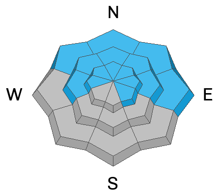
Sustained strong south winds over the weekend picked of vast quantities of Friday's nice light powder in lower angled terrain and meadows and drifted tons of snow into downwind deposition areas and avalanche starting zones.. The deep drifts added significant weight and hardness to a developing slab of windblown snow on slopes with buried persistent weak layers. The drifting created dangerous avalanche conditions, and today I plan to stay off of and out from under all drifted slopes in the backcountry steeper than about 30°.
Additional Information
Remember, when you leave the ski area boundary, Beaver Mt or Cherry Peak, you are entering the backcountry, and you could trigger dangerous avalanches....
Take the all-new online avalanche courses the UAC built for Know Before You Go or take other online courses listed on the KBYG website (Develop skills -> Online Learning).

Get your avalanche rescue gear ready for winter.
  • Put fresh batteries in your transceiver and update the firmware.
  • Inspect your shovel and probe.
  • Get your airbag backpack ready by possibly doing a test deployment and update the firmware if it is an electric version.
  • Practice Companion Rescue with your backcountry partners.
General Announcements
Please submit your observations from the backcountry HERE.
For a list of avalanche classes from the Utah Avalanche Center go HERE
For information on where you can ride your sled or snowbike, check out this map of the winter travel plan for the Tony Grove and Franklin Basin Areas HERE.
The Tony Grove Road and other forest roads in the Logan Ranger District are not maintained for wheeled vehicles in the winter.
This information does not apply to developed ski areas or highways where avalanche control is normally done. This forecast is from the U.S.D.A. Forest Service, which is solely responsible for its content. This forecast describes general avalanche conditions and local variations always occur.