Join us at our 2nd Annual Blizzard Ball

Forecast for the Logan Area Mountains

Toby Weed
Issued by Toby Weed on
Wednesday morning, December 11, 2024
The avalanche danger is LOW in the backcountry, and the weak sugary snow is stable on most slopes.
Use normal caution. Keep your speed down to avoid hitting shallowly buried stumps, rocks, and downed trees.
Low
Moderate
Considerable
High
Extreme
Learn how to read the forecast here
Weather and Snow
People might trigger small avalanches of wind-drifted snow and should avoid recently formed drifts on upper elevation slopes steeper than 30°. Fairly strong winds out of the west elevated avalanche conditions a little bit in exposed upper-elevation terrain. Loose avalanches, or sluffs, consisting of cohesionless faceted snow, are possible on very steep slopes. Our greatest concern continues to be people hitting rocks, downed trees, and stumps. If you're willing to work for it, you can find pockets of cold, dry old snow in sheltered, shaded terrain.
-I'm reading 20° F and 20 inches of total snow at the UAC Card Canyon weather station at 8700 feet above sea level.
-Currently, at 9700' at the CSI Logan Peak weather station, it's 19° F, and the wind is blowing 25 to 30 mph from the west.
-At 9500' at the UAC Paris Peak weather station it's 16° F, and winds are from the southwest, blowing 26 to 36 mph.
Expect mostly sunny weather in the mountains today, with 8500' high temperatures around 18° F and winds blowing from the west 6 to 9 mph.
Another cold front is expected to pass over the area on Thursday, with 1 to 3 inches of accumulation possible Thursday night on upper elevation slopes. It's still too early to get your hopes up, but another small storm could bring a few more inches of accumulation to the Bear River mountains over the weekend, especially on Sunday.
For more information, visit the UAC weather page here: Weather - Utah Avalanche Center
For Logan-specific weather, go here: Logan Mountain Weather - Utah Avalanche Center

Not much in the way of powder, but rime on the trees at upper elevations in the Bear River Range makes for a cold wintery scene.
Recent Avalanches
No significant avalanches have been reported recently.
You can read all observations here.
Ad
Avalanche Problem #1
Wind Drifted Snow
Type
Location
Likelihood
Size
Description
Winds blowing from the west in the last few days scoured snow off windward slopes and low-angled terrain in fetch areas and deposited it as stiff drifts or wind slabs where it decelerated in lee terrain.
  • People might trigger small avalanches of wind-drifted snow on recently drifted slopes steeper than 30°, where stiffer slabs formed on weak faceted snow.
  • Be vigilant in exposed, upper-elevation terrain facing north through southeast and in and around terrain features like gullies, rock outcroppings, and sub-ridges.
  • Getting caught in an avalanche right now is especially dangerous because of the abundance of fixed obstacles like stumps, rocks, and downed trees.
Additional Information
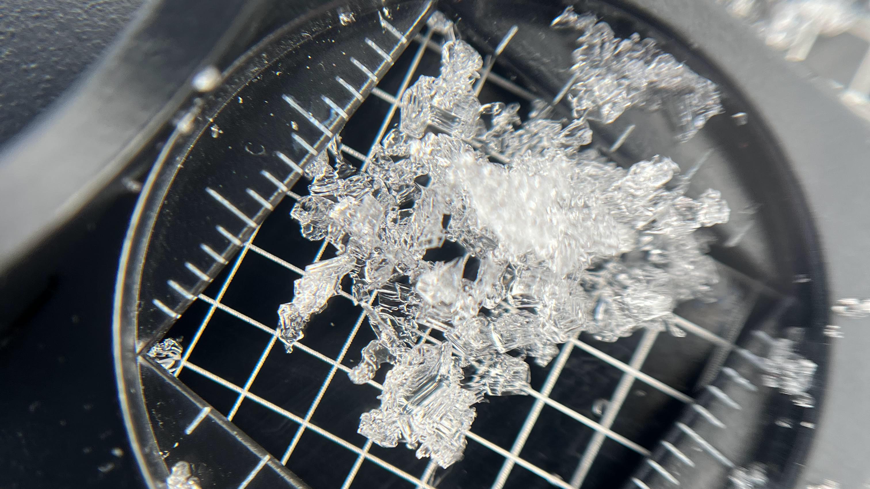
Matt found these nice, well-developed depth hoar crystals on Monday in the North Sinks Area.
In this video, Drew is looking at shallow, weak snow in Scott's Bowl near the Wasatch Crest above Park City. Snow conditions are similar in the Logan Zone and across the mountains of northern Utah.
General Announcements
-National Forest Winter Recreation Travel Maps show where it's open to ride: UWCNF Logan, Ogden LRD Tony Grove, Franklin Basin CTNF Montpelier
-Sign up for forecast region-specific text message alerts. You will receive messages about changing avalanche conditions, watches, and warnings...HERE.
-For all questions on forecasts, education, Know Before You Go, events, online purchases, or fundraising, call 801-365-5522.
-To report an avalanche or submit an observation from the backcountry, go HERE.
-Remember that the Tony Grove Road is not maintained for winter driving. Treacherous snow-covered and icy conditions will be encountered.

This forecast is from the U.S.D.A. Forest Service, which is solely responsible for its content. This forecast describes general avalanche conditions, and local variations always occur.