The holiday season is right around the corner!! Looking for that special something for your partner?
Well, we've got an easy shopping solution for you ...Buy your gifts at our Pray for Snow online auction and support the UAC in Logan.
HEREThankfully, a change in the weather and we will see some snow this weekend. A few snowflakes are already flying this morning at the Logan Summit UDOT sheds, and more will likely fall today, with about an inch of accumulation possible. A weak winter storm will impact the zone tomorrow, with moderate westerly winds and perhaps 2 to 4 inches of new snow stacking up on upper elevation slopes. After a brief break on Sunday, a stronger wave of storminess is forecast to pass over the zone Sunday night and Monday, with 6 to 12 inches of accumulation possible at upper elevations near the Idaho State Line.
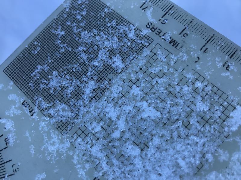
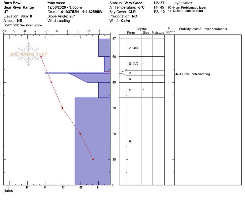
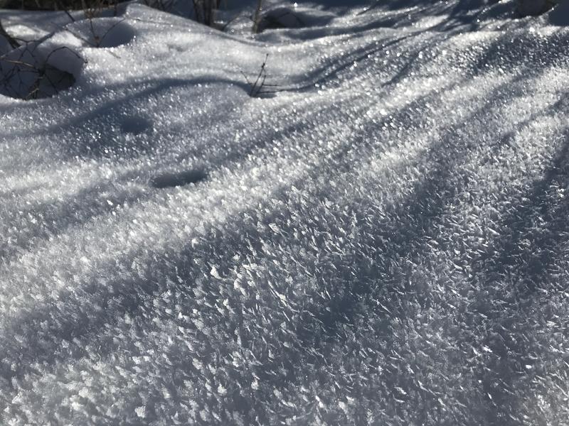
Currently, hitting rocks or other shallowly buried obstacles presents a significant hazard in the backcountry. Most slopes have less than about 2' of total snow, and a steep temperature gradient is turning the shallow snow into loose sugary or faceted grains. In many places, the weak snow is easy to punch through to the rocks below.
The shallow snow is becoming weak and sugary or faceted, especially in the upper 20 cms of the snowpack.
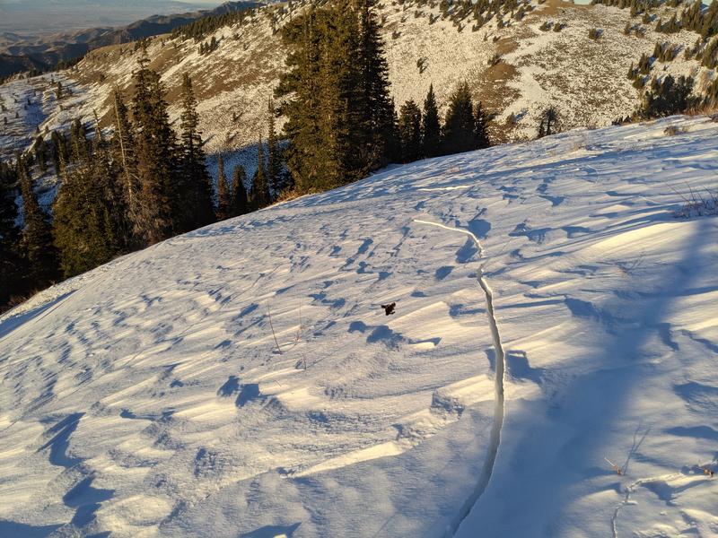
No avalanches yet reported, but last weekend a skier skinning up "Goal Post" avalanche path in Logan Dry Canyon triggered extensive and deep shooting cracks in the starting zone. "cracks to the ground shooting hundreds of feet in multiple directions"
Shooting cracks like these are a red flag indicating unstable snow.