Check out our Holiday Auction

Forecast for the Logan Area Mountains

Toby Weed
Issued by Toby Weed on
Wednesday morning, January 26, 2022
The snow is stable, the avalanche danger LOW, and avalanches are unlikely in the backcountry. Watch for and avoid fresh drifts at upper elevations.
  • Use normal caution.
    I will update this forecast by Friday morning at 7:30
Low
Moderate
Considerable
High
Extreme
Learn how to read the forecast here
Special Announcements
Thanks to the generous support of our local resorts and Ski Utah, discount lift tickets are now available. Support the UAC while you ski at the resorts this season. Tickets are available HERE
Weather and Snow
Most of the Logan Zone picked up a couple inches of light snow Monday night, with around 4 inches of powder accumulating at upper elevations in the Bear River Range. The 8400' Tony Grove Snotel reports 13°F, and there is 72 inches of total snow containing 122% of normal SWE for the date. Winds out of the northwest are blowing around 20 mph this morning at the 9700' CSI Logan Peak weather station, but wicked winds were blowing pretty hard from the east yesterday, stripping the fresh snow from upper elevation slopes.
Expect party sunny skies and fair weather in the mountains today, with 8500' high temperatures around 19°F, and moderate westerly winds driving wind chill values as low as -6°F. Tonight will be mostly clear in the mountains, with temperatures dropping to around 5°F. The static high pressure weather pattern will persist through the weekend, but there is finally some hope for a change in the weather beginning early next week, with good potential for more active weather and colder and wetter conditions.

A few inches of fresh snow really helped conditions in the backcountry. Call it dust-on-crust or shallow powder, but you'll find freshened and softened surface conditions on a solid supportable base and generally stable snow across the Logan Zone these days. I've been finding the best riding conditions on lower angled slopes in sheltered terrain.
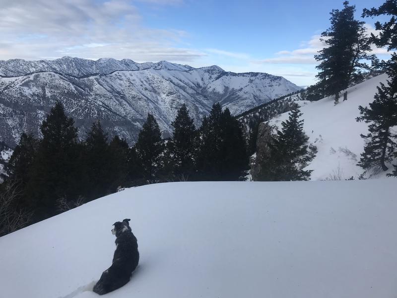
It's great to be able get into the backcountry and up and out from under the clouds in the valley. A few inches of fresh powder has certainly improved snow conditions and attitudes.
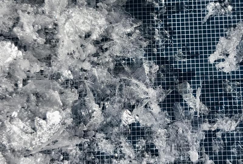
Monday I found widespread areas in sheltered terrain where the snow surface was adorned by these lovely and fragile surface hoar feathers or frost crystals. In some places, yesterday's couple inches of nice powder could have preserved a future persistent weak layer.
Recent Avalanches
Due to the benign January weather it's been a couple weeks since any significant avalanche activity occurred in the Logan Zone.

Check HERE for all the latest observations and avalanche activity.
Ad
Avalanche Problem #1
Normal Caution
Type
Location
Likelihood
Size
Description
Remember that Low avalanche danger doesn't mean No avalanche danger, and people still might trigger avalanches in extreme or isolated very steep backcountry terrain.
  • Small slab avalanches of freshly wind drifted snow and cornice falls are possible in upper elevation terrain exposed to the wind. People should avoid fresh drifts on the lee side of major ridges and in and around terrain features like gully walls, under cliff bands, and along sub-ridges..
  • Shallow loose wet avalanches may become possible midday in steep sunny terrain with sun softened snow. Solar heating could soften the snow surface in steep sheltered terrain and around rocky areas or cliff bands. Even a small avalanche could sweep you down a steep slope, so be aware of trees or other terrain traps below you if you travel in steep sunny terrain.

There are many other hazards in mountain travel that may be more of a concern than avalanche danger today.
  • The fresh snow was scoured right off of many upper elevation slopes, the remaining surface snow is hard and slick, and a person could easily slip, fall, and slide out of control rapidly down a steep slope. In some areas you may need crampons to get a grip and an ice ax to self arrest in case you fall.
  • Crusty snow under the fresh powder could grab a ski and send you head over tea kettle.
  • Going too fast could lead to collisions with trees or other riders.
Additional Information
  • Always follow safe backcountry travel protocols. Go one person at a time in avalanche terrain, (anytime while traveling on or under backcountry slopes steeper than 30°) while the rest of your party watches from a safe area.
  • Check your avalanche rescue equipment, change your batteries, and practice often with your backcountry partners.
    Check slope angles, and to avoid avalanches stay off of and out from under slopes steeper than 30° and adjacent slopes. Video Here
General Announcements
Who's up for some free avalanche training? Get a refresher, become better prepared for an upcoming avalanche class, or just boost your skills. Go to https://learn.kbyg.org/ and scroll down to Step 2 for a series of interactive online avalanche courses produced by the UAC.
  • Check out all the upcoming education classes and clinics HERE.
  • Please submit your observations from the backcountry HERE.
This information does not apply to developed ski areas or highways where avalanche control is normally done. This forecast is from the U.S.D.A. Forest Service, which is solely responsible for its content. This forecast describes general avalanche conditions and local variations always occur.