Forecast for the Abajos Area Mountains

Eric Trenbeath
Issued by Eric Trenbeath on
Friday morning, April 3, 2020
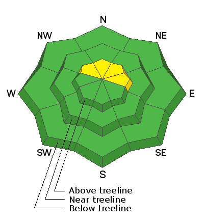
An isolated or MODERATE avalanche danger still exists on steep, upper elevation, wind drifted slopes that face the north half of the compass. On these same slopes an isolated possibility exists for an avalanche to fail on a buried persistent weak layer of loose, sugary, faceted snow. Most other terrain has generally LOW danger but with a strong sun this tine of year, always be alert to an increasing danger for loose, wet avalanches on sun-exposed slopes. Signs of instability include rollerballs pinwheels and point release sluffs. Get off of and out from under steep slopes that become wet and sloppy.
Low
Moderate
Considerable
High
Extreme
Learn how to read the forecast here
Special Announcements
Spring Awareness Campaign - Help us save lives through avalanche forecasts and education. Consider making a donation before April 8th.

Information on outdoor recreation - The State of Utah created this webpage with information about recreating on both state and federal public lands during the current health crisis.

January 5, 2019 - Read this collection of 6 stories and a podcast about that day with a low avalanche danger, 8 skier triggered avalanches, four catch and carries...a partial and critical burial, and a trip to the emergency room.
Weather and Snow
Weather: Skies are clear, NW winds are mostly light and it's cold up there! Continued light winds will shift to the SW, and high temps will climb to just above freezing. We should see some clouds developing later today ahead of a weak shortwave that will move through the area tonight. The weekend looks sunny and warm with high temps in the mid 40's. Overnight lows will drop into the mid 20's setting the stage for a good melt-freeze cycle and possibly some good corn skiing on S-W aspects. The long term forecast shows a Pacific low taking its time moving down the coast and eventually onshore by mid next week. things look to remain pretty quiet through Wednesday.
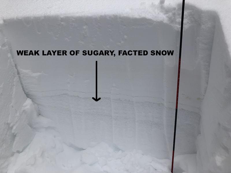
Snowpack: A mixed bag of spring conditions are in effect. Isolated, unstable areas of wind drifted snow may still exist on upper elevation, northerly facing slopes. Deeper in the snowpack, a layer of weak, sugary, faceted snow exists. In isolated areas, a triggered wind drift could step down to this buried weak layer causing a deeper and more dangerous avalanche.
Kevin Dressel photo.
Snow totals at Buckboard Flat (8924')
Snow totals at Camp Jackson (8858')
Additional Information
New to the backcountry (including riding at closed resorts) - Watch the award-winning, 15 minute Know Before You Go video, or take the 5-part, free online-learning series.
General Announcements
This forecast is from the U.S. Forest Service, which is solely responsible for its content. This forecast describes general avalanche conditions and local variations always occur.