Forecast for the Abajos Area Mountains

Issued by Eric Trenbeath on
Friday morning, March 22, 2019
Friday morning, March 22, 2019
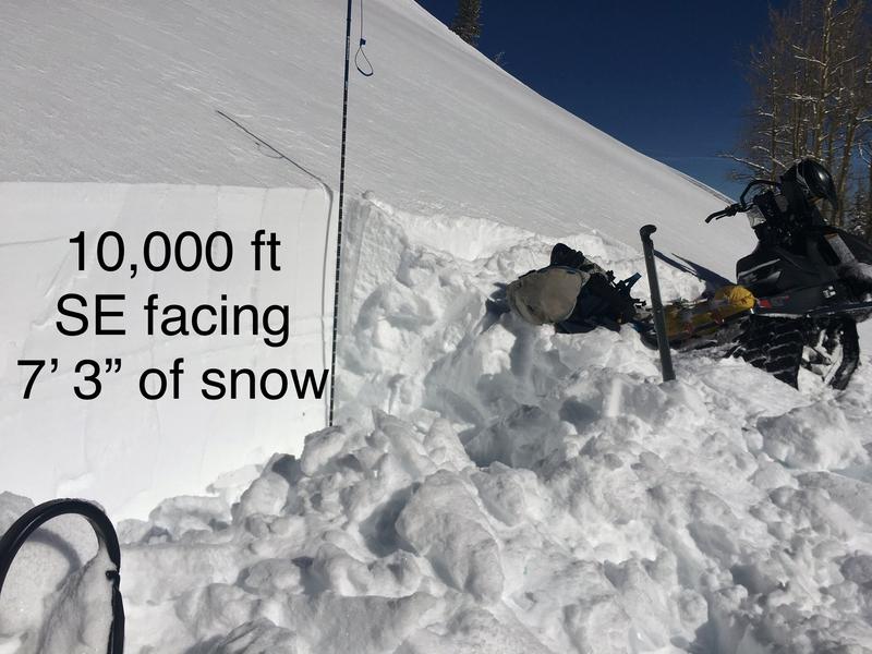
The avalanche danger is CONSIDERABLE today and human triggered avalanches are likely. New and drifting snow have created unstable conditions, primarily on mid and upper elevation slopes that face W-N-E. The danger is MODERATE for avalanches involving the new snow on steep slopes on all other aspects and elevations. If the sun pokes out, the new snow will quickly saturate, and the danger for wet slide activity will develop on sun exposed slopes. Signs of instability include roller balls, pinwheels, and loose snow sluffs. And finally, there also remains a small chance for triggering a slide that breaks deep in the snowpack on a buried, persistent weak layer. You would most likely encounter this problem on very steep, northerly facing slopes.

Low
Moderate
Considerable
High
Extreme
Learn how to read the forecast here