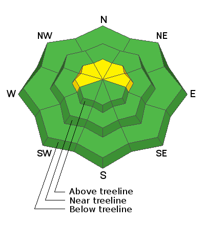
Forecast for the Abajos Area Mountains
Issued by Chris Benson on
Wednesday morning, March 10, 2021
Wednesday morning, March 10, 2021
A MODERATE avalanche danger exists at upper elevations on slopes facing the north half of the compass. In these areas, shallow, but potentially unstable deposits of wind drifted snow exist in the leeward sides of ridge crests and terrain features such as gully walls and sub ridges. It also remains possible to trigger an avalanche on a buried persistent weak layer of sugary faceted snow. This is becoming increasingly unlikely but thin snowpack areas around rock outcroppings and along slope margins are potential trigger points. With wind and snow in the forecast, look for the danger to rise over the next few days.

Low
Moderate
Considerable
High
Extreme
Learn how to read the forecast here


