A cold start to the day, as a trough passes overhead and brings cooler air from the north. Today it will be partly sunny followed by clearing skies. Highs 25 to 35 F. North winds 5 to 10 mph shifting to Southwest in the afternoon. Another low pressure system will approach this evening, but will favor areas to our north. For the weekend, continued shortwave disturbances will bring increasing clouds, cooler temperatures, but little precipitation.
Snowpack Discussion
Warm temperatures and time have helped consolidate the snowpack, but weak layers are still present, especially in shady areas at higher elevations. The snow we received last week has settled into a 1-3' slab that may disguise signs of the buried weak layers underneath. Yesterday in the La Sals, I found supportive snow and experienced localized whumpfing on a ridgeline where the snowpack was thinner and weaker. On a NW aspect near treeline, I observed poor snowpack structure and a stubborn slab. On a north aspect above treeline, the snowpack is deeper and contains stiff, wind-drifted snow that rests on weak layers. While I didn't get any results with two Extended Column Tests (ECTX x2), in areas where this slab is thinner, you can still trigger deep and dangerous avalanches. On sunny aspects, several inches of moist snow were present and may now be supportive crusts after several warm days.
Plenty of soft dry powder remains on sheltered, northerly aspects, but you still need to keep your slope angles under 30 degrees to avoid triggering an avalanche. Buried persistent weak layers of loose, sugary snow exist deep in the snowpack and storm snow from mid February has added stress to these weak layers. Deposits of wind drifted snow have added further stress to the weak snowpack.
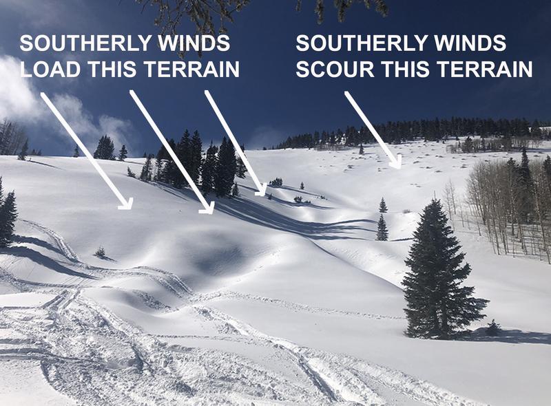
Photo below illustrates the type of terrain that should still be avoided. Slope is: 1) steep 2) subject to wind loading 3) northerly facing and therefore harboring layers of weak, sugary, faceted snow.
Under the current conditions, tickling slopes from below can cause avalanches to release from above.
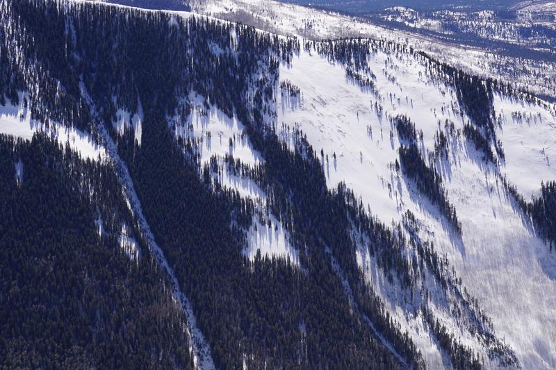
Steep north-facing terrain is the most likely place you can still trigger a deep, persistent-slab avalanche. This is an aerial photo of a NW aspect of Jackson Ridge taken on 2/23/2021. You can see that snow depth is variable, and winds have drifted snow, creating dangerous slabs over buried weak layers.
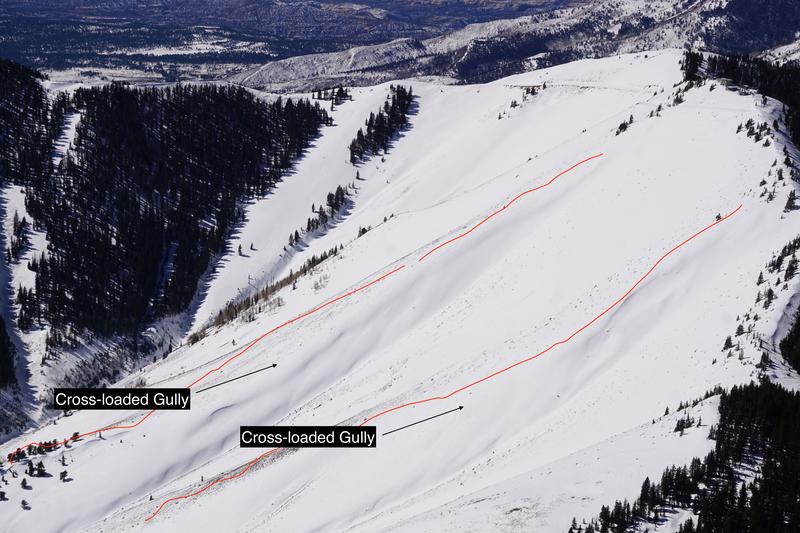
On SE aspects like this terrain on Abajo Peak, ridgelines are shallow, while more easterly aspects have been cross-loaded by winds over the last few weeks.
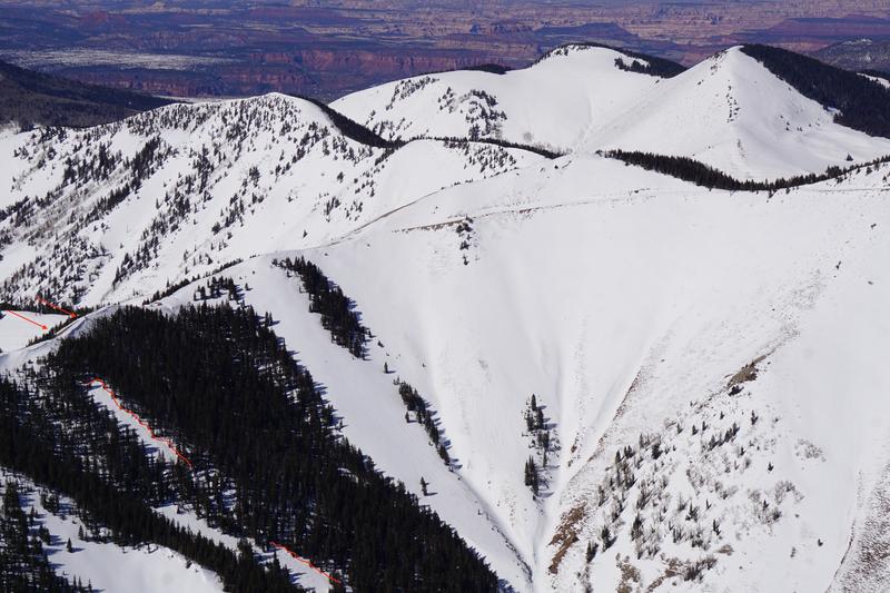
On Wednesday in the Abajo Mountains, I observed this avalanche on a NE aspect at 10,800' near Abajo Peak. This avalanche probably occurred sometime after Feb. 13th. Evidence of wind loading from the SW is visible in the left portion of the photo. With the current poor snowpack structure, this means many steep slopes are hanging in balance just waiting for a human trigger. Remember to avoid steep slopes with the same aspect, elevation, and configuration as recent avalanches.