Forecast for the Abajos Area Mountains

Eric Trenbeath
Issued by Eric Trenbeath on
Monday morning, December 31, 2018
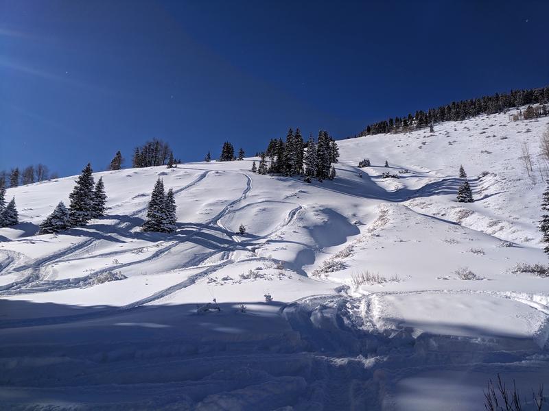
The avalanche danger is MODERATE today for human triggered avalanches within the new snow. Depending on snowfall rates or an increase in wind we could see the danger rise to CONSIDERABLE on steep, upper elevation slopes that face N-NE-E. Be alert to signs of wind drifted snow. There also remains an isolated, or MODERATE danger for avalanches stepping down 2'-4' deep into buried, persistent weak layers of loose, sugary, faceted snow. Northerly facing slopes with steep, rocky, and more radical terrain are the most suspect for this type of avalanche.
Low
Moderate
Considerable
High
Extreme
Learn how to read the forecast here
Special Announcements
The new UAC IOS mobile app is now available on the app store. Check out the new "My Weather" feature.
Check out the new free online avalanche course series developed by the Utah Avalanche Center. This is a great way to refresh your skills or prepare you for a Backcountry 101 or Level 1 class.
Weather and Snow
It's just begin to snow in the Abajo Mountains and it looks like we are going to get a good shot of snow with 4'-8" possible today and another 3"-7" tonight. Showers will continue through tomorrow with things drying out on Wednesday. Today look for snow and NW winds at 10-15 mph along ridge tops. High temps will be in the low teens.
Snow totals at Buckboard Flat (8924')
Snow totals at Camp Jackson (8858')
Wind, temperature, and humidity on Abajo Peak (11,000')
National Weather Service point forecast.
Conditions are starting to look a lot better up there! Photo courtesy of Dustin Randall.
Avalanche Problem #1
New Snow
Type
Location
Likelihood
Size
Description
Avalanches within the new snow will be the primary concern today. With the lack of wind, most of these slides should be manageable as shallow, loose snow sluffs. If winds increase, they will start to drift the new snow into sensitive soft slabs on the lee sides of ridge crests and terrain features. Be alert to areas of drifting snow and signs of instability such as cracking in the snow surface, and avoid steep slopes where this is present.
Avalanche Problem #2
Persistent Weak Layer
Type
Location
Likelihood
Size
Description
On upper elevation, northerly aspects, snow has been sitting around on the ground since October. This has formed a persistent weak layer of loose, sugary, faceted snow that makes an unstable base for new snow on top. In some areas it may be possible to trigger an avalanche 2'-3" deep down to these weak, sugary snow. Areas of steep, radical, and wind loaded terrain that faces the north half of the compass are where you are most likely to encounter this problem.
General Announcements
Your information can save lives. If you see anything we should know about, please help us out by submitting snow and avalanche observations HERE. You can also call me at 801-647-8896, or send me an email: eric@utahavalanchecenter.org.
Support the UAC through your daily shopping. When you shop at Smith's, or online at REI, Backcountry.com, Patagonia, NRS, Amazon, eBay by clicking on these links, they donate a portion of your purchase to the UAC. If you sell on eBay, you can have your See our Affiliate Page for more details on how you can support the UAC when you shop
This advisory is from the U.S.D.A. Forest Service, which is solely responsible for its content. This advisory describes general avalanche conditions and local variations always occur.