Forecast for the Abajos Area Mountains

Issued by Eric Trenbeath on
Saturday morning, December 29, 2018
Saturday morning, December 29, 2018
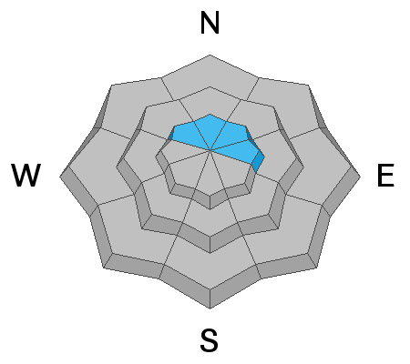
The avalanche danger is MODERATE today for human triggered avalanches involving wind drifted snow. Look for deposits of wind drifted snow on all aspects at upper elevations. On wind drifted slopes that face N-NE-E there is also an isolated possibility for avalanches to step down 2'-3' deep into buried, persistent weak layers of loose, sugary, faceted snow. Areas with steep, rocky, and more radical terrain are the most suspect for this type of avalanche. Most other terrain has generally LOW danger.

Low
Moderate
Considerable
High
Extreme
Learn how to read the forecast here