Forecast for the Abajos Area Mountains

Eric Trenbeath
Issued by Eric Trenbeath on
Wednesday morning, December 22, 2021
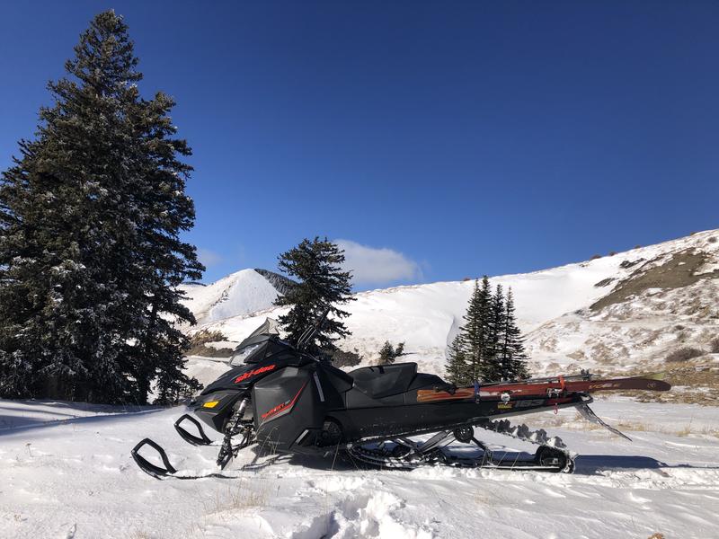
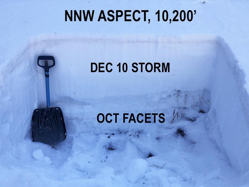
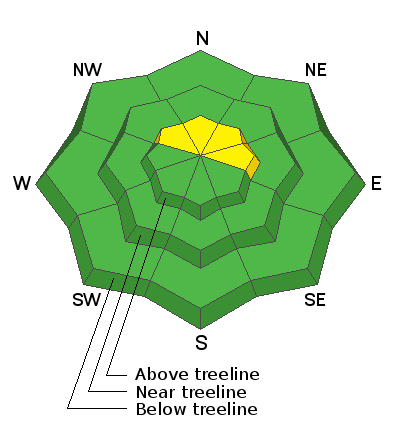
A MODERATE avalanche danger exists on steep, upper elevation, northerly facing terrain where early December snow has formed a cohesive slab on top of weak, sugary, faceted snow from October. This persistent weak layer problem is not yet very widespread, and these areas are difficult to access but it 's something worth paying attention to, especially when we get more snow. Most other terrain has generally LOW danger.
Low
Moderate
Considerable
High
Extreme
Learn how to read the forecast here
Special Announcements
Weather and Snow
Get current and past 24-hour readings from these real-time weather links.
Snow totals and temps at Buckboard Flat (8924')
Snow totals and temps at Camp Jackson (8858')
Mostly sunny skies and light southerly winds continue today while an active weather pattern develops off the west coast. Though the approaching system has the potential for big snow amounts in northern Utah, it doesn't look nearly as impressive for our region. We'll see increasing clouds on Thursday with possibly a few afternoon snow showers as a Pacific low-pressure trough drops south along the coast and moves inland. Our best chance for snow from this event comes Thursday night into Friday. 6" of snow seems a fair bet at this time. The pattern remains active however, and we'll see another chance for snow over Christmas with unsettled weather continuing into early next week.
I got up to North Creek Pass on Friday and conditions are generally too thin for travel off the road. Snow depths range from about about a foot near the bottom of North Creek to around 18" near the top with up to 2' in drifted areas. Sun and wind exposed slopes are barely covered and are still showing a lot of grass.
It's still pretty thin up there!
Avalanche Problem #1
Persistent Weak Layer
Type
Location
Likelihood
Size
Description
A classic setup of strong snow over weak snow is developing on upper elevation, northerly aspects that retained snow from October snow. This October snow has become loose, weak, and sugary, or as we say, faceted. This faceted snow can form a persistent weak layer at the base of the snowpack. For now, this problem isn't particularly widespread, and places where it does exist - upper elevation, northerly facing slopes - are difficult to access because of low snow cover. But as more snow begins to increase the load on this buried, weak and sugary, facted layer, we'll need to start paying attention.
Photo illustrates a cohesive slab from the Dec 10 storm sitting on top of loose, weak, sugary faceted snow from October.
General Announcements
Who's up for some free avalanche training? Get a refresher, become better prepared for an upcoming avalanche class, or just boost your skills. Go to https://learn.kbyg.org/ and scroll down to Step 2 for a series of interactive online avalanche courses produced by the UAC.
This forecast is from the U.S. Forest Service, which is solely responsible for its content. This forecast describes general avalanche conditions and local variations always occur.