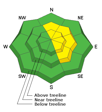
Forecast for the Abajos Area Mountains

Issued by Eric Trenbeath on
Saturday morning, December 19, 2020
Saturday morning, December 19, 2020
Isolated, unstable wind drifts may exist on mid and upper elevation slopes facing N-E-SE and the avalanche danger is MODERATE in these areas. On N-E aspects the underlying snow has deteriorated into layers of weak, sugary, faceted snow and signs of instability such as collapsing and whumphing are being observed. Suspect slopes that have smooth, rounded deposits of wind drifted snow and pay attention to signs of instability such as cracking and collapsing.
Low snow cover is the biggest hazard out there right now with rocks and logs lurking just below the surface, and even a small avalanche triggered under these conditions can have serious and painful consequences.

Low
Moderate
Considerable
High
Extreme
Learn how to read the forecast here


