Forecast for the Abajos Area Mountains

Eric Trenbeath
Issued by Eric Trenbeath on
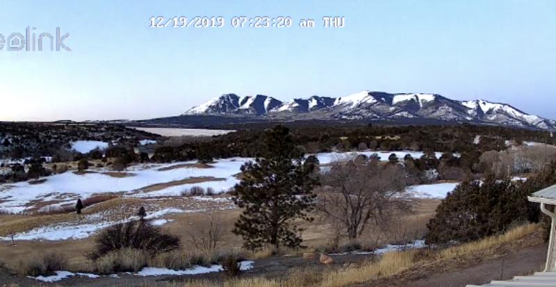
Thursday morning, December 19, 2019
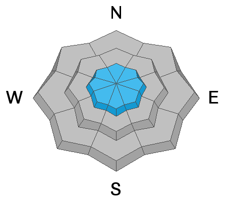
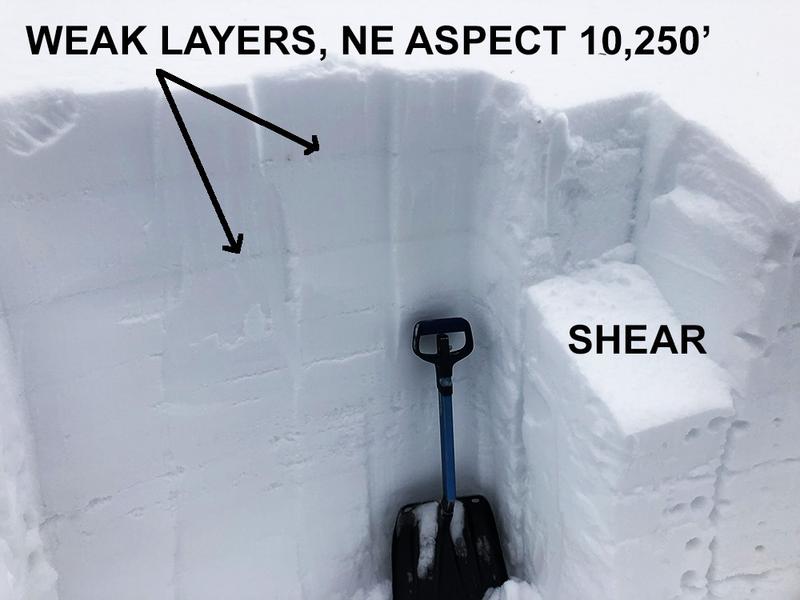
Blowing and drifting snow have created an isolated or MODERATE avalanche danger in steep upper elevation terrain. Look for fresh drifts on the lee sides of ridge crests and terrain features such as sub-ridges or gully walls. Signs of instability include cracking in the snow surface. It may also be possible to trigger an avalanche on a buried persistent weak layer on steep, upper elevation, northerly facing terrain. Most other terrain offers LOW danger.
Low
Moderate
Considerable
High
Extreme
Learn how to read the forecast here
Special Announcements
The second UAC podcast of the season "Betting your life - why forecasting is poker not chess - a conversation with Jenna Malone" is now out.
Get one of these cool t-shirts to support the UAC and other avalanche centers across the U.S.
Weather and Snow
The story is the wind. For most of the day yesterday and continuing overnight, SE winds blew in the 25-30 mph range with gusts to 40. The day before we had moderate to strong northerlies. It's been more than 2 weeks since our last significant snow and the surface is getting tired and worn. Dry conditions will continue through the weekend before the first of possibly two troughs track into the region early next week. It's a little far out to say, but it's looking like Christmas could be white.
Snow depths range from 30" at Camp Jackson and Buckboard Flat (9000') to more than 4' of snow at North creek Pass (10,500'). Some sun and wind-exposed slopes have considerably less and there is still some grass poking out, but all said we're off to a good start down here.
Snow totals at Buckboard Flat (8924')
Snow totals at Camp Jackson (8858')
Wind, temperature, and humidity on Abajo Peak (11,000')
Webcam image courtesy of Kevin Dressel.
Recent Avalanches
I'm very sad to report that a 45-year-old man was killed in an avalanche while snowboarding in the backcountry outside of the Canyons Resort in the Wasatch Mountains on Sunday. Our deepest condolences go out to the family and friends who are so affected by this tragedy. Here is the final report.
Avalanche Problem #1
Wind Drifted Snow
Type
Location
Likelihood
Size
Description
Winds over the past few days have blown around what little snow was available for transport and isolated drifts have formed on the leeward sides of ridge crests and terrain features in upper elevation, wind exposed terrain. Fresh drifts are mostly shallow and shouldn't pose too much of a hazard, but they could sweep you off your feet and carry you over a cliff. Wind drifts are recognizable by their smooth, rounded appearance, and cracking in the snow is a sign of instability. The best practice is to avoid steep slopes with wind drifted snow.
Avalanche Problem #2
Persistent Weak Layer
Type
Location
Likelihood
Size
Description
Generally speaking, the mountains have a deep, strong snowpack for this time of year without the typical layer of weak, sugary "faceted" snow at the base. In my travels on Friday, 13 however, I observed two weak layers that have formed in the upper 12"-18" of the snowpack. Though not overly reactive at this time, there is a possibility for triggering an avalanche on one of these buried weak layers on steep slopes facing NW-N-E, especially in areas that have overlying deposits of wind drifted snow. We will want to pay attention to these weak layers as new or wind drifted snow will add additional stress, increasing the likelihood of triggering an avalanche.
General Announcements
This forecast is from the U.S. Forest Service, which is solely responsible for its content. This forecast describes general avalanche conditions and local variations always occur.