25th Annual Black Diamond Fall Fundraising Party
Thursday, September 13; 6:00-10:00 PM; Black Diamond Parking Lot
25th Annual Black Diamond Fall Fundraising Party
Thursday, September 13; 6:00-10:00 PM; Black Diamond Parking Lot
| Advisory: Skyline Area Mountains | Issued by Brett Kobernik for Saturday - February 10, 2018 - 6:43am |
|---|

|
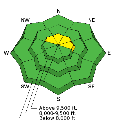
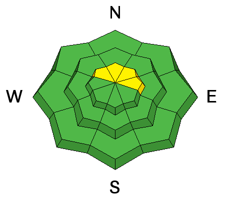
bottom line The avalanche danger will increase a bit today to MODERATE on slopes steeper than 35˚ that face west, north and east above 9500' in elevation. This means human triggered avalanches are possible. Outside of this terrain the avalanche danger is generally LOW. This means that most people can travel safely in the mountains today as long as you're not getting onto the slopes mentioned.
|
 |
current conditions The Skyline picked up 2 to 4 inches of snow last Monday night which improved riding conditions a bit but didn't do a whole lot to help the overall shallow travel conditions. The new snow didn't really change the avalanche danger much and it's been mostly LOW all week. Temperatures remained unseasonably warm through the week. We have clouds this morning with mountain temperatures in the mid to upper 20s and west wind in the moderate to strong category especially along the ridges. |
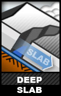
| type | aspect/elevation | characteristics |
|---|
|
|
LIKELIHOOD
 LIKELY
UNLIKELY
SIZE
 LARGE
SMALL
TREND
 INCREASING DANGER
SAME
DECREASING DANGER
|
|
description
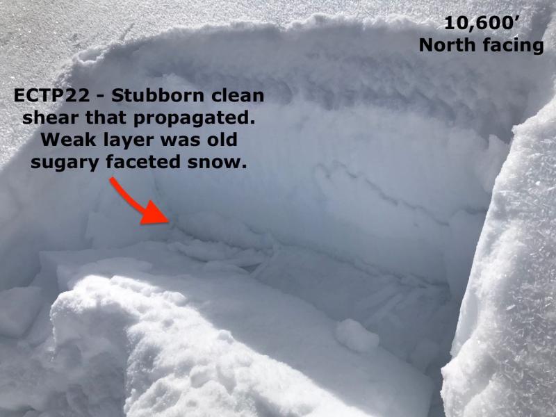
With benign weather and avalanche conditions, it's easy to forget about the weak snow lurking near the ground. Well, it's still there. We just haven't added enough new snow to make it reactive again. Some snowpit tests still show clean failures and propagation, albeit somewhat stubborn. Above about 9000 feet it's easy to find the weak snow near the ground on the more northerly aspects. Just get off your machine and your boots sink to the ground right through this weak faceted snow. Dig down with your hand and you'll find the sugary faceted snow. There is enough of this stuff to keep me off many steeper slopes that I would travel on if things were completely stable. ADDITIONAL SNOW AND WIND TODAY MAY CREATE LARGE ENOUGH DRIFTS TO OVERLOAD THE WEAK SNOW NEAR THE GROUND.
|
 |
weather We have a storm moving through this morning which hopefully bring us 2 to 4 inches of snow in the mountains. Temperatures will drop into the teens later today. West wind will shift more northwest and remain moderate to strong in speed in the higher terrain. Sunday looks like a nice day with mostly clear skies and high temperatures rebounding into the upper 20s and light wind. Another minor weather disturbance will move through on Monday which might bring a few snow flurries with no significant accumulation. |
| general announcements Support the Utah Avalanche Center through your everyday shopping. DETAILS HERE We will publish full detailed advisories Saturday and Sunday mornings by 7am. We will also be publishing basic avalanche danger ratings & info during the week. If you are getting out into the mountains, we love to hear from you! You can SUBMIT OBSERVATIONS ONLINE or EMAIL US If you would like to have avalanche advisories emailed to you, SIGN UP HERE We can provide basic avalanche awareness presentations for your school, group or club. To enquire, CLICK HERE |