25th Annual Black Diamond Fall Fundraising Party
Thursday, September 13; 6:00-10:00 PM; Black Diamond Parking Lot
25th Annual Black Diamond Fall Fundraising Party
Thursday, September 13; 6:00-10:00 PM; Black Diamond Parking Lot
| Advisory: Skyline Area Mountains | Issued by Brett Kobernik for Wednesday - March 8, 2017 - 6:56am |
|---|

|
bottom line Most of the terrain has a LOW avalanche danger today. A MODERATE danger exists where it is possible a person might trigger a recently formed wind drift or slab along the upper ridgelines and terrain features. Avoid large drifts and cornices. Also, move off steep sunny slopes as they heat up to avoid triggering wet avalanches.
|
 |
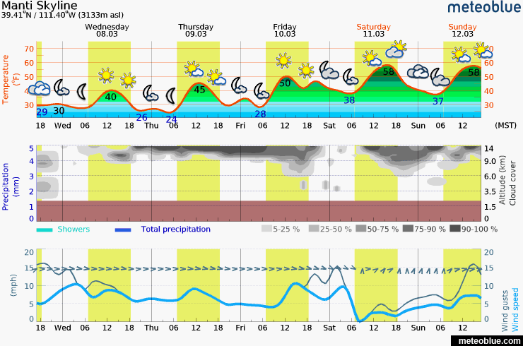
current conditions Southwest wind continued to blow in the moderate speed category on Tuesday. Plumes could be seen off the high peaks and ridges in the morning. We experienced drifting snow in the 9000 to 10,000 foot range on various aspects. The sun heated many southerly facing slopes and there will be a crust on them this morning. |
 |
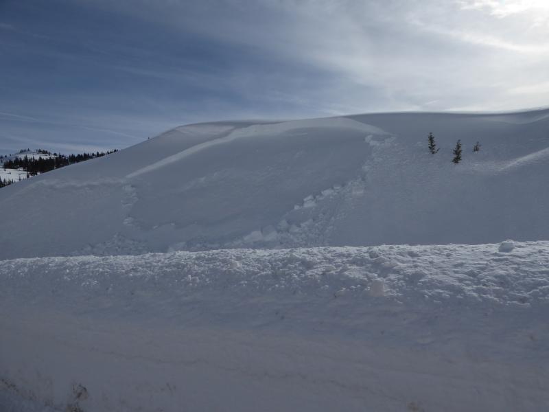
recent activity There was some minor avalanche activity on Tuesday. A UDOT snowblower clearing snow along SR 264 triggered a small wind slab from the snow being thrown from the blower onto a steep wind loaded slope. This demonstrates what type of avalanche activity you can expect again today along the steep upper leeward slopes.
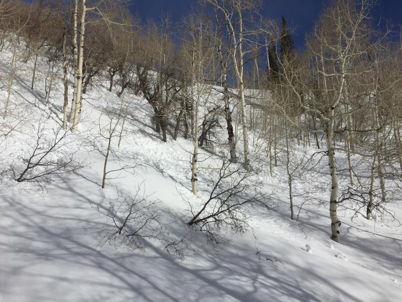
There was also a small wet slide triggered by a skier in the lower elevations as the snow became damp later in the day. It was only 3" deep and 20 feet wide or so. New snow is most sensitive to heating the first time it gets heated after a storm. After it goes through a few melt freeze cycles, it is not as sensitive and triggering avalanches is less likely. Photo: Richard Stum
|
 |
weather
|
| general announcements We will publish full detailed advisories Saturday and Sunday mornings by 7am. We will also be publishing basic avalanche danger ratings & info during the week. If you are getting out into the mountains, we love to hear from you! You can SUBMIT OBSERVATIONS ONLINE or EMAIL US If you would like to have avalanche advisories emailed to you, SIGN UP HERE We can provide basic avalanche awareness presentations for your school, group or club. To enquire, CLICK HERE |