25th Annual Black Diamond Fall Fundraising Party
Thursday, September 13; 6:00-10:00 PM; Black Diamond Parking Lot
25th Annual Black Diamond Fall Fundraising Party
Thursday, September 13; 6:00-10:00 PM; Black Diamond Parking Lot
| Advisory: Skyline Area Mountains | Issued by Brett Kobernik for Thursday - February 2, 2017 - 6:53am |
|---|

|
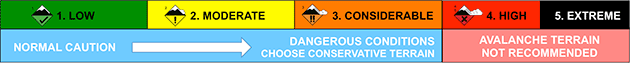
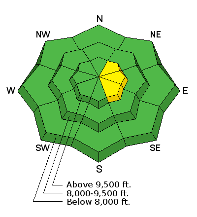
bottom line The overall avalanche danger remains generally low. Recently formed drifts are very stubborn at this point. If one were to break loose on a person, it would be at the upper elevation more east facing very steep slopes. Consider consequences if even a small wind slab were to release and push you into a gully or into trees.
|
 |
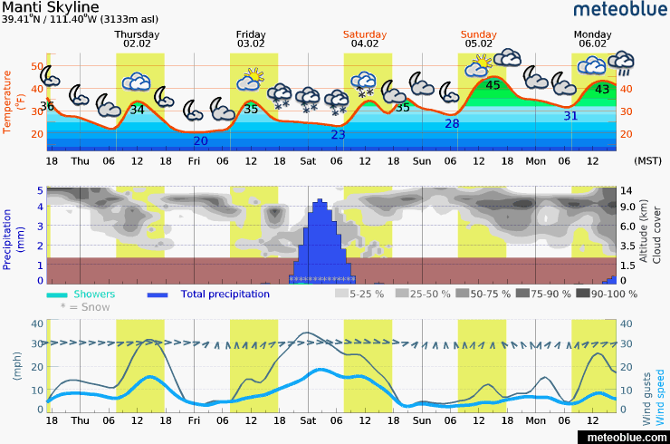
weather Wind will pick up again later today from the southwest as a minor disturbance moves through perhaps producing light snow. No significant snow accumulation is anticipated. Another minor disturbance late Friday into Saturday may add a trace to a few inches of snow. A more promising storm is shaping up for Tuesday which could give us a decent shot of new snow. Weather in the high country looks fairly windy with quite mild temperatures through next week.
|
| general announcements We will publish full detailed advisories Saturday and Sunday mornings by 7am. We will also be publishing basic avalanche danger ratings & info during the week. If you are getting out into the mountains, we love to hear from you! You can SUBMIT OBSERVATIONS ONLINE or EMAIL US If you would like to have avalanche advisories emailed to you, SIGN UP HERE We can provide basic avalanche awareness presentations for your school, group or club. To enquire, CLICK HERE |