25th Annual Black Diamond Fall Fundraising Party
Thursday, September 13; 6:00-10:00 PM; Black Diamond Parking Lot
25th Annual Black Diamond Fall Fundraising Party
Thursday, September 13; 6:00-10:00 PM; Black Diamond Parking Lot
| Advisory: Skyline Area Mountains | Issued by Brett Kobernik for Saturday - December 24, 2016 - 7:00am |
|---|

|
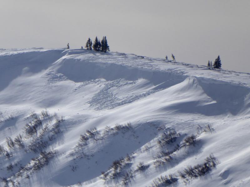
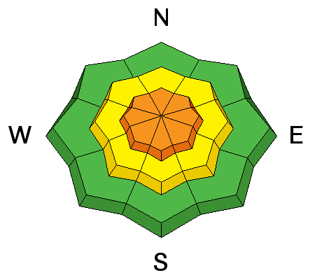
bottom line The avalanche danger will most likely reach CONSIDERABLE during the day today. The blustery wind drifting snow is the main concern. Natural avalanches and cornice falls are possible. Avoid the higher elevation terrain as well as other locations where the wind is drifting snow. The avalanche danger is much lower out of the wind effect areas.
|
 |
current conditions Temperatures are in the low 20s this morning. Wind directions are from the southeast which is not the normal direction for us. It's been quite blustery in the high country and it looks like the wind is getting down into the mid parts of the canyons in some locations. 2 to 3 inches of snow fell on Thursday and the wind has been blowing it around. Riding conditions will be hit or miss with some areas holding very nice turning snow and others will have wind crusts and drifts. |
 |
recent activity The wind drifted snow along the higher terrain enough to form some fresh drifts and cornices along the ridges. Some of these cornices were breaking off naturally. They were not triggering any avalanches once they hit the slope below.
|
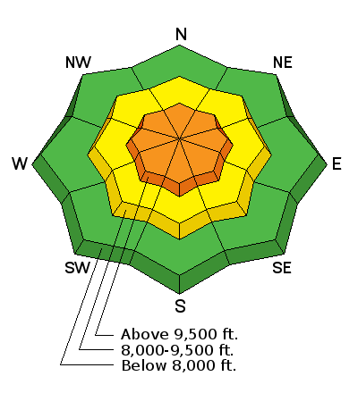
| type | aspect/elevation | characteristics |
|---|
|
|
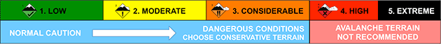
LIKELIHOOD
 LIKELY
UNLIKELY
SIZE
 LARGE
SMALL
TREND
 INCREASING DANGER
SAME
DECREASING DANGER
|
|
description
The blustery wind will continue during the day today before slowing down later tonight. This will continue to drift snow into potentially sensitive fresh drifts, wind slabs and cornices. The anticipated storm should start producing snow soon this morning and this snow will surely get blown around today. |
| type | aspect/elevation | characteristics |
|---|
|
|
LIKELIHOOD
LIKELY
UNLIKELY
SIZE
 LARGE
SMALL
TREND
INCREASING DANGER
SAME
DECREASING DANGER
|
|
description
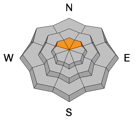
The wind will most likely form fresh cornices that will be sensitive today. Keep in mind that they may form in some areas where they usually don't due to the odd southeast wind direction. |
 |
weather A fairly potent storm is ramping up and we'll see gusty conditions with snowfall today. The flow is going to be southerly with southeast wind directions. Temperatures will be in the mid 20s and continue to drop later today. A cold front moves through this evening and the wind direction will shift more westerly and decrease in speed. We should see 4 to 8 inches of snow during the day today. Huntington Canyon could see more due to the southeast upslope flow. Snow will continue tonight and into Christmas Day. Storm totals should be a foot or more of snow in many locations. The snow density should decrease as the storm progresses and with lighter wind toward the end of the storm, this should produce nice riding conditions. |
| general announcements We will publish full detailed advisories Saturday and Sunday mornings by 7am. We will also be publishing basic avalanche danger ratings & info during the week. If you are getting out into the mountains, we love to hear from you! You can SUBMIT OBSERVATIONS ONLINE or EMAIL US If you would like to have avalanche advisories emailed to you, SIGN UP HERE We can provide basic avalanche awareness presentations for your school, group or club. To enquire, CLICK HERE |