| Please join us at the 23rd annual Black Diamond Fall Fundraiser Party Thursday Sept 15. Tickets are on sale now here, at the Black Diamond store & at REI. Special bonus raffle for online ticket purchasers! |
| Please join us at the 23rd annual Black Diamond Fall Fundraiser Party Thursday Sept 15. Tickets are on sale now here, at the Black Diamond store & at REI. Special bonus raffle for online ticket purchasers! |
| Advisory: Skyline Area Mountains | Issued by Brett Kobernik for Saturday - February 6, 2016 - 6:50am |
|---|

|
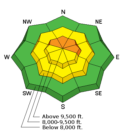
bottom line A CONSIDERABLE avalanche danger still exists in northwest through east facing terrain steeper than 35 degrees which has avalanched earlier in the season. There is no way to know if a slope has previously avalanched just by looking at it. You will have had to follow it's progression carefully all year. If you keep your slope angles less than 35 degrees, the avalanche danger is much lower.
|
 |
current conditions We have mostly clear skies this morning with ridgetop temperatures in the low 20s and light west northwest wind. You will find excellent riding conditions in most locations. Sunny slopes will have a sun crust from yesterday and you'll note some wind affected snow scattered about as well. |
| type | aspect/elevation | characteristics |
|---|

|
|
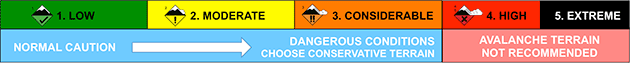
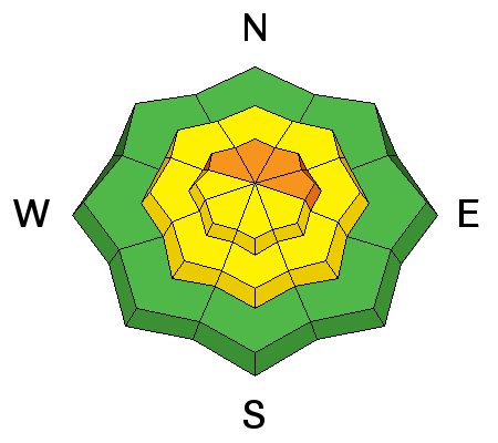
LIKELIHOOD
 LIKELY
UNLIKELY
SIZE
 LARGE
SMALL
TREND
 INCREASING DANGER
SAME
DECREASING DANGER
|
|
description
There is still a chance that you could trigger an avalanche that breaks into weak snow near the ground today. Here are the ingredients needed to find trouble:
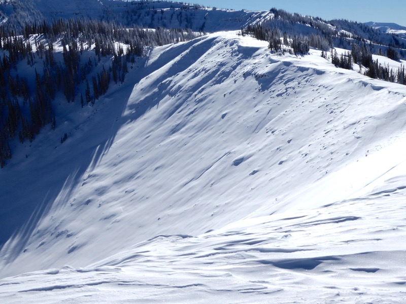
Obvious signs of instability will be absent today. You won't see any other recent avalanches. Most likely, you won't experience any cracking of the new snow. It's possible you may feel the snow collapse below you. If so, this is a significant red flag. Below is a photo of a slope which shows which type of slope I wouldn't touch today. This is east facing in upper Seeley. The photo was taken in December after it avalanched to the ground. There is a very small amount of new snow on top of the bed surface which became weak again and is now buried. This is only one example but there are numerous other similar slopes out there.
|
 |
weather Someone just flipped the switch on our weather pattern. It's going to feel like sapring for the next week with mostly clear skies and warming temperatures. Today, ridgetop highs will be near freezing and west northwest wind will be light to moderate in speed. Sunday looks similar but slightly warmer with a bump in wind speed. Ridgetop highs are forecast to reach into the upper 40s by mid week. This warm weather may make the snowpack a little cranky at first but it may be just what we need to finally settle out the deeper instabilities. |
| general announcements We will publish full detailed advisories Saturday and Sunday mornings by 7am. We will also be publishing basic avalanche danger ratings & info during the week. If you are getting out into the mountains, we love to hear from you! You can SUBMIT OBSERVATIONS ONLINE or EMAIL US If you would like to have avalanche advisories emailed to you, SIGN UP HERE We can provide basic avalanche awareness presentations for your school, group or club. To enquire, CLICK HERE |