
| During the month of April, Mark Miller will donate $75 to the charity of your choice (5 to chose from, including the Utah Avalanche Center!) Mark Miller Subaru has raised over $300k in the previous 6 Do Good Feel Good events. More Info here |  |
| During the month of April, Mark Miller will donate $75 to the charity of your choice (5 to chose from, including the Utah Avalanche Center!) Mark Miller Subaru has raised over $300k in the previous 6 Do Good Feel Good events. More Info here | |
| Advisory: Skyline Area Mountains | Issued by Brett Kobernik for Saturday - February 22, 2014 - 7:04am |
|---|

|
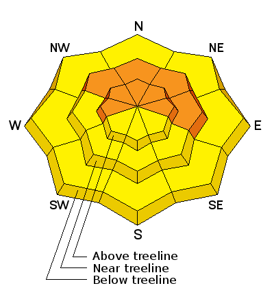
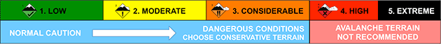
bottom line A CONSIDERABLE avalanche danger exists on steep slopes that face west through north through east. It is not a weekend to be "hillclimbing" on these slopes.
|
 |
current conditions The Skyline picked up 3 or 4 inches of snow in a windy storm on Wednesday. Temperatures were cold but have been gradually on the rise. Northwest winds slowed a bit late Friday and have picked up a bit again. They are generally west in direction. Quite a bit of wind damage occurred to the snow surface but sheltered areas still hold nice snow. |
 |
recent activity No new avalanches have been reported since We continue to get views into different areas which unveil the very impressive avalanche cycle that occurred during the big storm two weeks ago. There were many large slides that snapped trees as well as numerous in odd locations such as thicker trees and lower elevations. Here is the avalanche list that hardly covers a sliver of the terrain that avalanched over the last few weeks:
|
| type | aspect/elevation | characteristics |
|---|
|
|
LIKELIHOOD
 LIKELY
UNLIKELY
SIZE
 LARGE
SMALL
TREND
 INCREASING DANGER
SAME
DECREASING DANGER
|
|
description
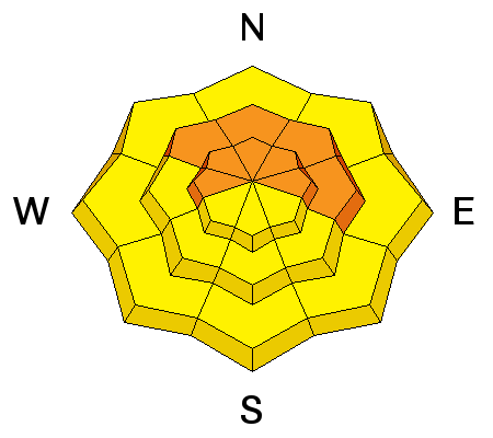
As time goes on, the chances for triggering one of these large slides decreases but in no way should you trust any steep slope on the more north half of the compass. The weak layer is now "bridged" with a thick, strong slab of snow. I call it bridged because the weak snow is below the strong snow. I don't like a bridge because I don't know exactly the spots where it may break and I'll trigger something into the weak snow. The most pronounced danger is above around 8500'. Below that, the snowpack is very locked up after becoming wet and then freezing. There are more thoughts, photos and videos on the deep slab issue HERE. Darce Trotter also submitted some thoughts HERE |
| type | aspect/elevation | characteristics |
|---|

|
|
LIKELIHOOD
 LIKELY
UNLIKELY
SIZE
 LARGE
SMALL
TREND
 INCREASING DANGER
SAME
DECREASING DANGER
|
|
description
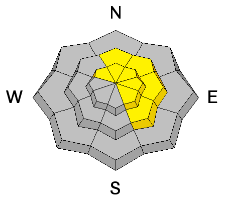
The combination of a little new snow and some wind have, of course, formed some fresh drifts. Most of these are "manageable" but a number of lee slopes will be drifted in pretty deep and could be dangerous. More importantly, on these lee slopes, this added weight from the new drifts will just stress the "bridging" over the weak snow even more. |
 |
weather We'll see mostly clear skies Saturday and Sunday with ridgetop temperatures up around 30 today and a bit warmer on Sunday. Ridgetop westerly winds will be in the moderate speed category today and slow slightly on Sunday. The next storm looks like it will be sometime later next week. Perhaps around Thursday. |
| general announcements Donate to your favorite non-profit –The Utah Avalanche Center. The UAC depends on contributions from users like you to support our work. Benefit the Utah Avalanche Center when you buy or sell on ebay - set the Utah Avalanche Center as a favorite non-profit in your ebay account here and click on ebay gives when you buy or sell. You can choose to have your seller fees donated to the UAC, which doesn't cost you a penny. Utah Avalanche Center mobile app - Get your advisory on your iPhone along with great navigation and rescue tools. The information in this advisory is from the US Forest Service which is solely responsible for its content. This advisory describes general avalanche conditions and local variations always occur. This advisory will be updated by 7:00 AM Saturday, March 1st, 2014 or sooner if conditions warrant. |


.jpg)
 last week's close call when a snowmobiler triggered a very large slide near the Skyline Summit. (photo- Cade Beck) The rider tirggered the slide at the apex of his high mark and was able to ride it most of the way before getting thrown but not buried or injured.