| During the month of April, Mark Miller will donate $75 to the charity of your choice (5 to chose from, including the Utah Avalanche Center!) Mark Miller Subaru has raised over $300k in the previous 6 Do Good Feel Good events. More Info here |  |
| During the month of April, Mark Miller will donate $75 to the charity of your choice (5 to chose from, including the Utah Avalanche Center!) Mark Miller Subaru has raised over $300k in the previous 6 Do Good Feel Good events. More Info here | |
| Advisory: Skyline Area Mountains | Issued by Brett Kobernik for Saturday - February 8, 2014 - 6:20am |
|---|

|
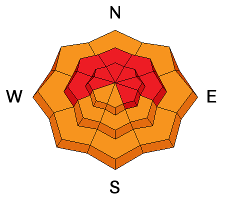
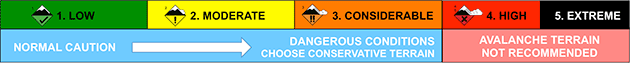
bottom line The avalanche danger is HIGH this weekend. It is crucial to avoid all steep slopes. This includes staying out from underneath them also. Be careful while riding on Forest Service roads as a number of these summer roads pass underneath steep avalanche paths. KEEP IN MIND DANGEROUS AVALANCHE CONDITIONS WILL PERSIST INTO NEXT WEEK.
|
 |
avalanche warning HEAVY SNOW AND STRONG WIND HAS LED TO A HIGH AVALANCHE DANGER. VERY DANGEROUS AVALANCHE CONDITIONS EXIST. LONGER RUNNING NATURAL AVALANCHES MAY OCCUR OVER THE WEEKEND. LARGE AVALANCHES MAY BE TRIGGERED ON AND FROM WELL BELOW STEEP TERRAIN. BACKCOUNTRY TRAVEL IS NOT RECOMMENDED. |
 |
current conditions Temperatures continue to inch up and are in the low 20s along the ridges. West winds are strong along the ridges with moderate speeds around the 9000 foot level. We have picked up about 6 inches of snow over the last day or so. Riding conditions were excellent on Friday although the deep snow does limit travel. This nice fluffy 'right side up' snow may change as winds continue and snow densities increase making the snow 'upside down'. Below are a couple of observations from Friday:
|
 |
recent activity Natural avalanches were reported from the Skyline area on Thursday. No details were given other than avalanches were falling on their own. |
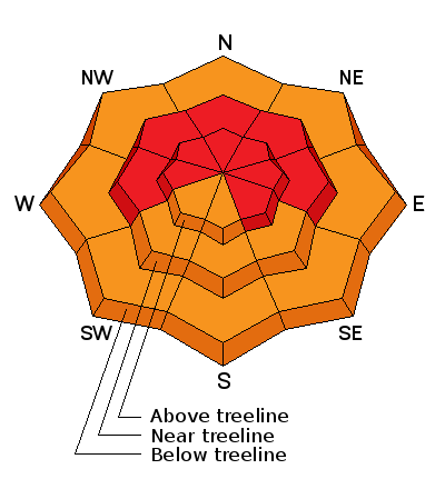
| type | aspect/elevation | characteristics |
|---|
|
|
LIKELIHOOD
 LIKELY
UNLIKELY
SIZE
 LARGE
SMALL
TREND
 INCREASING DANGER
SAME
DECREASING DANGER
|
|
description
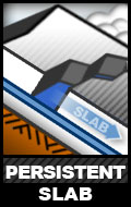
All of the snow from November until mid January turned into a sugary faceted unconsolidated loose and weak layer of snow. We now have add a significant new slab (new layer of snow) on top of the weak layers. THIS IS A VERY UNSTABLE SITUATION. I have experienced an unbelievable amount of collapsing over the last week. This is where the snowpack screams at you by making a loud 'WHOOMP'! This is the weak snow failing under the new snow load AND you're weight acting as the trigger. |
 |
weather West winds should remain quite strong on Saturday. Ridgetop temperatures will be in the upper 20s. We should see a couple of impulses of snow through the weekend. We should see 3 to 6 inches on Saturday. A few more inches are possible Saturday night. Another good impulse will move through on Sunday bringing another 3 to 6 inches or better. Temperatures will again be in the upper 20s. Winds shift more northwest and gradually start to slow on Sunday. I would not be surprised to see 1 to 2 feet of snow by the time it winds down Monday. |
| general announcements Donate to your favorite non-profit –The Utah Avalanche Center. The UAC depends on contributions from users like you to support our work. Benefit the Utah Avalanche Center when you buy or sell on ebay - set the Utah Avalanche Center as a favorite non-profit in your ebay account here and click on ebay gives when you buy or sell. You can choose to have your seller fees donated to the UAC, which doesn't cost you a penny. Utah Avalanche Center mobile app - Get your advisory on your iPhone along with great navigation and rescue tools. The information in this advisory is from the US Forest Service which is solely responsible for its content. This advisory describes general avalanche conditions and local variations always occur. This advisory will be updated by 7:00 AM Saturday, February 15th, 2014. |


.jpg)