| During the month of April, Mark Miller will donate $75 to the charity of your choice (5 to chose from, including the Utah Avalanche Center!) Mark Miller Subaru has raised over $300k in the previous 6 Do Good Feel Good events. More Info here |  |
| During the month of April, Mark Miller will donate $75 to the charity of your choice (5 to chose from, including the Utah Avalanche Center!) Mark Miller Subaru has raised over $300k in the previous 6 Do Good Feel Good events. More Info here | |
| Advisory: Skyline Area Mountains | Issued by Craig Gordon for Saturday - January 11, 2014 - 6:39am |
|---|

|
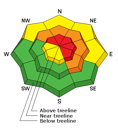
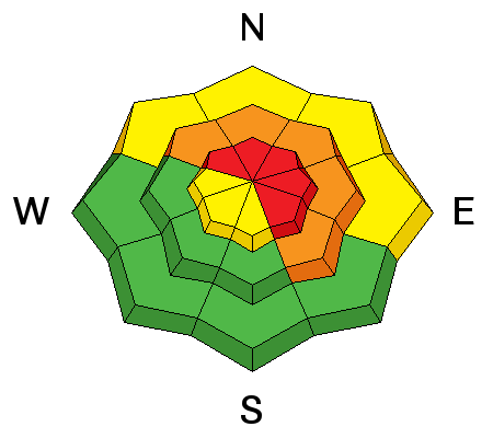
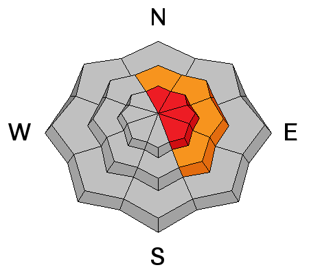
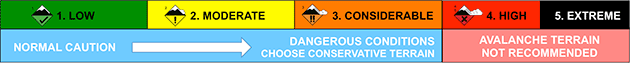
bottom line A HIGH avalanche danger exists on steep, upper elevation, wind drifted slopes, especially those facing the north half of the compass. Both human triggered and natural avalanches are very likely. Slopes with an easterly component to their aspect are most dangerous. A CONSIDERABLE avalanche danger is found at mid elevations where human triggered avalanches are likely on steep, wind drifted slopes. Wind sheltered terrain offers LOW avalanche danger
|
 |
avalanche warning THIS AVALANCHE WARNING IS FOR THE MOUNTAINS OF NORTHERN AND CENTRAL UTAH, TO INCLUDE THE WESTERN UINTA MOUNTAINS AND THE MANTI-SKYLINE. VERY DANGEROUS AVALANCHE CONDITIONS EXIST THROUGH THE WEEKEND...AVOID BEING ON OR BENEATH STEEP MOUNTAIN SLOPES...AS AVALANCHES MAY BE TRIGGERED LOW ON THE SLOPE AS WELL. |
 |
special announcement
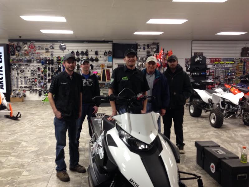
A huge shout out and many thanks to Jared and the team from Big Pine Sports in partnership with Arctic Cat for suppling the Utah Avalanche Center with this bitchin' new loaner sled for the 2013-14 season. |
 |
current conditions Looks like a break this morning with partly cloudy skies and temperatures in the mid 20's. Yesterday's punishing winds have mellowed somewhat and are currently blowing 15-25 mph out of the west-southwest. The region picked up 8"-10" of snow from Thursday's storm, vastly improving the coverage. However, there's hardly any base and the riding and turning conditions are a bit of a wallowfest.
|
 |
recent activity
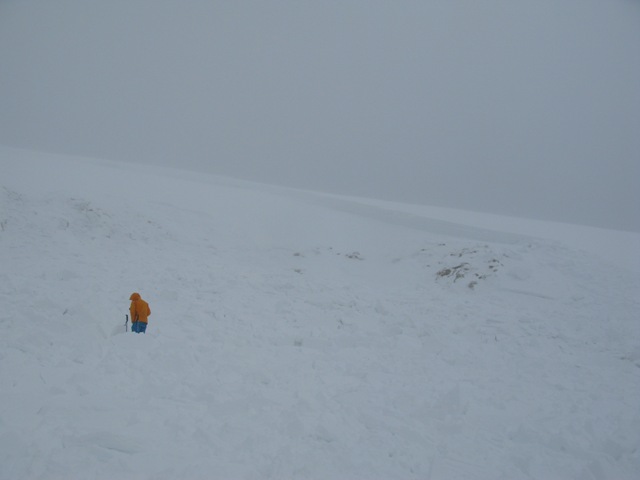
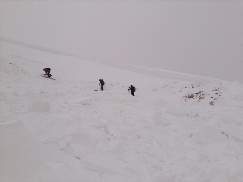
The snowpack on the Skyline is spooky. We remotely triggered this 3' deep avalanche low on the slope, from a distance. The slide broke to weak, sugary snow near the ground. More can be found here. Brett was in Pleasant Creek and put a great video synopsis together of his findings. Click here to view. After channeling the ghost of Monte Atwater, our top notch observers Darce and Steve found some interesting conditions lower in the canyon. Click here to view.
|
| type | aspect/elevation | characteristics |
|---|
|
|
LIKELIHOOD
 LIKELY
UNLIKELY
SIZE
 LARGE
SMALL
TREND
 INCREASING DANGER
SAME
DECREASING DANGER
|
|
description
The Manti-Skyline has some of the weakest snow in the state and the Thursday/Friday storm was the first notable event to test our fragile snowpacks strength. Unfortunately, it reminded me of my high school days... it failed miserably. We have a very dangerous setup on the Skyline right now because the snow won't be as tender as yesterday and it will allow us to get well out onto the slope before it fails and breaks to the ground. These are the type of avalanche conditions that lead to most avalanches accidents on the Skyline and today is no different. Steep, upper elevation, wind drifted slopes, especially those with an easterly component, need to be avoided. Once triggered, avalanches will break deep and wide, taking out the entire seasons snowpack, creating an unsurvivable slide. It doesn't mean you can't ride. It does mean you need to stay off of and out from under steep wind drifted slopes, especially slopes facing the north half of the compass. Best to avoid being in avalanche terrain today. Stick to gentle, wind sheltered slopes and avoid being under or adjacent to slide paths. You can find good riding in the trees and low angle meadows.
|
| type | aspect/elevation | characteristics |
|---|
|
|
LIKELIHOOD
LIKELY
UNLIKELY
SIZE
LARGE
SMALL
TREND
INCREASING DANGER
SAME
DECREASING DANGER
|
|
description
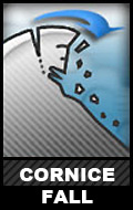
Cornices have grown huge, especially on leeward ridges near the summit. These monsters can easily break back further than you might expect, taking you for a nasty, unexpected ride down the elevator shaft, and possibly triggering a large avalanche as you both hit the slope below.. |
 |
weather Warm and windy today with highs reaching into the upper 30's. Clouds and southwest wind increase late in the day as a strong cold front bears down on the state. The first of two pieces arrives late tonight with 2"-4" of snow expected and another, colder shot of snow slides through early Sunday with an additional 6". High pressure builds for early in the week.
|
| general announcements Remember your information can save lives. Please let us and the rest of the community know what you are seeing out there by submitting snow and avalanche conditions. This is a great time of year to schedule a free avalanche awareness presentation for your group or club. Contact either Craig Gordon or Brett Kobernik by emailing us: Donate to your favorite non-profit –The Utah Avalanche Center. The UAC depends on contributions from users like you to support our work. Benefit the Utah Avalanche Center when you buy or sell on ebay - set the Utah Avalanche Center as a favorite non-profit in your ebay account here and click on ebay gives when you buy or sell. You can choose to have your seller fees donated to the UAC, which doesn't cost you a penny. Utah Avalanche Center mobile app - Get your advisory on your iPhone along with great navigation and rescue tools. The information in this advisory is from the US Forest Service which is solely responsible for its content. This advisory describes general avalanche conditions and local variations always occur. We will update this advisory by 7:00 AM on Saturday Jan. 18, 2014 or sooner if conditions warrant. |


.jpg)