

Avalanche Advisory
| Advisory: Skyline Area Mountains | Issued by Craig Gordon for March 2, 2013 - 6:56am |
|---|


Above treeline
Near treeline
Below treeline
|
bottom line Pockets of CONSIDERABLE danger exist on steep, upper elevation wind drifted terrain and human triggered avalanches are likely. Out of the wind zone a MODERATE avalanche danger will be found on steep slopes with recent deposits of wind drifted snow and human triggered avalanches are possible. As the day heats up, expect the avalanche danger to rise at lower elevations, as damp avalanches will become more likely.
|

 |
special announcement Our thoughts and prayers go out to the friends and family of James Childs, a 30 year old snowmobiler who was killed in an avalanche accident yesterday on the southern end of the Manti-Skyline. We visited the site and our investigation is posted here.
|
 |
current conditions A couple of midweek systems helped keep winter going on the Skyline and riding conditions are quite good in wind sheltered terrain. Better get after it early though... with temperatures already in the low 30's and light winds, today's strong sunshine will turn the light powder into damp, manky snow quickly today.
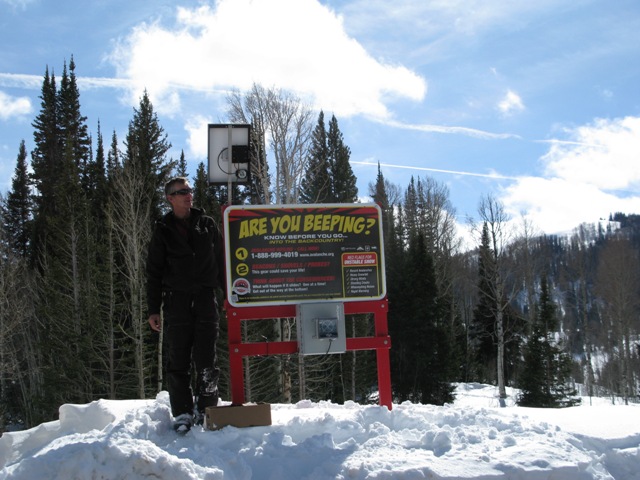
Your fundraising donations at work. In conjunction with BCA, we installed a beacon checker at the Miller Flat trailhead yesterday. Thanks to Ted and Steve for all the help and thanks to all of you for all the great support! |
 |
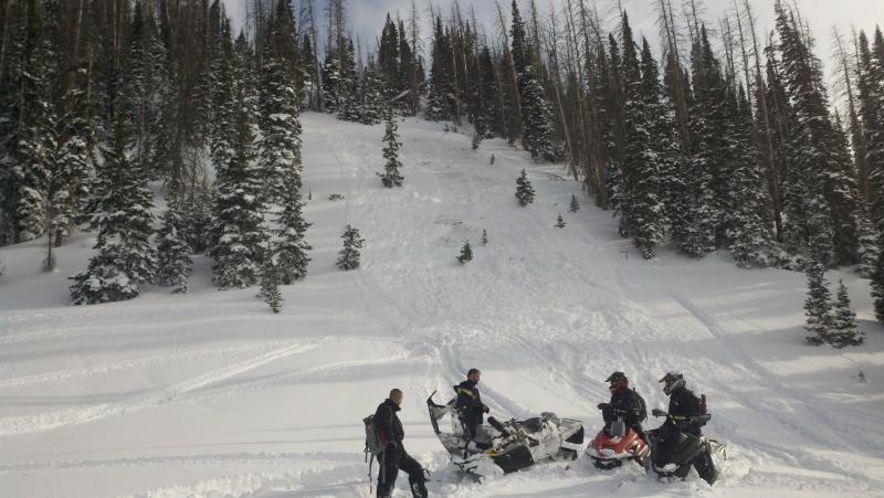
recent activity This was a close call in Ephraim Canyon Monday. An experienced local sledder triggered this slide which broke to the ground and was found with just his hand sticking out of the snow. Click here for more details.
|
Avalanche Problem 1over the next 24 hours
| type | aspect/elevation | characteristics |
|---|
 |

Above treeline
Near treeline
Below treeline
|
|
|
description
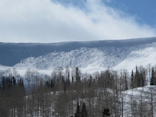
Upper elevation winds have been howling, stripping west facing windward terrain of their snow and forming stiff wind slabs on leeward slopes. Today's wind drifts may not be quite as sensitive as yesterday, but they'll be packing a punch a may break wider and deeper than you might expect. Look for and avoid fat, rounded pillows of snow especially on slopes with an easterly component to their aspect. |

Avalanche Problem 2over the next 24 hours
| type | aspect/elevation | characteristics |
|---|
 |
Above treeline
Near treeline
Below treeline
|
|
|
description
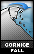
Cornices have grown huge the past few days and can break back further than you might expect. Best to steer clear of these unpredictable pieces of snow.
|

Avalanche Problem 3over the next 24 hours
| type | aspect/elevation | characteristics |
|---|
 |


Above treeline
Near treeline
Below treeline
|
|
|
description
Our deeper snowpack issues aren't going away anytime soon and may actually come out of their dormant state with today's spike in temperatures. Steep, rocky slopes, especially those where strong feeling snow overlies weak, "punchy" snow such be considered suspect. Once triggered, today's avalanches can break to the ground. The danger may be more pronounced on the south half of the range. |
 |
weather A beautiful day is on tap for the Skyline with light winds, plenty of sunshine, and temperatures soaring into the mid 40's. Increasing clouds on Sunday signal an approaching storm that should deliver 2"-4" of snow by late in the day. High pressure returns for early in the week before a series of systems slides through the region starting Wednesday, None of the storms look overly impressive. |
| general annoucements Remember your information can save lives. If you see anything we should know about, please participate in the creation of our own community avalanche advisory by submitting snow and avalanche conditions. You can call me directly at 801-231-2170, email craig@utahavalanchecenter.org, or email by clicking HERE This is a great time of year to schedule a free avalanche awareness presentation for your group or club. You can contact me at 801-231-2170 or email craig@utahavalanchecenter.org Donate to your favorite non-profit –The Friends of the Utah Avalanche Center. The UAC depends on contributions from users like you to support our work. The information in this advisory is from the US Forest Service which is solely responsible for its content. This advisory describes general avalanche conditions and local variations always occur. This advisory will be updated by 7:00 AM Saturday, March 9th. |