Home
utahavalanchecenter.org
Keeping you on top!

Sponsor Ads

  • About
    • Submit Avalanche Observations
    • Contact
    • Who we are
    • Staff
    • FUAC
    • How we generate an advisory
    • Log in
  • Advisories
    • Logan
    • Ogden
    • Salt Lake
    • Provo
    • Uintas
    • Skyline
    • Moab
    • Tomorrow's Danger Rating
    • Podcasts
    • Archives
  • Education
    • Classes/Workshops
    • Know Before You Go
    • Tutorials
    • Beacon Practice
    • Avalanche Stats
    • FAQ
    • Encyclopedia
  • Detailed Info
    • Submit Backcountry Observations
    • All the Good Stuff
      • All Regions
      • Logan
      • Ogden
      • Salt Lake
      • Provo
      • Uintas
      • Skyline
      • Moab
    • Avalanches
      • All Regions
      • Logan
      • Ogden
      • Salt Lake
      • Provo
      • Skyline
      • Uintas
      • Moab
      • Detailed List
    • Accidents
    • Video
    • Photos
      • Avalanches
    • Maps
      • Selected Routes
      • Place Names Map
    • Archives
  • Blog
  • Weather
    • Mtn Weather Forecasts
      • Logan
      • Moab
      • Salt Lake
    • 48hr Weather Charts
      • Temps-Wind-Precip
      • Precipitation
    • Seasonal Weather Charts
      • Current Season
      • Alta Monthly Snowfall
      • Archives
    • Radar Loops
      • Salt Lake Regional
      • US Composite
  • Resources
    • Essential Gear
    • Smartphone Apps
    • Beacon Tech
    • Beacon Practice
    • Books & Videos
    • Guide Services
    • Wasatch Backcountry Rescue
    • Local Mtn Info
    • Place Names Map
  • Events
    • List View
    • Calendar View
      • September
      • October
      • November
      • December
      • January
      • February
      • March
      • April
  • Store
    • Online Store
    • Online Store Help
  • Sponsors
  • Donate
Avalanche Advisory
Tweet
Advisory: Skyline Area Mountains Issued by Craig Gordon for December 25, 2012 - 6:05am
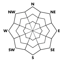
Above treeline
Near treeline
Below treeline
bottom line

Terrain to avoid- steep, rocky terrain where a solid feeling slab overlies thin, weak snow. The avalanche danger is HIGH and dangerous human triggered avalanches are very likely.

A CONSIDERABLE avalanche danger exists in mid elevation terrain and human triggered avalanches are probable on steep wind drifted slopes.

LOW avalanche danger is found on low angle, low elevation, wind sheltered slopes.


danger scale: 1. Low 2. Moderate 3. Considerable 4. High 5. Extreme
avalanche warning

The Manti-Skyline mountains have a weak underlying snowpack and dangerous avalanche conditions exist. Yesterdays big storm coupled with recent winds have increased the avalanche danger. Large, human triggered avalanches breaking to the ground are likely and avalanches can be triggered from a distance and on relatively flat terrain. A HIGH avalanche danger exists, particularly on steep, upper elevation, wind drifted slopes.

special announcement

It's never too late to give that special someone (or yourself) an avalanche class for the holidays. A couple of clicks and you are done - no standing in line or shipping. Check out the Snowmobile Avalanche and Riding Skills Workshop... an avy class designed by riders for riders. Click here for more details.

current conditions

Merry Christmas! The Skyline got quite the present yesterday getting clobbered with 12"-18" of new snow. The south half of the range picking up the bulk of the storm. Westerly winds gusted into the 30's as the front reached the area late yesterday, they've switched to the northwest and mellowed out and are currently blowing 10-20 mph along the ridges. Under mostly cloudy skies, temperatures are in the single digits. Riding in the low angle, open meadows will be epically deep.... and the safest place to be today!

recent activity

This big avalanche was remotely triggered from hundreds of feet away. Breaking to the ground, this is the type of avalanche dragon we're dealing with on the Skyline.

Click here to see a great video describing the slide below.

From Miller Flat trailhead looking up at the Phone Shot as we prepared for our field day.

Darce took this picture as we raced to the top of the slope to make sure no one was caught or buried. Fortunately neither was the case.

After the dust settled, I snapped this pic of Phone Shot on our way home. This gives you a great perspective of just how wide and deep avalanches are breaking.

Avalanche Problem 1over the next 24 hours
type aspect/elevation characteristics
Above treeline
Near treeline
Below treeline
likelihood size
likely
unlikely
large
small
distribution trend
widespread
isolated
More Dangerous
Same
Less Dangerous
description

A weak and complex snowpack exists on the Skyline and avalanche conditions are deceptively tricky. Hiding the nefarious avalanche dragon is all the deep, light snow that fell overnight. Adding to this intoxicating mix are clearing skies and bright sunshine. Unfortunately, the snowpack might not share our same enthusiasm. We've gotta think not only about the snow we're riding in, but also the snow we're riding on. Just a few days ago, riders were able to trigger avalanches from a distance and on relatively flat terrain. This type of avalanche condition just doesn't go away in a few days... it lingers for long periods of time. Today's avalanches have the potential to break wide and deep, taking out the entire seasons snowpack, producing a very dangerous slide. Even if you're carving in low angle meadows make sure there's no steep slopes above or adjacent to where you're riding.

Avalanche Problem 2over the next 24 hours
type aspect/elevation characteristics
Above treeline
Near treeline
Below treeline
likelihood size
likely
unlikely
large
small
distribution trend
widespread
isolated
More Dangerous
Same
Less Dangerous
description

Yesterdays gusty winds and new snow created sensitive wind drifts along the leeward side of upper elevation ridges. While today's soft slabs might not be quite as reactive, remember that avalanches triggered within the new snow can easily break into deeper buried weak layers as they crash down onto the slope below. This chain of events would quickly turn a manageable avalanche into something you didn't bargain for. Best to play it safe and avoid steep, wind drifted slopes.

weather

Snow showers begin to taper off in the next few hours and we should see partly cloudy skies as a short-lived ridge of high pressure builds. Daytime highs reach into the low 20's with overnight lows dipping into the teens. Winds switch to the southwest late in the day and increase into the 30's by Wednesday morning, as a trough takes up residence over the region through early Friday. Snow develops late today with off and on snow through the end of the week. Storm totals should be around a foot.

general annoucements

Remember your information can save lives. If you see anything we should know about, please participate in the creation of our own community avalanche advisory by submitting snow and avalanche conditions.   You can call me directly at 801-231-2170, email craig@utahavalanchecenter.org, or email by clicking HERE

This is a great time of year to schedule a free avalanche awareness presentation for your group or club. You can contact me at 801-231-2170 or email craig@utahavalanchecenter.org

Donate to your favorite non-profit –The Friends of the Utah Avalanche Center. The UAC depends on contributions from users like you to support our work.

The information in this advisory is from the US Forest Service which is solely responsible for its content. This advisory describes general avalanche conditions and local variations always occur.

The advisory expires 24 hours after the date and time posted, but will be updated by 7:00 AM Saturday December 29th.


Tweet

2242 West North Temple | Salt Lake City, UT 84116 | (801) 524-5304 | Advisory Hotline: (888) 999-4019 | Contact

Powered by Drupal