

Avalanche Advisory
| Advisory: Skyline Area Mountains | Issued by Craig Gordon for December 22, 2012 - 6:50am |
|---|


Above treeline
Near treeline
Below treeline
|
bottom line Terrain to avoid- steep, upper elevation wind loaded terrain. The avalanche danger is HIGH and dangerous human triggered avalanches are very likely, especially in steep, rocky terrain where a solid feeling slab overlies thin, weak snow. A CONSIDERABLE avalanche danger exists in mid elevation terrain and human triggered avalanches are probable on steep wind drifted slopes. LOW avalanche danger is found on low angle, wind sheltered slopes.
|
 |
special avalanche bulletin The Manti-Skyline mountains have a weak underlying snowpack and dangerous avalanche conditions exist. Last weeks big storm coupled with recent winds have increased the avalanche danger. Large, human triggered avalanches breaking to the ground have already occurred. Avalanches can be triggered from a distance and on relatively flat terrain. A HIGH avalanche danger exists, particularly on steep wind drifted slopes and human triggered avalanches are very likely.
|

 |
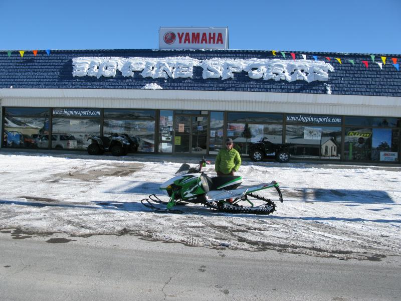
special announcement Many thanks to Big Pine Sports and Arctic Cat for helping to supply us with a loaner sled this year.... you guys... and gals are awesome!
|
 |
current conditions Skies are clear and temperatures in the low to mid 20's. West and southwest winds picked up late yesterday and blew in the low 30's along the ridges, but have mellowed out somewhat and are currently blowing 20-25 mph along the high ridges. Recent winds have formed some funky, breakable snow conditions in upper elevation windward terrain, but in wind sheltered meadows the riding is deep and creamy.
|
 |
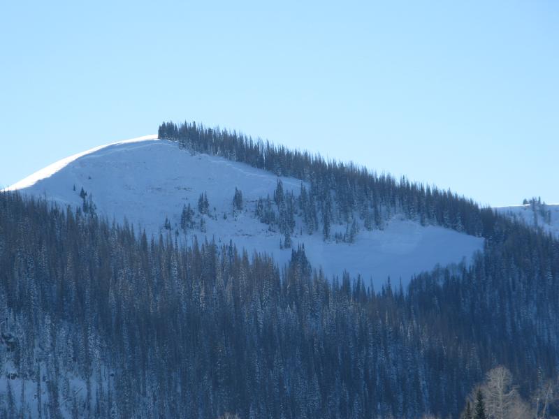
recent activity We came across this big avalanche which was remotely triggered from hundreds of feet away. Breaking to the ground, this is the type of avalanche dragon we're dealing with this weekend. Click here to see a great video describing the slide below.
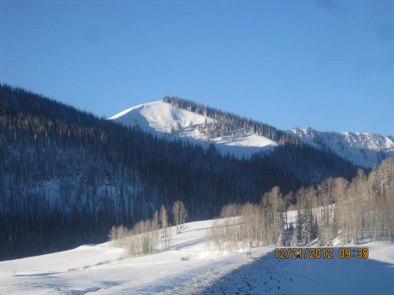
From Miller Flat trailhead looking up at the Phone Shot as we prepared for our field day.
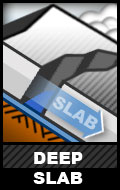
Darce took this picture as we raced to the top of the slope to make sure no one was caught or buried. Fortunately neither was the case.
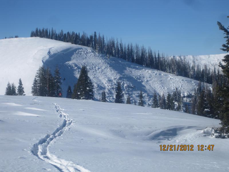
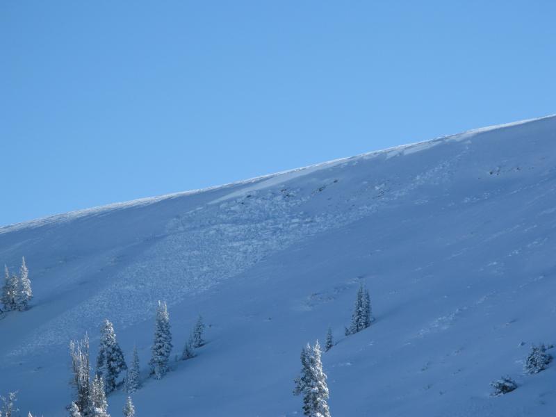
After the dust settled, I snapped this pic of Phone Shot on our way home. This gives you a great perspective of just how wide and deep avalanches are breaking.
|
Avalanche Problem 1over the next 24 hours
| type | aspect/elevation | characteristics |
|---|
 |
Above treeline
Near treeline
Below treeline
|
|
|
description
A weak and complex snowpack exists on the Skyline and avalanche conditions are deceptively tricky. Last Tuesday's big storm essentially tripled our total snow depth and the snowpack is reeling, trying desperately to adjust to all this added weight. The past few days have been crazy and riders are able to trigger avalanches from a distance and on relatively flat terrain... perhaps the Mayan Prophecy is coming true. This type of avalanche condition just doesn't go away in a few days... it lingers for long periods of time. Not much has changed overnight and once triggered, today's avalanches have the potential to break wide and deep, taking out the entire seasons snowpack, producing a very dangerous and possibly unsurvivable slide. Even if you're carving in low angle meadows make sure there's no steep slopes above or adjacent to where you're riding.
|

Avalanche Problem 2over the next 24 hours
| type | aspect/elevation | characteristics |
|---|
 |


Above treeline
Near treeline
Below treeline
|
|
|
description
Winds have helped complicate the avalanche danger and are forming yet another layer of slab to our already sketchy snowpack. Today you'll want to avoid steep slopes facing the north half of the compass, especially those with recent deposits of wind drifted snow. Avalanches triggered in the fresh wind drifts can easily break deeper and wider than you might expect. |
 |
weather Today we should see increasing clouds and wind as a weakening weather system moves across the region late tonight into Sunday morning. Southwest winds remain a nuisance, blowing 15-30 mph with gusts in the 40's and 50's along the high peaks. High temperatures don't vary much from where we're at this morning and overnight lows dip into the mid teens. By morning we should see 1"-3" of new snow. A stronger system moves across the area Sunday night into Tuesday morning. Might be another good snow producer for the Skyline with perhaps a foot of new snow for Christmas. More details to come for tomorrows advisory. |
| general annoucements Remember your information can save lives. If you see anything we should know about, please participate in the creation of our own community avalanche advisory by submitting snow and avalanche conditions. You can call me directly at 801-231-2170, email craig@utahavalanchecenter.org, or email by clicking HERE This is a great time of year to schedule a free avalanche awareness presentation for your group or club. You can contact me at 801-231-2170 or email craig@utahavalanchecenter.org Donate to your favorite non-profit –The Friends of the Utah Avalanche Center. The UAC depends on contributions from users like you to support our work. The information in this advisory is from the US Forest Service which is solely responsible for its content. This advisory describes general avalanche conditions and local variations always occur. The advisory expires 24 hours after the date and time posted, but will be updated by 7:00 AM Sunday December 23rd.
|