

Avalanche Advisory
| Advisory: Skyline Area Mountains | Issued by Craig Gordon for December 15, 2012 - 6:49am |
|---|


Above treeline
Near treeline
Below treeline
|
bottom line Terrain to avoid- steep, upper elevation wind loaded terrain. A MODERATE avalanche danger exists and human triggered avalanche are possible. The danger will be more pronounced in the southern half of the region, closer to I-70, which received more snow. In general you'll find a LOW avalanche danger in a vast majority of the terrain along the Skyline this weekend.
|

 |
special announcement Please join us at North San Pete High School at 7:00 pm Thursday Dec. 20th for an evening movie featuring Boondockers 9.
|

 |
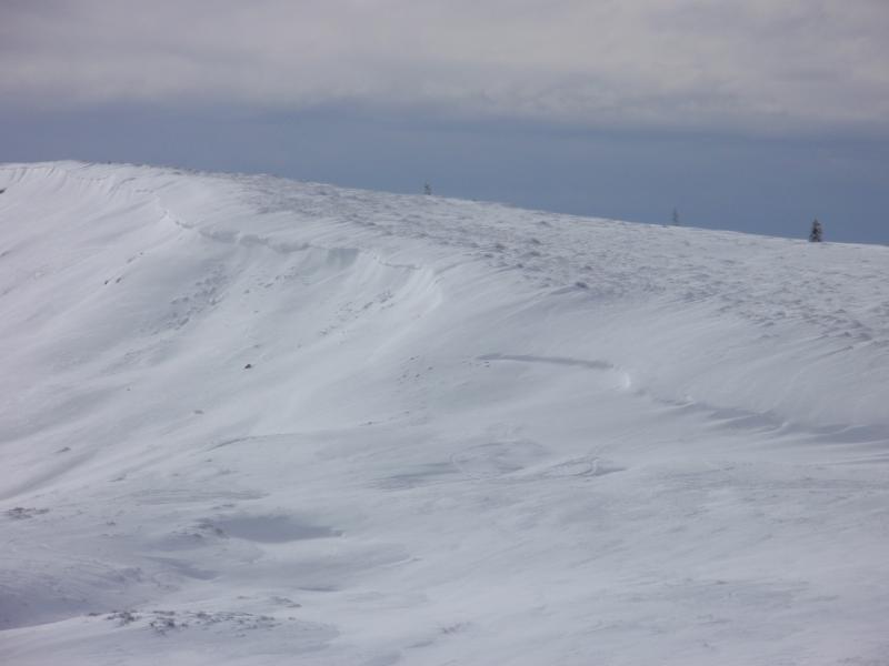
current conditions Clouds and a few light snow showers hang over the Skyline this morning as last nights storm slides to the east. It looks like the southern half of the range from Seeley Creek to I-70 received close to 6" of snow. Traveling northward snow totals are in the 3" range. Temperatures are in the mid 20's. West and southwest winds spiked for a few hours early this morning with gusts in the upper 20's and low 30's, but have mellowed out and are currently blowing 10-15 mph along the high ridges. The new snow will vastly help out the riding and turning conditions, but overall the Skyline remains pretty thin.
This image pretty much sums up conditions at lower elevations... it's thin and brushy out there.
|

 |
recent activity One sled triggered slide was reported in steep terrain, near the highway along the Skyline. Around a foot in depth, this hard slab broke into weak snow near the ground as a result of the midweek winds of 12-12-12. In addition, both Steve and Darce have experienced lots of collapses and loud, booming, whoomphing sounds.
|
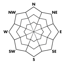
Avalanche Problem 1over the next 24 hours
| type | aspect/elevation | characteristics |
|---|
 |
Above treeline
Near treeline
Below treeline
|
|
|
description
Sensitive wind drifts along the leeward side of upper elevation ridges are todays most obvious and easy to deal with avalanche concern. Smooth rounded pillows of snow are easy to detect and will break at or below your skis, board, or sled. Unfortunately, it's still very thin out there an even a small slide could result in a body beating, season ending slide. Best to continue avoiding steep, wind drifted slopes this weekend.
Winds have been busy at work along the summit, stripping snow on the windward side and forming sensitive drifts on the leeward side of upper elevation ridges. |

Avalanche Problem 2over the next 24 hours
| type | aspect/elevation | characteristics |
|---|
 |
Above treeline
Near treeline
Below treeline
|
|
|
description
With a series of storms poised to slide into the region, avalanche conditions will become progressively tricky the next few days and slides breaking into weak snow near the ground will become more widespread. Our snowpack is a bit of a mess and this great field report by our ace observers Steve Cote and Darce Trotter clearly explains the setup. The most likely place to trigger an avalanche that breaks deeper than you might expect is going to be in steep rocky, upper elevation terrain, especially on slopes with a thin, shallow snowpack. |
 |
weather Snow should become more showery in nature this morning and we should see a break in the action by around lunchtime. Westerly winds remain light and temperatures don't vary much from where we're at this morning. Overnight lows dip into the teens. Another wave slides into the region on Sunday, bringing colder air with 2"-5" of snow expected. Sunday night and Monday it gets interesting with rising temperatures, dense snow, and strong westerly winds. Yet another system is slated for midweek. Looks like we're finally got get some snow on the Skyline! |
| general annoucements Remember your information can save lives. If you see anything we should know about, please participate in the creation of our own community avalanche advisory by submitting snow and avalanche conditions. You can call me directly at 801-231-2170, email craig@utahavalanchecenter.org, or email by clicking HERE This is a great time of year to schedule a free avalanche awareness presentation for your group or club. You can contact me at 801-231-2170 or email craig@utahavalanchecenter.org Donate to your favorite non-profit –The Friends of the Utah Avalanche Center. The UAC depends on contributions from users like you to support our work. The information in this advisory is from the US Forest Service which is solely responsible for its content. This advisory describes general avalanche conditions and local variations always occur. The advisory expires 24 hours after the date and time posted, but will be updated by 7:00 AM Saturday December 22nd.
|