

Avalanche Advisory
| Advisory: Skyline Area Mountains | Issued by Bruce Tremper for November 9, 2012 - 9:19am |
|---|


Above treeline
Near treeline
Below treeline
|
bottom line As new snow accumulates, avalanche danger will likely rise from Low to Moderate by Friday afternoon or Saturday. Especially watch for upper elevation, northerly facing slopes where new snow is falling on the slippery, old snow surface instead of on bare ground. Be sure to see how well the new snow is bonding by digging down with your hand or jump on small test slopes. This forecast will be updated on an intermittent bases as needed.
|

 |
special announcement Welcome to the new look of the avalanche advisory. This past summer we had a series of meetings and negotiated a unified look-and-feel of the avalanche advisories and web pages for other avalanche centers in this reagion including Jackson, Wyoming, Sun Valley and the Sierra Avalanche Center. Eventually all these sites should look very similar and the plan is for Colorado to join the look next winter. In another week or two we expect to have two viewing choices for the advisory page--this basic view and the "advanced" view most are familiar with from last season with colored danger ratings in the aspect-elevation diagram. We are still in the process of transferring the pages and content from our old website to the new site, so be patient. We are also tweaking the look and design so you may notice some changes. When everything is finished, it should all be pretty cool. |
 |
current conditions The snow from the last storm did not hit the Manti Skyline very hard and what snow did fall, has mostly melted away on the sunnier, south facing slopes but you can still find about 6 inches of settled snow on the upper elevation, northerly facing slopes. |
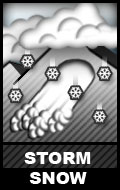
Avalanche Problem 1over the next 48 hours
| type | aspect/elevation | characteristics |
|---|
 |
Above treeline
Near treeline
Below treeline
|
|
|
description
As this weekend's snow begins to accumulate it should bond well to the bare ground but the old snow surface is much more slippery. So especially watch for avalanches within the new snow on the upper elevation, northerly-facing slopes where the new snow is falling on the old snow surface. The avalanche danger should start out Low on Friday but may rise to Moderate through the weekend. As you travel in the new snow, be sure to regularly check to see how well the new snow is bonding to the old snow surface by digging down with your hand or jump on small test slopes. |

 |
weather We are expecting about a foot or two of new snow on the Plateau over the weekend with dramatically colder temperatures--from about zero to 15 degrees. For more detailed information check the National Weather Service forecast for the area |
| general annoucements We will update this advisory on an intermittent basis as needed. |