

| Advisory: Salt Lake Area Mountains | Issued by Drew Hardesty for March 1, 2013 - 5:18am |
|---|


Above 9,500 ft.
8,000-9,500 ft.
Below 8,000 ft.
|
bottom line Pockets of MODERATE danger exist in the backcountry today. Human triggered avalanches are possible in steep terrain at the mid and upper elevations on all aspects. Collapsing and cracking are sure-fire indicators of localized instability. If skies clear earlier than expected, the steepest southerly aspects will start to produce shallow wet sluffs, which may gouge into older layers...though this may be more pronounced on Saturday.
|
 |
current conditions Not that I have anything against what they call a "moist warm air advection pattern"...Seems we've had plenty of these this winter and they often mean warming temps, overcast skies, high humidity (~green-housing), moderate to strong ridgetop northwest winds, and yes, riming. Temps are in the low 20s, northwesterlies are 15-20mph - though 35-40mph along the highest, most exposed ridgelines - and skies are overcast. Riding conditions remain best on sheltered northerly slopes; southerlies sport a mix of supportable to breakable crusts. |
 |
recent activity Yesterday's northwesterly winds toppled a cornice along the Cardiac Ridge (specifically above the Wyatt Couloir - named not for my son but Evelyn's husband Rick Wyatt), which, in turn, triggered a 1-2' deep and 100' wide soft slab. This on a steep northeast facing slope at 10,600'. Investigation of the weak layer revealed not-so-weak small grained damp faceted snow. Careful probing along the fracture line indicated an average snowpack depth of 6' and to our surprise - NOT triggered at a thin, rocky zone. More of the write-up can be found at the top our avalanche list here. Photo below of Utah Avalanche Center Executive Director and - more importantly - good friend Paul Diegel checking out the crown yesterday... |
| type | aspect/elevation | characteristics |
|---|
 |


Above 9,500 ft.
8,000-9,500 ft.
Below 8,000 ft.
|
|
|
description
Continued elevated winds will keep the wind slabs an issue in the high alpine terrain. These are all soft shallow-ish wind slabs that will be reactive to cornice fall or ski and slope cuts. Diminishing winds later and warming temps should allow these to settle out and become more isolated and unlikely over the next 24 hours. They're more pronounced in the high easterly facing terrain, though high cross-loaded terrain may be suspect as well. |
| type | aspect/elevation | characteristics |
|---|
 |


Above 9,500 ft.
8,000-9,500 ft.
Below 8,000 ft.
|
|
|
description
With the two older buried facet layers from January comfortably dormant, we now concern ourselves with localized areas where the February faceted grains are showing their hand. The well documented collapses and avalanching within the facet-crust sandwiches on the southerly aspects have now been joined by activity on upper elevation northeast... My sense is that these are more low probability, moderate consequence players; still - it doesn't engender much confidence (in this forecaster anyway) when there is such complexity and variability slope-to-slope...even in the same drainage. Additional wind loading and rapid warming - either this afternoon or tomorrow - are secondary factors that may further stress the poor snowpack structure. Bottom line here is with this uncertainty - with clear cut avalanche activity in unusual terrain (southerlies) - one should plan their routes carefully...follow good travel protocol and choose terrain where consequences are not as severe. |
| type | aspect/elevation | characteristics |
|---|
 |


Above 9,500 ft.
8,000-9,500 ft.
Below 8,000 ft.
|
|
|
description
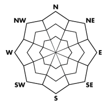
The rose reflects a forecast of sun by the afternoon...as well as "greenhousing" affecting the low elevation northerly shady slopes. Keep an eye on the cloud cover and adjust route plans to avoid being on or beneath damp and deteriorating soggy slopes. |
 |
weather We'll have overcast skies becoming partly cloudy by the afternoon. Temps will rise into the upper 20s at 10,000' and mid 30s at 8000'. The northwesterly winds will remain moderate to strong along the highest most exposed ridgelines...then lose steam by mid to late afternoon. Skies clear for tomorrow accompanied by rapid warming and light winds. A weak system moves through for Sunday...with another disturbance on tap for late Wednesday. |
| general annoucements
Go to http://www.backcountry.com/utah-avalanche-center to get tickets from our partners at Beaver Mountain, Canyons, Sundance, and Wolf Mountain. All proceeds benefit the Utah Avalanche Center. If you trigger an avalanche in the backcountry - especially if you are adjacent to a ski area – please call the following teams to alert them to the slide and whether anyone is missing or not. Rescue teams can be exposed to significant hazard when responding to avalanches, and do not want to do so when unneeded. Thanks. Salt Lake and Park City – Alta Central (801-742-2033), Canyons Resort Dispatch (435-615-3322) Ogden – Snowbasin Patrol Dispatch (801-620-1017) Powder Mountain Ski Patrol Dispatch (801-745-3772 ex 123) Provo – Sundance Patrol Dispatch (801-223-4150) Dawn Patrol Forecast Hotline, updated by 05:30: 888-999-4019 option 8. Twitter Updates for your mobile phone - DETAILS Daily observations are frequently posted by 10 pm each evening. Subscribe to the daily avalanche advisory e-mail click HERE. UDOT canyon closures UDOT at (801) 975-4838 Wasatch Powderbird Guides does daily updates about where they'll be operating on this blog http://powderbird.blogspot.com/ . Remember your information can save lives. If you see anything we should know about, please participate in the creation of our own community avalanche advisory bysubmitting snow and avalanche conditions. You can also call us at 801-524-5304 or 800-662-4140, or email by clicking HERE Donate to your favorite non-profit –The Friends of the Utah Avalanche Center. The UAC depends on contributions from users like you to support our work. For a print version of this advisory click HERE. This advisory is produced by the U.S. Forest Service, which is solely responsible for its content. It describes only general avalanche conditions and local variations always exist. Specific terrain and route finding decisions should always be based on skills learned in a field-based avalanche class. |