

| Advisory: Salt Lake Area Mountains | Issued by Evelyn Lees for November 25, 2012 - 5:46am |
|---|


Above 9,500 ft.
8,000-9,500 ft.
Below 8,000 ft.
|
bottom line The snowpack is mostly stable, and the avalanche danger is Low today. Use normal caution and travel one at a time on steep slopes.
|
 |
current conditions The strong valley inversions extend into the mountains, where temperatures in the canyon bottoms are in the 20’s this morning, the mid elevations are in the 30’s to low 40’s, and the highest peaks cool back down into the mid 20’s. Winds are from the southwest, and speeds increased just in bit in the past few hours – averages are 10-15 mph, with gusts to 25. Upper elevation travel remains reasonable on smooth, shady slopes with 2 to 3 feet of snow, but entrances and exits are the hard part, with mixes of rock, dirt and ice in places, and hitting a rock or stump remains a significant hazard. |
 |
recent activity No new avalanche activity was reported from the backcountry or resorts yesterday. |
| type | aspect/elevation | characteristics |
|---|
 |


Above 9,500 ft.
8,000-9,500 ft.
Below 8,000 ft.
|
|
|
description
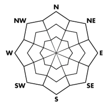
It has been almost 2 weeks since the last snow, and there is not much going on avalanche wise. Very steep, high elevation shady terrain has a slightly higher avalanche risk – of perhaps triggering an old wind drift or a small sluff that could knock you off your feet. Even with the warm temperatures, the snow is changing – on shady, mid and upper elevation slopes the snow surface is faceted and loose, and shallow areas are weakening from top to bottom. |
 |
weather Another weak, dry cold front will cross northern Utah this afternoon. This will bring nothing more than a few clouds, a wind shift to the northwest, and slightly cooling temperatures. Bands of mid to high level clouds will cross northern Utah today, with temperatures warming into the upper 30’s at 10,000’. The light winds will shift to the west, and then northwest by this evening. Averages will remain in the 5 to 15 mph range, with only the highest peaks occasionally gusting above 25 mph. Then it is back to warm, dry high pressure through the end of the month. |
| general annoucements If you trigger an avalanche in the backcountry - especially if you are adjacent to a ski area – please call the following teams to alert them to the slide and whether anyone is missing or not. Rescue teams can be exposed to significant hazard when responding to avalanches, and do not want to do so when unneeded. Thanks. Salt Lake and Park City – Alta Central (801-742-2033) Ogden – Snowbasin Patrol Dispatch (801-620-1017) Provo – Sundance Patrol Dispatch (801-223-4150) Dawn Patrol Forecast Hotline, updated by 05:30: 888-999-4019 option 8. Twitter Updates for your mobile phone Daily observations are frequently posted by 10 pm each evening. Subscribe to the daily avalanche advisory e-mail click HERE. UDOT canyon closures UDOT at (801) 975-4838 Wasatch Powderbird Guides does daily updates about where they'll be operating on this blog http://powderbird.blogspot.com/ . Remember your information can save lives. If you see anything we should know about, please participate in the creation of our own community avalanche advisory by submitting snow and avalanche conditions. You can also call us at 801-524-5304 or 800-662-4140, or email by clicking HERE Donate to your favorite non-profit –The Friends of the Utah Avalanche Center. The UAC depends on contributions from users like you to support our work. This advisory is produced by the U.S. Forest Service, which is solely responsible for its content. It describes only general avalanche conditions and local variations always exist. Specific terrain and route finding decisions should always be based on skills and procedures learned in a field-based avalanche class. Bruce will update this forecast tomorrow. Thanks for calling. |