

| Advisory: Logan Area Mountains | Issued by Toby Weed for February 2, 2013 - 7:28am |
|---|


Above 8,500 ft.
7,000-8,500 ft.
5,000-7,000 ft.
|
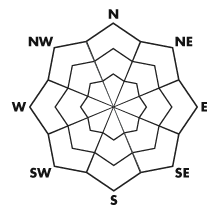
bottom line The danger is MODERATE (or level 2) on most slopes in the backcountry, with heightened avalanche conditions and large triggered avalanches possible in isolated areas.. Dangerous avalanche conditions exist in some areas, and there is a CONSIDERABLE (or level 3) danger on drifted slopes, especially those with a poor snow structure. Dangerous triggered persistent slab avalanches are possible in pockets, mainly on shady slopes at mid elevations, and wind slab avalanches are possible on many steep drifted upper elevation slopes. You also could trigger loose wet avalanches on steep lower elevation slopes with sun-warmed saturated snow. Careful snowpack evaluation, cautious route-finding, and conservative decision making will be essential in the backcountry again today.
|
 |
current conditions The Tony Grove Snotel at 8400' reported about a foot-and-half of new snow since Monday, containing 2-and-a-half inches of water. It's 18 degrees, there is 60 inches of total snow, and 70% of average water content for the date. It's a chilly 4 degrees at the UDOT Hwy 89 Logan Summit weather station, with recorded hourly average wind speeds diminishing into the single digits overnight after recording sustained fairly strong winds from the northwest yesterday. Wednesday's strong and sustained westerly winds, warm temperatures, heavy inverted fresh snow, and riming played havoc with conditions, but you'll still be able to find good riding and decent although somewhat heavy powder conditions, especially in more sheltered areas. |
 |
recent activity Yesterday, a rider in the Monte Cristo Area was successfully recovered by his party using beacons after being caught and fully buried by 350' wide avalanche he triggered while breaking trail through a creek bottom in southeast facing drifted terrain at around 8500' in elevation. A couple other good sized rider triggered avalanches were reported in the Provo and Skyline Area Mountains. Locally; There was widespread natural storm snow activity across the region on Tuesday, and I've observed evidence indicating that some of the big avalanche paths in the Wellsville Range and Wood Camp Hollow ran naturally then as well. Riders gingerly tested many slopes in the Tony Grove and Providence Canyon Areas and triggered no avalanches yesterday. But, parties in the Steam Mill Peak Area out of Franklin Basin and in Garden City Canyon report extensive whumpfing or collapsing, which is a classic indication of unstable snow...... Here's a link to our updated avalanche list...
|
| type | aspect/elevation | characteristics |
|---|
 |


Above 8,500 ft.
7,000-8,500 ft.
5,000-7,000 ft.
|
|
|
description
Avalanches might fail 2 to 3 feet deep on very weak faceted snow created during the drawn-out January high pressure systems. Areas plagued by the shallowly buried January 8 rime-crust , which is intact and fairly widespread in the region, and weak faceted snow associated with it are most suspect. The preexisting snow on shady mid elevation slopes is especially weak, and avalanches could occur in unexpected areas on slopes approaching or steeper than 35 degrees. In these conditions, you could trigger avalanches in some areas remotely, from a distance or worse, from below. Audible collapsing or whumpfing, recent avalanches, and cracking are red flags indicating instability...
|
| type | aspect/elevation | characteristics |
|---|
 |


Above 8,500 ft.
7,000-8,500 ft.
5,000-7,000 ft.
|
|
|
description
I expect that most of the large drifts from the very windy Wednesday will be stubborn or fairly stable by today, but triggered wind slab avalanches are still possible on drifted upper and mid elevation slopes..I noticed some new drifting despite heavy surface snow yesterday. Also, significant loading from the drifting will create a higher danger of persistent slab avalanches in areas with buried weak layers. Watch for and avoid stiffer wind slabs on the lee side of major ridges and in and around terrain features like cliff bands, sub-ridges, gullies, and scoops. Potential wind slabs are drifts that often appear smooth or rounded and chalky looking, and they sometimes sound rather hollow. Stiff wind slabs might allow you to get well out on them before releasing. |
| type | aspect/elevation | characteristics |
|---|
 |


Above 8,500 ft.
7,000-8,500 ft.
5,000-7,000 ft.
|
|
|
description
Loose wet avalanches are possible at lower and mid elevations, especially if high clouds trap solar heat and midday temperatures climb above freezing.... Avoid and stay out from under slopes with saturated surface snow. Roller balls, pin-wheels, and point-release sluffs are all signs that wet avalanche activity is possible. |
 |
weather High pressure conditions will set up over the area for the weekend, continuing through at least the first half of next week. Expect high temperatures of around 30 degrees at 8500' today and a light west breeze. Conditions will be similar and slightly warmer tomorrow. I'm sorry to say that the high pressure conditions will cause the dreaded inversion to set in, with smog building up in the valleys again. Expect fair weather in the mountains. A storm scheduled for around Thursday should clear the smog out of the Cache and is likely to bring a bit of snowfall to the mountains. Check out the new Logan Mountain Weather page...
|
| general annoucements The infamous annual CROWBAR backcountry ski race is scheduled for Saturday, February 23 in Beaver Creek Canyon. Click HERE for more details... For a printer friendly version of this advisory click HERE Remember your information from the backcountry can save lives. If you see or trigger an avalanche, or see anything else we should know about, please send us your snow and avalanche observations. You can also call us at 801-524-5304 or email by clicking HERE. In the Logan Area you can contact Toby Weed directly at 435-757-7578. I will update this advisory on Monday, Wednesday, Friday, and Saturday mornings by around 7:30... This advisory is produced by the U.S.D.A. Forest Service, which is solely responsible for its content. It describes only general avalanche conditions and local variations always exist. |