

| Advisory: Logan Area Mountains | Issued by Toby Weed for December 29, 2012 - 7:07am |
|---|


Above 8,500 ft.
7,000-8,500 ft.
5,000-7,000 ft.
|
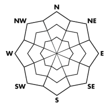
bottom line Heightened avalanche conditions exist, you could trigger avalanches, and there's a MODERATE (or level 2) danger, at upper and mid-elevations in the backcountry today. Triggered deep slabs, wind slabs, and loose avalanches are all possible in steep terrain. The danger is lower and the snow is mostly stable in sheltered terrain, at lower elevations, and on lower angled slopes. Evaluate the snow and terrain carefully, and continue to use safe travel protocols....
|
 |
current conditions You'll find fine knee-deep, light powder conditions across the zone and great riding. This week's fresh snow is well behaved so far, and it's your actions this weekend that are my biggest avalanche concern. We expect lots of people to be out in the backcountry, many so far untested slopes to see traffic for the first time this season, and a real chance that somebody will find unstable snow and trigger a dangerous avalanche.... The Tony Grove Snotel at 8400' reports a chilly 8 degrees this morning, 1 inch of accumulation overnight, 55 inches of total snow, and 92% of average water content for the date. Campbell Scientific's 9700' Logan Peak weather station reports a current temperature of 4 degrees, and the wind sensor appears to be rimed. The UDOT hwy 89 Logan Summit wind sensor is showing hourly average wind speeds in the lower single digits, and Mt.Ogden reports an overnight wind shift from the south-southwest, with wind speeds currently averaging in the 20s....
|
 |
recent activity A small fresh natural wind slab was sighted by observers in Amazon Basin on Christmas Day, and we've been able to initiate a few loose sluffs in very steep terrain in the past couple days, but no other avalanche activity has been reported recently in the Logan Area. Ski resorts in the Park City and Ogden Areas report explosively triggering a couple large avalanches that broke down to an early December rain-crust and ran on sugary faceted snow near the ground. There were also a handful of interesting human triggered avalanches in the backcountry near Salt Lake City where significantly more snow fell since Christmas. Here's a link to our avalanche list... |
| type | aspect/elevation | characteristics |
|---|
 |


Above 8,500 ft.
7,000-8,500 ft.
5,000-7,000 ft.
|
|
|
description
Although becoming less of a threat with time, there are still areas with poor snow structure where you might trigger dangerous hard slab avalanches releasing on buried persistent weak layers. Outlying steep slopes facing the northern half of the compass with generally shallow and weak snow are the most suspect. An avalanche of this type will probably take a pretty big thump to trigger., and the weight of one person on a slope may not be enough, while two or three on sleds might be.... It'll take a bit of probing or digging to determine, but be wary if you find loose sugary snow in the basal layers. Avalanches running on persistent weak layers might be triggered remotely from a distance or worse, from below. Remember that you might very well be the first person or party to test the stability of that big slope this season.. Please report any audible collapsing or whumpfing you may encounter, as this is an important sign of persistent instability. ..
|
| type | aspect/elevation | characteristics |
|---|
 |


Above 8,500 ft.
7,000-8,500 ft.
5,000-7,000 ft.
|
|
|
description
With all the light powder around, it won't take much wind to build sensitive new wind slabs on the lee side of major ridges and in and around terrain features like cliff bands, sub-ridges, gullies, and scoops. We've seen a slight increase in wind speeds and winds shifted around from the south-southwest overnight. In some areas, stiffer old wind slabs are now buried and hidden by fresh powder. These may be stubborn and could allow you to get out on them before releasing....
|
| type | aspect/elevation | characteristics |
|---|
 |


Above 8,500 ft.
7,000-8,500 ft.
5,000-7,000 ft.
|
|
|
description
We've triggered several loose dry sluffs in steep terrain in the past couple days, a few of these gained a bit of steam as they ran and a couple went pretty far down the slope.... You might encounter more of the same in steep areas today. |
 |
weather The high pressure system overhead will track to the east today and high clouds from the next pacific system will begin to move in. Expect mostly sunny conditions in the mountains today with temperatures in the twenties and a light south-southwest breeze. A little snow is possible overnight, and an inch or two could accumulate tomorrow with a slightly stronger west wind. Looks like a split pattern is developing and we will enter a period of weather controlled by a strong high pressure system. This means fair weather in the mountains and developing urban haze in the Cache at least through next week.... Check out the Logan Mountain Weather page...
|
| general annoucements The friends of the Utah Avalanche Center in Logan is presenting an Advanced Skills backcountry 201 class in early January. A classroom session on the evening of January 3 and a field day on Saturday January 5. Here's a link for more information and registration; Advanced Skills, backcountry 201 or call 435-757-2794. Remember your information from the backcountry can save lives. If you see or trigger an avalanche in the backcountry or see anything else we should know about, please send us your snow and avalanche observations. You can also call us at 801-524-5304 or email by clicking HERE. In the Logan Area you can contact Toby Weed directly at 435-757-7578. This advisory is produced by the U.S.D.A. Forest Service, which is solely responsible for its content. It describes only general avalanche conditions and local variations always exist. |