

| Advisory: Logan Area Mountains | Issued by Toby Weed for December 26, 2012 - 7:18am |
|---|


Above 8,500 ft.
7,000-8,500 ft.
5,000-7,000 ft.
|
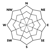
bottom line Heightened avalanche conditions exist, you could trigger avalanches, and there's a MODERATE (or level 2) danger in the backcountry today. By afternoon, heavy snowfall and continuing southwest wind could cause the danger to rise to CONSIDERABLE (or level 3) in some areas. Triggered wind slab and storm snow avalanches will become more likely and natural avalanches possible in steep terrain, especially during periods of heavy snowfall. Dangerous persistent slab avalanches remain possible on steep upper and mid-elevation slopes with shallow and weak underlying old snow. Evaluate the snow and terrain carefully, and continue to make conservative decisions regarding your route selection.
|
 |
current conditions The Tony Grove Snotel reports 51 inches of total snow, 94% of average water content for the date, and it's 15 degrees at 8400' this morning. Campbell Scientific's 9700' Logan Peak weather station reports a current temperature of 12 degrees, and 30 mph wind from the south-southeast with gusts in the mid 40s. Observers report stellar powder conditions from Christmas Day.
|
 |
recent activity No avalanches were reported in the Logan Area since last weekend.... |
| type | aspect/elevation | characteristics |
|---|
 |


Above 8,500 ft.
7,000-8,500 ft.
5,000-7,000 ft.
|
|
|
description
Fresh wind slab and storm snow avalanches will become more likely today, especially during periods of heavy snowfall. Southwest winds will build soft and sensitive wind slabs in exposed terrain. Natural soft slab avalanches may become possible in steep terrain during periods of heavy snowfall, so you should avoid travel below steep slopes or in avalanche run-out zones... Triggered avalanches are possible and will become more likely on slopes that pick up significant accumulations of drifted new snow. ..
|
| type | aspect/elevation | characteristics |
|---|
 |


Above 8,500 ft.
7,000-8,500 ft.
5,000-7,000 ft.
|
|
|
description
There are areas with poor snow structure where you might trigger dangerous and broad avalanches releasing on buried persistent weak layers. Drifted slopes facing the northern half of the compass with shallow and weak preexisting snow are the most suspect. Avalanches running on persistent weak layers might be triggered remotely from a distance or worse, from below. Pay close attention to red flags like audible collapsing and cracking, and always be willing to reevaluate or turn back.
|
 |
weather Expect periods of heavy snow today with daytime totals of around a foot possible in upper elevation areas favored by a southwest flow. Expect mountain high temperatures around 25 degrees, and southwest winds averaging in the teens. Several more inches of snow may fall tonight, winds will come around from the west and northwest and temperatures will drop into the lower teens, 4 to 8 inches of accumulation is forecast. Snow is likely to continue tomorrow, with temperatures in the mid teens and a west-northwest breeze. Looks like a strong high pressure system will build over the region over the weekend, with fog and building urban haze likely to develop in Cache Valley. A splitting storm may bring a bit of relief and a little snow late Sunday, but confidence is low.... Check out the Logan Mountain Weather page...
|
| general annoucements The friends of the Utah Avalanche Center in Logan is presenting an Advanced Skills backcountry 201 class in early January. A classroom session on the evening of January 3 and a field day on Saturday January 5. Here's a link for more information and registration; Advanced Skills, backcountry 201 or call 435-757-2794. Discount lift tickets are in and it would be a good day for lift serviced riding! Go to http://www.backcountry.com/ The Friends of the Utah Avalanche Center in Logan have a two person pass for a day of powder skiing or riding with Park City Powder Cats, and they're opening this weekend. If you are interested in a good deal for a memorable powder experience call Paige at 435-757-2794.... Remember your information can save lives. If you see or trigger an avalanche in the backcountry or see anything else we should know about, please participate in the creation of our own community avalanche advisory by submitting snow and avalanche observations. You can also call us at 801-524-5304 or email by clicking HERE. In the Logan Area you can contact Toby Weed directly at 435-757-7578. This advisory is produced by the U.S.D.A. Forest Service, which is solely responsible for its content. It describes only general avalanche conditions and local variations always exist. |