Check out our Holiday Auction

Forecast for the Logan Area Mountains

Toby Weed
Issued by Toby Weed on
Wednesday morning, January 12, 2022
The snow is stable, the danger LOW, and avalanches are unlikely in most backcountry terrain. However, areas with heightened avalanche conditions and MODERATE danger remain on upper elevation slopes facing the northern half of the compass steeper than 30°, where people might trigger dangerous avalanches breaking several feet deep on sugary faceted snow near the ground.
  • Continue to evaluate snow and terrain carefully.

I will update this advisory before about 7:30 Friday morning.
Low
Moderate
Considerable
High
Extreme
Learn how to read the forecast here
Weather and Snow
The snow is quite supportable, hard even, and you don't sink in more than a couple inches in most places. We found a supportable rain-crust all the way to the top of Beaver Mountain from last week's storm (1-6-2022), now capped by a dusting to couple inches of frosty recrystallized powder. The 8400' Tony Grove Snotel reports 27°F this morning and there is 77 inches of total snow containing 158% of average SWE for the date. Winds out of the west are blowing around 25 mph this morning at the CSI Logan Peak weather station. Expect fair weather in the mountains today, continuing through the weekend and beyond. High temperatures at 8500' will be around 31°F today and will drop to around 14°F tonight.
Unfortunately, weak layers form and become weaker during high pressure weather conditions, with dry air and cold clear nights. A weak sugary layer will continue to develop on the snow surface right above Thursday's hard and slick rain-crust, and sugary faceted snow near the ground will continue to grow and weaken where snow cover is shallow.

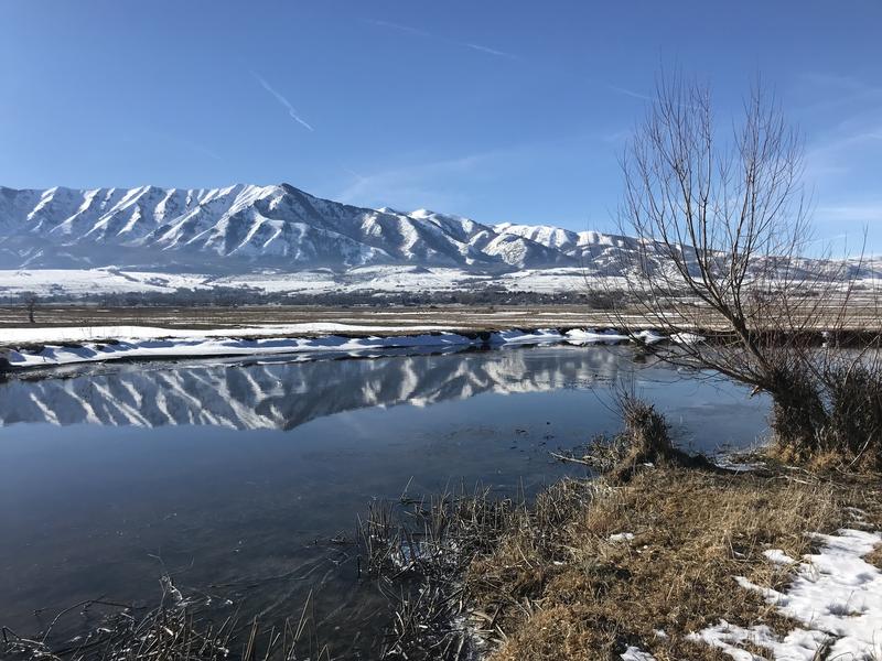
The northern part of the Wellsville Range under high pressure conditions and reflected on waters flowing in the Little Bear River.
Recent Avalanches
Heavy snow, wind drifting, and rain on snow caused many natural avalanches to occur during last week's storm across the zone. Since then no new avalanches were reported.

Check HERE for all the latest observations and avalanche activity.
Ad
Avalanche Problem #1
Persistent Weak Layer
Type
Location
Likelihood
Size
Description
The deeply buried persistent weak layer is trending towards dormancy, and it's becoming pretty unlikely that a person could trigger a dangerous avalanche breaking on a sugary persistent weak layer near the ground. But, I'm still avoiding high north facing slopes slopes steeper than 30°, because one would be lucky to survive such an avalanche.
Although they have become much less likely and harder to trigger, dangerous deep hard slab avalanches remain possible above about 8000' in elevation on slopes facing the northern half of the compass including west, north, and east...

Sunday, I found weak faceted snow at the bottom of the snowpack on a shallow (previously scoured) west facing slope in the Beaver Mountain Backcountry.
Additional Information
  • Always follow safe backcountry travel protocols. Go one person at a time in avalanche terrain, while the rest of your party watches from a safe area.
  • Check your avalanche rescue equipment, change your batteries, and practice often with your backcountry partners.
    Check slope angles and stay off of and out from under slopes steeper than 30° and adjacent slopes. Video Here
General Announcements
Who's up for some free avalanche training? Get a refresher, become better prepared for an upcoming avalanche class, or just boost your skills. Go to https://learn.kbyg.org/ and scroll down to Step 2 for a series of interactive online avalanche courses produced by the UAC.
  • Check out all the upcoming education classes and clinics HERE.
  • Please submit your observations from the backcountry HERE.
This information does not apply to developed ski areas or highways where avalanche control is normally done. This forecast is from the U.S.D.A. Forest Service, which is solely responsible for its content. This forecast describes general avalanche conditions and local variations always occur.