Check out our Holiday Auction

Forecast for the Logan Area Mountains

Toby Weed
Issued by Toby Weed on
Monday morning, April 5, 2021
Dangerous wet avalanche conditions and CONSIDERABLE danger exist on steep mid and upper elevation slopes. People are likely to trigger loose wet avalanches. Significant natural wet avalanche activity and dangerous wet slab avalanches are possible on very steep slopes, especially near cliffs or rock bands, but anywhere where the rapidly melting snow is soft and saturated.
AVOID TRAVEL ON OR BELOW STEEP SLOPES WITH MELT-SOFTENED SATURATED SNOW
Low
Moderate
Considerable
High
Extreme
Learn how to read the forecast here
Special Announcements
Thank you to everyone who helped make our Spring Campaign a huge success. We are grateful for your donations and what they will allow us to accomplish next season. We look forward to continuing to serve you with our forecasting, education, and awareness programs in new and exciting ways.
Weather and Snow
It's way too warm again this morning, and dangerous wet avalanche conditions exist in steep terrain again today. The exceptionally warm weather created dangerous wet avalanche conditions on very steep upper and mid elevation slopes facing all directions, not just on sunny slopes. The snow is mostly melted off or very shallow at lower elevations, and in some areas there is more wildfire hazard than avalanche danger.
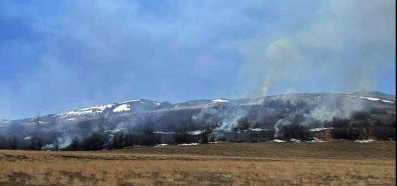
A wildland fire burning at lower elevations above Bear Lake on Sunday (4-4-2021)
It's 42°F this morning at the 8400' Tony Grove Snotel, and there is 55 inches of total snow containing only 65% of normal SWE. Temperatures finally dropped below 40°F and it's 39°F at the 9700' CSI Logan Peak weather station. Winds from the southwest increased overnight and are blowing around 26 mph. Exceptionally warm weather will continue today, with sunny conditions this morning giving way to increasing clouds in the afternoon, and intensifying wind blowing from the southwest. High temperatures at 9000' in elevation will likely be over 50°F today, but will drop significantly tonight, with lows expected to be around 20°F.
Snow showers are possible this afternoon including a chance of thunder showers. Expect snow to accumulate in the high country tonight and tomorrow, with northwest winds and 6 to 12 inches of new snow on upper elevation slopes by tomorrow evening in the northern and central parts of the Logan Zone.
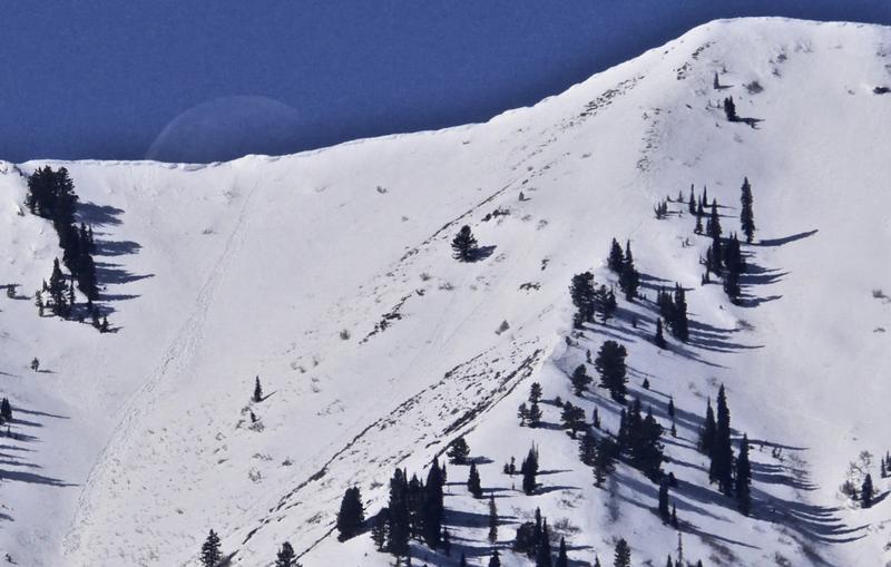
A new natural wet loose avalanche in the Wellsville Mountain Wilderness seen beneath the setting moon, 4-3-21.
Recent Avalanches
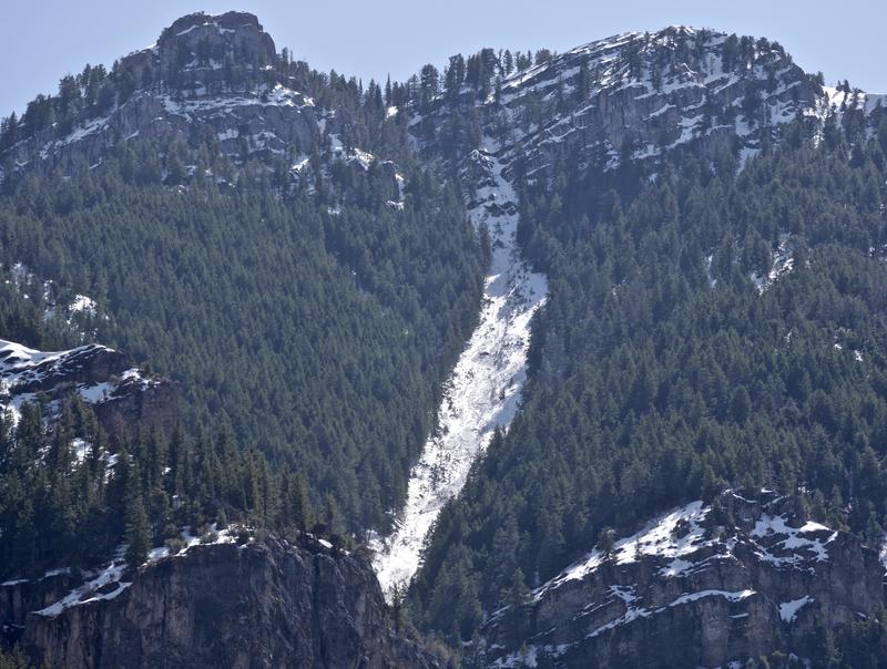
The heat this weekend certainly caused some natural wet avalanche activity to occur on steep slopes in the Logan Zone, including this nice wet avalanche in Drop-in, Drop-out in Lower Logan Canyon.
Natural wet avalanches initiate from saturated snow falling off rocks or cliff bands and then they entrain more saturated surface snow as they run down the slope. These can get pretty big on sustained slopes.
This natural wet avalanche in Lower Logan Canyon was observed yesterday on a north facing slope, and it started at around 8000' in elevation.
Ad
Avalanche Problem #1
Wet Snow
Type
Location
Likelihood
Size
Description
  1. Loose wet avalanches are likely today on steep slopes, especially near cliffs or rock bands where the snow surface is soft and saturated. People could easily trigger wet loose avalanches, and significant natural activity is possible. Dangerous wet slab avalanches have not yet been observed locally, but the exceptional heat may cause some to occur on very steep slopes with shallow snow cover and poor snow structure.
  2. Large, overhanging ridge-top cornices have grown recently, and people might be fooled into getting too close to the edge. Cornices tend to break back further than you might expect. The heat is likely to cause some to buckle or calve off and they could start wet avalanches on steep slopes below. Avoid travel on and below cornices.
Additional Information
General Spring Travel Advise:
As daytime temperatures rise, softening the snow, the danger of wet avalanches will increase, so its a good idea to get in the habit of an early start and to plan on heading down before things get too sloppy.
-Watch for trees or other terrain traps below you if you venture onto steep slopes.
-If you start sinking deeply into wet snow, or if the snow you are traveling on becomes unsupportable due to the heat, it's time to leave.
Do you have the essential avalanche rescue gear (transceiver, probe, and shovel) and do you know how to use them? Watch this video to see how the three pieces of equipment work together. HERE

Please keep practicing with the Beacon Training Park at the Franklin Basin Trailhead. Test yourself and your riding partners. It is free, fun, and easy to use.
General Announcements
Visit this website with information about Responsible Winter Recreation by the Utah Office of Outdoor Recreation.
EMAIL ADVISORY. If you would like to get the daily advisory by email you subscribe HERE.
Remember your information can save lives. If you see anything we should know about, please help us out by submitting snow and avalanche observations....HERE. You can also call us at 801-524-5304, email by clicking HERE, or include #utavy in your Instagram, or @UAClogan on Twitter.
We will update this forecast by around 7:30 tomorrow morning.
This forecast is from the USDA Forest Service, which is solely responsible for its content. The forecast describes general avalanche conditions and local variations always occur.